D Street / West Broadway in Boston in Suffolk County, Massachusetts — The American Northeast (New England)
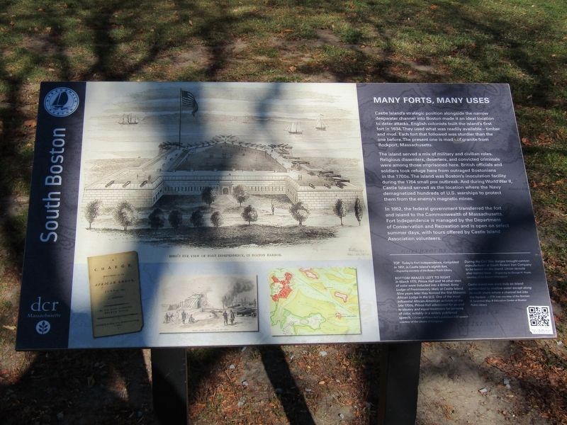
Many Forts, Many Uses
South Boston
Photographed by Conrad Ward, November 17, 2025
1. Many Forts, Many Uses Marker
Castle Island's strategic position alongside the narrow deepwater channel into Boston made it an ideal location to deter attacks. English colonists built the island's first fort in 1634. They used what was readily available—timber and mud. Each fort that followed was sturdier than the one before. The present one is made of granite from Rockport, Massachusetts.
The island served a mix of military and civilian roles. Religious dissenters, deserters, and convicted criminals were among those imprisoned here. British officials and soldiers took refuge here from outraged Bostonians in the 1700s. The island was Boston's inoculation facility during the 1764 small pox outbreak. And during World War II, Castle island served as the location where the Navy demagnetized hundreds of U.S. warships to protect them from the enemy's magnetic mines.
In 1962, the federal government transferred the fort and island to the Commonwealth of Massachusetts. Fort Independence is managed by the Department of Conservation and Recreation and is open on select summer days, with tours offered by Castle Island Association volunteers.
[Captions:]
Today's Fort Independence, completed in 1851, is Castle Island's eighth fort.
~Engraving courtesy of the Boston Public Library
In March 1775, Prince Hall and 14 other men of color were inducted into a British Army Lodge of Freemasonry likely at Castle Island. Nine years later they formed the first Masonic African Lodge in the U.S. One of the most influential African-American activists of the late 1700s, Prince Hall advocated for an end to slavery and equal treatment for persons of color, notably in a widely published speech. ~ Cover of Prince Hall's published 1797 speech courtesy of the Library of Congress
During the Civil War, barges brought cannon manufactured at South Boston Iron Company to be tested on the island. Union recruits also trained here. ~ Engraving by George H. Hayes, courtesy of the Boston Athenaeum
Castle Island was once truly an island surrounded by shallow water except along its north shore where a channel led into the harbor. 1776 map courtesy of the Norman B. Leventhal Map & Education Center at Boston Public Library
Erected by Boston
this page online
Topics. This historical marker is listed in these topic lists: African Americans • Forts and Castles • Fraternal or Sororal Organizations • War, World II. A significant historical year for this entry is 1851.
Location. 42° 20.26′ N, 71° 0.66′ W. Marker is in Boston, Massachusetts, in Suffolk County. It is in D Street / West Broadway. It can be reached from William J Day Boulevard east of Shore Road, on the right when traveling east. Touch for map. Marker is at or near this postal address: 2010 William J Day Blvd, South Boston MA 02127, United States of America. Touch for directions.

Regionally, this marker is in Massachusetts’ Historic Boston. It is also in the American Northeast, in New England, and on the Eastern Seaboard. Globally, it is in the North Atlantic Region, North America, the Western Hemisphere, the Western World, and the Anglosphere. Historically, it finds itself in what was once one of the original Thirteen Colonies.
Other nearby markers. At least 8 other markers are within walking distance of this marker: Harbor of Shame No More
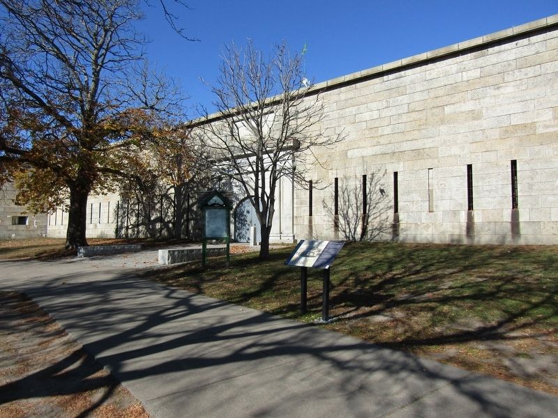
Photographed by Conrad Ward, November 17, 2025
2. Many Forts, Many Uses Marker
More about this marker. The marker was likely erected in 2021 or 2023.
Related marker. Click here for another marker that is related to this marker. Dorchester Heights
Also see . . .
1. Fort Independence - National Park Service. Fort Independence is part of a State Park on Castle Island. (Submitted on March 18, 2026, by G.W.Bartlett of Hingham, Massachusetts.)
2. Fort Independence (Wikipedia article). Fort Independence is a granite bastion fort that provided harbor defenses for Boston Massachusetts. (Submitted on March 18, 2026, by G.W.Bartlett of Hingham, Massachusetts.)
Additional keywords. Castle William

Photographed by G.W.Bartlett, March 17, 2026
3. View to Dorchester Heights
View of Dorchester Heights tower from Fort Independence. This demonstrates the positioning of Castle William vs. Dorchester Point Battery in 1776 across Pleasure Bay (East Broadway & Farragut Drive) & Dorchester Heights Tower when the Colonial
Army placed cannon on these heights to force the British Navy to evacuate Boston in March 1776.
Credits. This page was last revised on March 20, 2026. It was originally submitted on April 26, 2025, by Conrad Ward of Guilford, Connecticut. This page has been viewed 146 times since then and 45 times this year. Last updated on March 20, 2026, by G.W.Bartlett of Hingham, Massachusetts. Photos: 1, 2. submitted on April 26, 2025, by Conrad Ward of Guilford, Connecticut. 3. submitted on March 18, 2026, by G.W.Bartlett of Hingham, Massachusetts. • Devry Becker Jones was the editor who published this page.
Editor’s want-list for this marker. A wide shot of the marker in context. • Can you help?
