Lemont in Cook County, Illinois — The American Midwest (Great Lakes)
Lemont Tornado of 1976
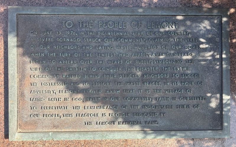
Photographed by Sean P. Flynn, March 18, 2026
1. Lemont Tornado of 1976 Marker
Erected by Lemont National Bank.
Topics and series. This historical marker is listed in these topic lists: Disasters • Patriots & Patriotism • Religion & Religious Structures. In addition, it is included in the The Spirit of ’76, America’s Bicentennial Celebration series list. A significant historical date for this entry is June 13, 1976.
Location. 41° 40.455′ N, 87° 59.964′ W. Marker is
this page online

Regionally, this marker is in Greater Chicago. It is also in the American Midwest. Globally, it is in North America, on the Great Lakes, in the Western Hemisphere, in the Western World, and in the Anglosphere. Historically, it finds itself in what was once the Viceroyalty of New France, the territory of the Mississippian Culture, and the Northwest Territory.
Other nearby markers. At least 8 other markers are within walking distance of this marker: Lemont Veterans Memorial (about 300 feet away, measured in a direct line); World War Two Honor Roll (about 300 feet away); Korean War Memorial (about 300 feet away); Old Stone Church (about 400 feet away); Civil War Recruiting Depot (about 400 feet away); Lemont Village Hall (about 500 feet away); Lemont Station (approx. 0.2 miles away); Lemont Civil War Memorial

Photographed by Sean P. Flynn, March 18, 2026
2. Lemont Tornado of 1976 Marker in front of Lemont National Bank
Also see . . . June 13, 1976 Lemont Tornado. The National Weather Service shares the story of the F4 tornado that hit the Lemont area in the summer of 1976.
Excerpt: “During the evening hours of June 13, 1976, a few isolated storms developed in northeastern Illinois near the Chicago Metropolitan Area. One of those storms developed into a slow-moving, supercell thunderstorm. This storm produced a tornado starting near Lemont which followed an unusual winding path over the hour to near Darien and Downers Grove. This tornado caused 2 fatalities, 23 injuries, and approximately $13 million ($76 million in 2025) in damages.”(Submitted on March 21, 2026, by Sean P. Flynn of Oak Park, Illinois.)
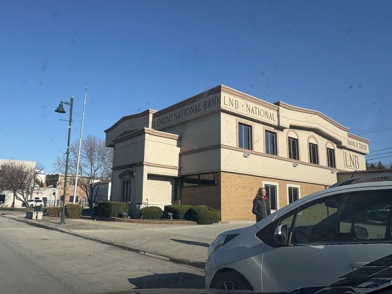
Photographed by Sean P. Flynn, March 18, 2026
3. Lemont National Bank
Credits. This page was last revised on August 27, 2026. It was originally submitted on March 21, 2026, by Sean P. Flynn of Oak Park, Illinois. This page has been viewed 85 times since then. Photos: 1, 2, 3. submitted on March 21, 2026, by Sean P. Flynn of Oak Park, Illinois.
