Fürth, Bavaria, Germany — Central Europe
Rathaus
⎯⎯⎯
City Hall
| — | Orte der Verfolgung und des Gedenkens | — |
Photographed by Andrew Ruppenstein, February 5, 2026
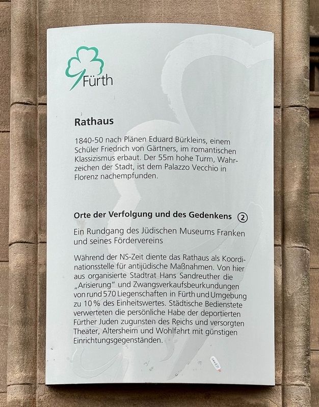
1. Rathaus / City Hall Marker

Orte der Verfolgung und des Gedenkens (2)
Ein Rundgang des Jüdischen Museums Franken und seines Fördervereins
Während der NS-Zeit diente das Rathaus als Koordinationsstelle für antijüdische Maßnahmen. Von hier aus organisierte Stadtrat Hans Sandreuther die „Arisierung“ und Zwangsverkaufsbeurkundungen von rund 570 Liegenschaften in Fürth und Umgebung zu 10% des Einheitswertes. Städtische Bedienstete verwerteten die persönliche Habe der deportierten Fürther Juden zugunsten des Reichs und versorgten Theater, Altersheim und Wohlfahrt mit günstigen Einrichtungsgegenständen.
(English translation):
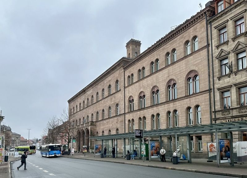
Built between 1840 and 1850 according to plans by Eduard Bürklein, a student of Friedrich von Gärtner, in the Romantic Classical style. The 55-meter-high tower, a landmark of the city, is modeled after the Palazzo Vecchio in Florence.
Sites of Persecution and Remembrance (2)
A tour by the Jewish Museum of
this page online
During the Nazi era, the town hall served as a coordination center for anti-Jewish measures. From here, City Councilor Hans Sandreuther organized the "Aryanization" and forced sale of approximately 570 properties in Fürth and the surrounding area for 10% of their assessed value. City employees seized the personal belongings of deported Fürth Jews for the benefit of the Reich and provided theaters, retirement homes, and welfare organizations with inexpensive furnishings.
Erected by Stadt Fürth. (Marker Number 2.)
Topics and series. This historical marker is listed in these topic lists: Government & Politics • War, World II. In addition, it is included in the The Holocaust series list. A significant historical year for this entry is 1840.
Location. 49° 28.649′ N, 10° 59.348′ E. Marker is in Fürth, Bayern (Bavaria). It is on Königstraße north of Brandenburger Straße, on the right when traveling south. Touch for map. Marker is at or near this postal address: Königstraße 88, Fürth BY 90762, Germany. Touch for directions.

Regionally, it is in Europe, the European Union, Atlantic Europe,
Photographed by Andrew Ruppenstein, February 5, 2026
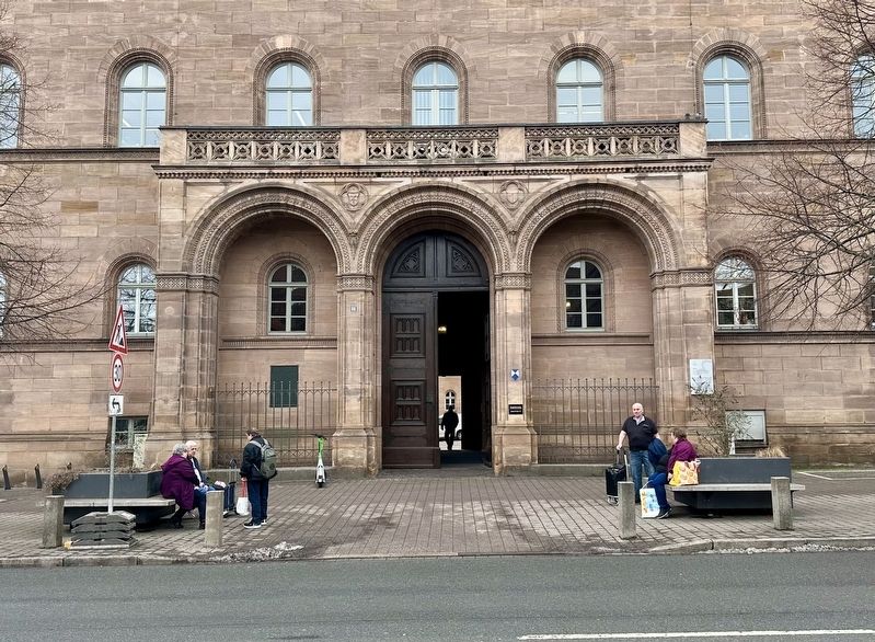
2. Rathaus / City Hall Marker - wide view
The marker is visible here to the right of the entrance.
Other nearby markers. At least 8 other markers are within walking distance of this marker: Wilhelm Königswarter (a few steps from this marker); Dr. Otto Mayer (within shouting distance of this marker); Wohnhäuser / Residential Buildings (about 90 meters away, measured in a direct line); Professor Jakob Henle (about 150 meters away); Leopold Ullstein (about 150 meters away); Ehemaliges Wirtshaus zum Roten Roß / The Former Red Horse Inn (about 150 meters away); Feuerwache / Fire Station (about 180 meters away); Ehemalige Gabrielschul / Former Gabriel Schul (about 180 meters away). Touch for a list and map of all markers in Fürth.
Photographed by Andrew Ruppenstein, February 5, 2026
3. Fürth Rathaus / City Hall
Credits. This page was last revised on March 22, 2026. It was originally submitted on March 22, 2026, by Andrew Ruppenstein of Lamorinda, California. This page has been viewed 15 times since then. Photos: 1, 2, 3. submitted on March 22, 2026, by Andrew Ruppenstein of Lamorinda, California.
