
Near Covington in Alleghany County, Virginia — The American South (Mid-Atlantic)
Alleghany County
⎯⎯⎯
West Virginia

Photographed by Stephen Escalera
1. Alleghany County side of the marker
Alleghany County Virginia. 458 Square Miles. Formed in 1822 from Bath, Botetourt, and Monroe, and named for the Alleghany Mountains. At Fort Mann in this county a battle took place between settlers and Indians led by Cornstalk, 1763.
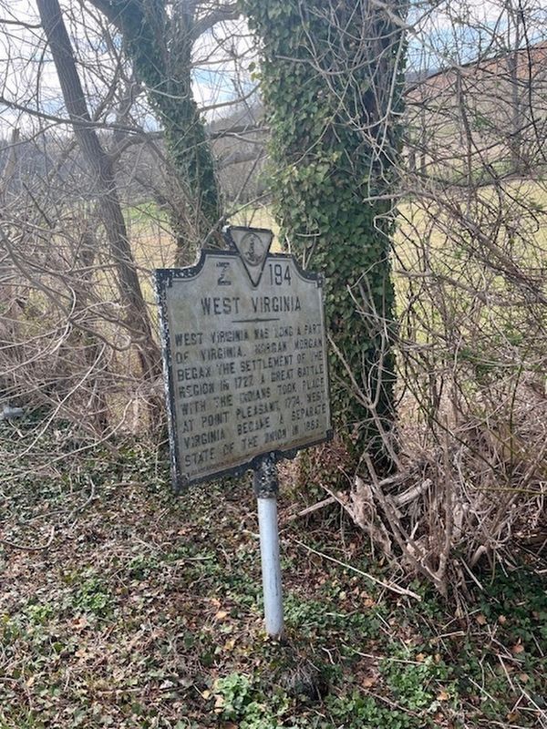
West Virginia. West Virginia was long a part of Virginia. Morgan Morgan began the settlement of the region in 1727. A great battle with the Indians took place at Point Pleasant in 1774. West Virginia became a separate state of the Union in 1863.
Erected 1936 by Conservation & Development Commission. (Marker Number Z-194.)
Topics and series. This historical marker is listed in this topic list: Political Subdivisions. In addition, it is included in the Virginia Department of Historic Resources (DHR) series list. A significant historical year for this entry is 1822.
Location. 37° 38.287′ N, 80° 14.357′ W. Marker is near Covington, Virginia, in Alleghany County. It is on Kanawha Trail (Route 311) south of Sweet Springs Lane, on the right when traveling south. Touch for map. Marker is at or near this postal address: 131 Kanawha Trail, Covington VA 24426, United States of America. Touch for directions.

Regionally,
this page online
Other nearby markers. At least 8 other markers are within 5 miles of this marker, measured as the crow flies: Governor John Floyd's Grave (within shouting distance of this marker); Boundary Monument (within shouting distance of this marker); Ann Royall / Sweet Springs (approx. 0.6 miles away in West Virginia); Gov. John Floyd (approx. 0.9 miles away in West Virginia); Rowan Memorial Home (approx. 0.9 miles away in West Virginia); Governor John Floyd (approx. 0.9 miles away in West Virginia); West Virginia / Monroe County (approx. 0.9 miles away in West Virginia); The Tale Of Tingler's Mill
Photographed by Stephen Escalera, March 21, 2026
2. West Virginia side of the marker
Another marker is no longer nearby. Craig County / West Virginia (was approx. 2.2 miles away but has been confirmed missing).
Credits. This page was last revised on April 24, 2026. It was originally submitted on March 23, 2026, by Stephen Escalera of Roanoke, Virginia. This page has been viewed 24 times since then. Photos: 1, 2. submitted on March 23, 2026, by Stephen Escalera of Roanoke, Virginia. • Devry Becker Jones was the editor who published this page.
