Arrington in Amherst County, Virginia — The American South (Mid-Atlantic)
Nelson County
⎯⎯⎯
Amherst County
Photographed by Stephen Escalera
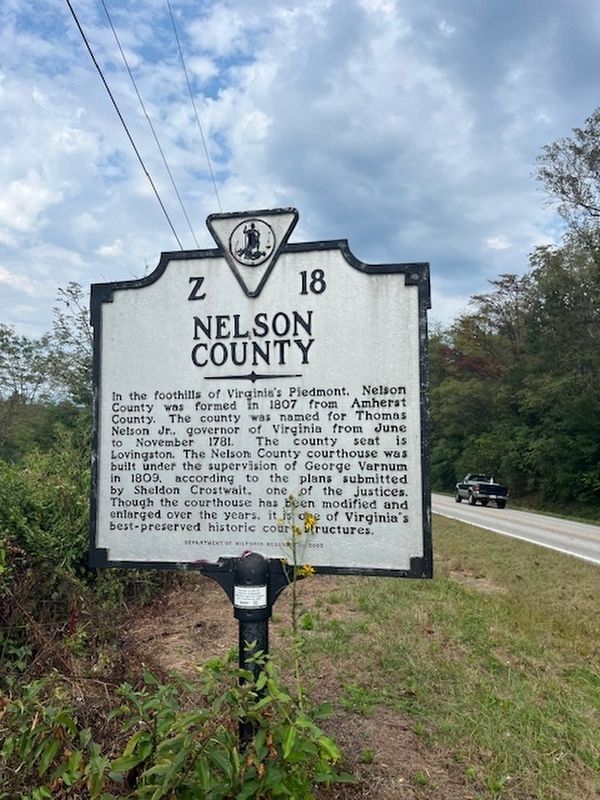
1. Nelson County side of the marker
Nelson County. In the foothills of Virginia's Piedmont, Nelson County was formed in 1807 from Amherst County. The county was named for Thomas Nelson Jr., governor of Virginia from June to November 1781. The county seat is Lovingston. The Nelson County courthouse was built under the supervision of George Varnum in 1809, according to the plans submitted by Sheldon Crostwait, one of the justices. Though the courthouse has been modified and enlarged over the years, it is one of Virginia’s best-preserved historic court structures.
Amherst County. Amherst County, formed from Albemarle County in 1761, is named for Maj. Gen. Jeffery Amherst, a British commander in North America during the latter part of the French and Indian War. He was governor of Virginia from 1759 to 1768. The county seat is Amherst and the present county courthouse was built in 1872. Sweet Briar College, a nationally renowned liberal arts college for women was founded here in 1901. Esteemed architect Ralph Adams Cram designed several of its buildings.
Erected 2003 by Department of Historic Resources. (Marker Number Z-18.)
Topics and series.
this page online
Location. 37° 42.055′ N, 79° 1.712′ W. Marker is in Arrington, Virginia, in Amherst County. It is on Patrick Henry Highway (Route 151) north of Warrick Barn Road, on the right when traveling south. Touch for map. Marker is at or near this postal address: 1099 Warwick Barn Rd, Arrington VA 22922, United States of America. Touch for directions.

Regionally, this marker is in Central Virginia. It is also in the American South and specifically in the Upper South. Globally, it is in North America, the Western Hemisphere, the Western World, and the Anglosphere. Historically, it finds itself in what was once the territory of the Mississippian Culture, one of the original Thirteen Colonies, one of the Confederate States of America, and the Antebellum South.
Other nearby markers. At least 8 other markers are within 5 miles of this marker, measured as the crow flies: Virginia Blue Ridge Railway (approx. 0.6 miles away); a different marker also named The Virginia Blue Ridge Railway (approx. 0.6 miles away); American Cyanamid (approx. 0.6 miles away); Hurricane Camille (approx. 0.8 miles away); The Rivers (approx. 2.8 miles away); The Reverend Robert Rose (approx. 4.2 miles away); Grave of Patrick Henry’s Mother (approx. 4½ miles away); Action at Tye River (approx. 4.9 miles away).
Credits. This page was last revised on April 3, 2026. It was originally submitted on March 23, 2026, by Stephen Escalera of Roanoke, Virginia. This page has been viewed 21 times since then. Photo 1. submitted on March 23, 2026, by Stephen Escalera of Roanoke, Virginia. • Devry Becker Jones was the editor who published this page.
Editor’s want-list for this marker. A photo of the Amherst County side of the marker. • A wide shot of the marker in context. • Can you help?
