Heuchling in Lauf an der Pegnitz in Nürnberger Land, Bavaria, Germany — Central Europe
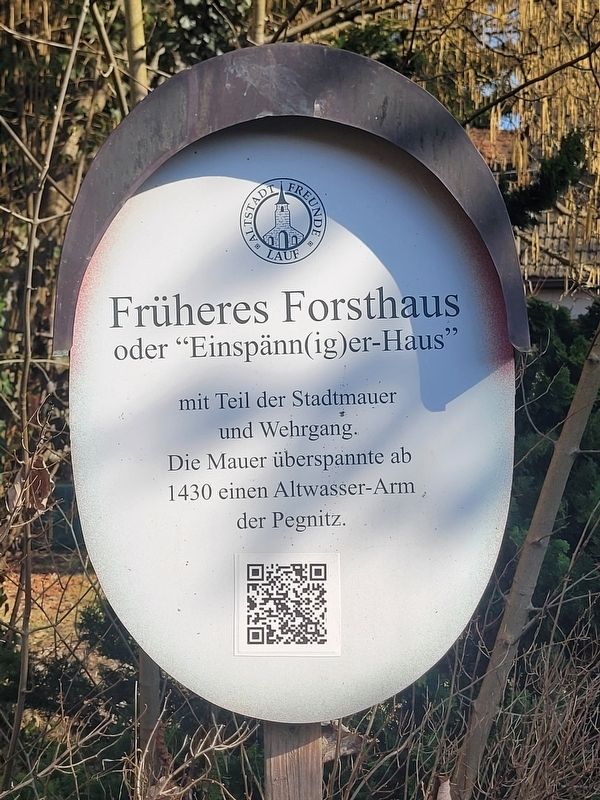
Früheres Forsthaus oder "Einspänn(ig)er-Haus"
⎯⎯⎯
Former Forester’s House or Einspänniger House
Photographed by James Hulse, March 3, 2026
1. Früheres Forsthaus oder "Einspänn(ig)er-Haus" / Former Forester’s House or Einspänniger House Marker

oder "Einspänn(ig)er-Haus"
mit Teil der Stadtmauer
und Wehrgang.
Die Mauer überspannte ab
1430 einen Altwasser-Arm
der Pegnitz.
Former Forester’s House or “Einspänniger House with part of the city wall and the wall-walk. From 1430 onward, the wall spanned an old branch of the Pegnitz River.
Erected by Old Town Friends of Lauf e.V.
Topics. This historical marker is listed in this topic list: Forts and Castles. A significant historical year for this entry is 1430.
Location. 49° 30.631′ N, 11° 16.905′ E. Marker is in Lauf an der Pegnitz, Bayern (Bavaria), in Nürnberger Land. It is in Heuchling. It is on Am Schloß just south of Spitalstraße, on the left when traveling south. Touch for map. Marker is at or near this postal address: Am Schloß 3, Lauf an der Pegnitz BY 91207, Germany. Touch for directions.

Regionally, this marker is in German Franconia. Globally, it is in Europe, the European Union, Atlantic Europe, Central Europe, the Schengen Area, Western Europe, and the Western World. Historically, it finds itself in what was once the Holy
this page online
Other nearby markers. At least 8 other markers are within walking distance of this marker: Liebesbriefe aus dem Forsthaus auf der Insel / Love Letters from the Forester’s House on the Island (here, next to this marker); Glockengießerspital mit St. Leonhardskirche / Glockengießer Hospital with St. Leonhard’s Church (within shouting distance of this marker); Wassertores / Water Gate (within shouting distance of this marker); Ehemalige Pfarr- und Spitalkirche St. Leonhard / Former Parish and Hospital Church of St. Leonhard (within shouting distance of this marker); Wenzelschloß / Castle of St. Wenceslas (within shouting distance of this marker); Kindergarten Alter Schulhof / Kindergarten Old Schoolyard (about 90 meters away, measured in a direct line); Lauf a. d. Pegnitz, Reichelsche Schleif / Lauf on the Pegnitz, Reichel Grinding Mill (about 90 meters away); Reichel’sche Schleif / Reichel Grinding Mill (about 90 meters away). Touch for a list and map of all markers in Lauf an der Pegnitz.
Also see . . . History of the Lauf “Einspänniger or Forester’s House” between the castle and the (German language).

Photographed by James Hulse, March 3, 2026
2. Früheres Forsthaus oder "Einspänn(ig)er-Haus" / Former Forester’s House or Einspänniger House Marker
The view of the marker with the Forester’s House in the background.
History of the Lauf “Einspänniger or Forester’s House” between the castle and the hospital.
Between the Pegnitz river and the rear wall of the bell foundry below the castle footbridge, in a beautiful valley of the Pegnitz, stands the so-called "Einspänniger- oder Forsthaus" (one-horse carriage or forester's house), which has been empty for several years.
The history of this listed building in Lauf is closely linked to the construction of a southern city wall and changes in the course of the Pegnitz river.
The first city walls were built in connection with the granting of city rights in 1355 by Charles IV. Due to the effects of war and the ongoing development of weaponry, repeated renovations and reinforcements of the city's fortifications were necessary. During these renovations, the decision was made to connect the city with the neighboring moated castle, thus creating a strongly fortified unit. Originally, two winged sections were also planned, spanning the northern arm of the Pegnitz River with stone arches and battlements. This would have integrated the castle island into the city's fortifications.
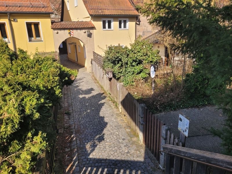
Photographed by James Hulse, March 3, 2026
3. Früheres Forsthaus oder "Einspänn(ig)er-Haus" / Former Forester’s House or Einspänniger House Marker
The view of the marker along the sidewalk in front of the Forester’s House.
Credits. This page was last revised on March 25, 2026. It was originally submitted on March 24, 2026, by James Hulse of Medina, Texas. This page has been viewed 9 times since then. Photos: 1, 2, 3. submitted on March 25, 2026, by James Hulse of Medina, Texas.
