Heuchling in Lauf an der Pegnitz in Nürnberger Land, Bavaria, Germany — Central Europe
Nürnberger Tor
⎯⎯⎯
Nuremberg Gate
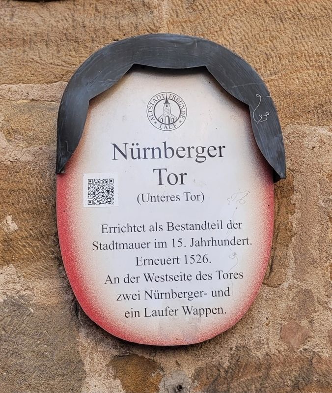
Photographed by James Hulse, March 3, 2026
1. Nürnberger Tor / Nuremberg Gate Marker

(Unteres Tor)
Errichtet als Bestandteil der
Stadtmauer im 15. Jahrhundert.
Erneuert 1526.
An der Westseite des Tores
zwei Nürnberger- und
ein Laufer Wappen.
Nuremberg Gate (Lower Gate). Built as part of the city wall in the 15th century. Renovated in 1526. On the west side of the gate are two Nuremberg coats of arms and one from Lauf.
Erected by Old Town Friends of Lauf e.V. (Marker Number 17.)
Topics. This historical marker is listed in this topic list: Forts and Castles. A significant historical year for this entry is 1526.
Location. 49° 30.69′ N, 11° 16.775′ E. Marker is in Lauf an der Pegnitz, Bayern (Bavaria), in Nürnberger Land. It is in Heuchling. It is at the intersection of Marktplatz and Mauergasse, on the right when traveling west on Marktplatz. Touch for map. Marker is at or near this postal address: Marktpl 2, Lauf an der Pegnitz BY 91207, Germany. Touch for directions.

Regionally, this marker is in German Franconia. Globally, it is in Europe, the European Union, Atlantic Europe, Central Europe, the Schengen Area, Western Europe, and the Western World. Historically, it finds itself in what was once the Holy Roman Empire and also the former West Germany.
Other nearby markers. At least 8 other markers are within walking distance of this marker: St. Johannis (within shouting distance of this marker); Prof. Dr. jur. Hermann Roesler (within shouting distance of this marker); Altes Rathaus / Old Town Hall (about 120 meters away, measured in a direct line); Judenturm / Jewish Tower (about 150 meters away); Thomas Alva Edison
this page online
More about this marker. The “Nürnberger Tor” name means the city gate facing the direction of the city of Nürnberg.
Also see . . . Old Town Stroll Sign 17 – Nuremberg Gate (German language). Excerpt (in translation):
No trace remains of the drawbridge that once spanned the city moat. Today, traffic to and from Nuremberg flows over a wide, embankment. Narrow paths have been cut through to the left and right of the gate for pedestrians, which reduces the structure's defensive capabilities but facilitates traffic flow.(Submitted on March 24, 2026, by James Hulse of Medina, Texas.)
The Nuremberg Gate is clearly overshadowed by the tower of St. John's Church. Its tower keeper could also assume the watchman's duties, which were otherwise the responsibility of the gate's watchman, and announce approaching enemies in time. The other two gates, the Hersbruck Gate (also called the Upper Gate) and the Water Gate, however, had their own towers to monitor traffic on the Golden Road between Nuremberg and Prague and on the north-south route to Regensburg, respectively.
Photographed by James Hulse, March 3, 2026
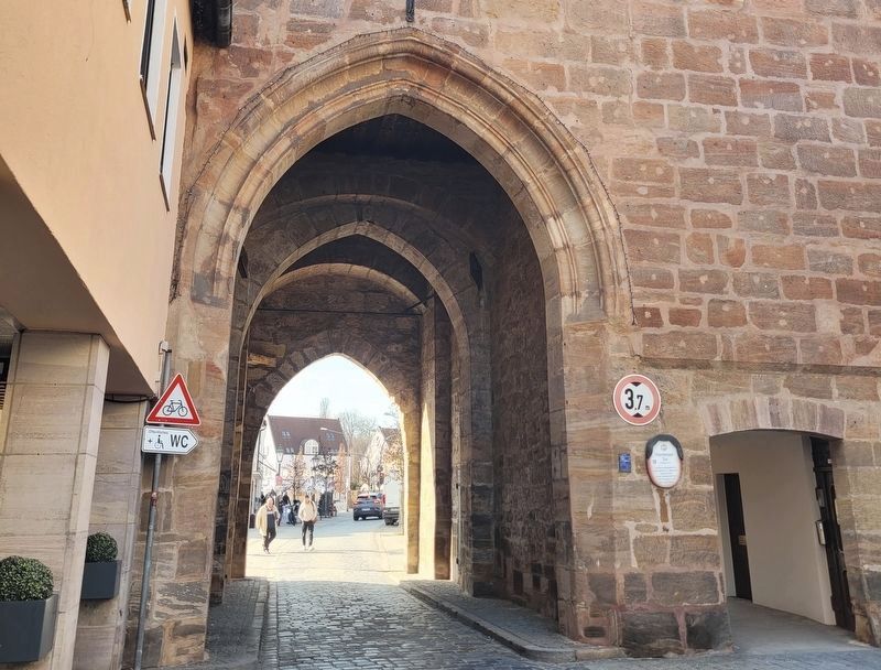
2. Nürnberger Tor / Nuremberg Gate Marker
The view of the gate with the marker from inside the city wall.
Photographed by James Hulse, March 3, 2026
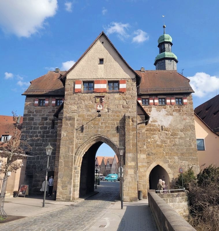
3. Nürnberger Tor / Nuremberg Gate Marker
The view of the gate from outside the city wall.
Credits. This page was last revised on March 26, 2026. It was originally submitted on March 24, 2026, by James Hulse of Medina, Texas. This page has been viewed 18 times since then. Photos: 1, 2, 3. submitted on March 26, 2026, by James Hulse of Medina, Texas.
