Heuchling in Lauf an der Pegnitz in Nürnberger Land, Bavaria, Germany — Central Europe
Judenturm
⎯⎯⎯
Jewish Tower
Photographed by James Hulse, March 3, 2026
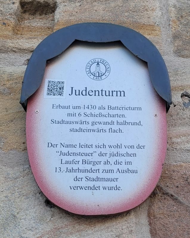
1. Judenturm / Jewish Tower Marker

Erbaut um 1430 als Batterieturm
mit 6 Schießscharten.
Stadtauswärts gewandt halbrund,
stadteinwärts flach.
Der Name leitet sich wohl von der
"Judensteuer" der jüdischen
Laufer Bürger ab, die im
13. Jahrhundert zum Ausbau
der Stadtmauer
verwendet wurde.
Jewish Tower. Built around 1430 as a battery tower with six gun slits. Semicircular on the outside of the city wall, flat on the side facing the town. The name probably derives from the “Jewish tax” paid by the Jewish citizens of Lauf, which in the 13th century was used for the expansion of the city wall.
Erected by Old Town Friends of Lauf e.V. (Marker Number 19.)
Topics. This historical marker is listed in these topic lists: Forts and Castles • Religion & Religious Structures. A significant historical year for this entry is 1430.
Location. 49° 30.612′ N, 11° 16.795′ E. Marker is in Lauf an der Pegnitz, Bayern (Bavaria), in Nürnberger Land. It is in Heuchling. It is on Höllgasse just west of Leßnergasse, on the left when traveling west. Touch for map. Marker is at or near this postal address: Höllgasse
this page online

Regionally, this marker is in German Franconia. Globally, it is in Europe, the European Union, Atlantic Europe, Central Europe, the Schengen Area, Western Europe, and the Western World. Historically, it finds itself in what was once the Holy Roman Empire and also the former West Germany.
Other nearby markers. At least 8 other markers are within walking distance of this marker: Reichel’sche Schleif / Reichel Grinding Mill (within shouting distance of this marker); Lauf a. d. Pegnitz, Reichelsche Schleif / Lauf on the Pegnitz, Reichel Grinding Mill (within shouting distance of this marker); Wassertores / Water Gate (within shouting distance of this marker); Ehemalige Kunstmühle Schlicht / Former Schlicht Roller Mill (about 90 meters away, measured in a direct line); Schlicht'sche Kunstmühle und Schleifmühle Reichel / Schlicht Roller Mill and Reichel Grinding Mill (about 90 meters away); St. Johannis (about 90 meters away); Früheres Forsthaus oder "Einspänn(ig)er-Haus" / Former Forester’s House or Einspänniger House (about 150 meters away); Liebesbriefe aus dem Forsthaus auf der Insel / Love Letters from the Forester’s House on the Island
Photographed by James Hulse, March 3, 2026
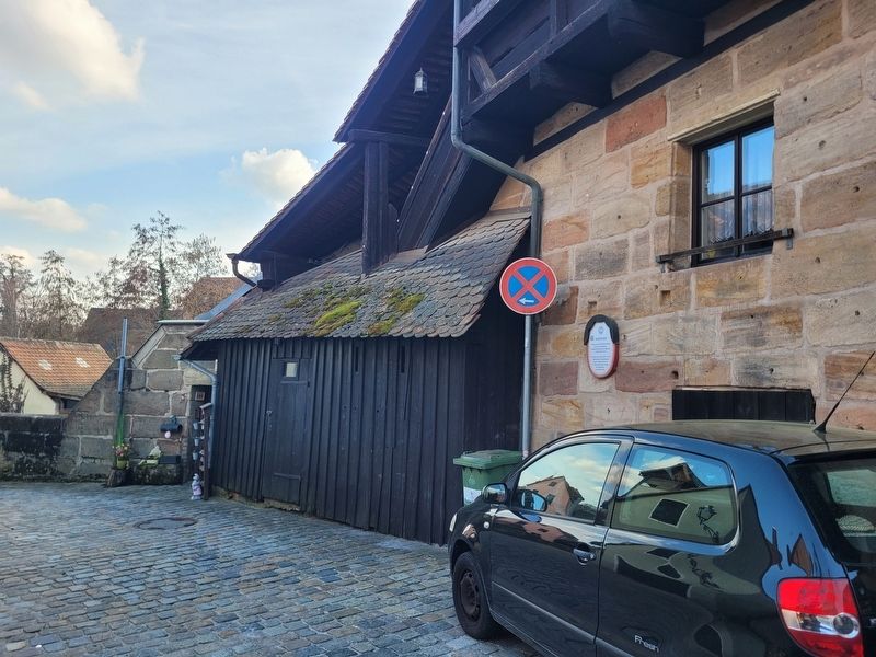
2. Judenturm / Jewish Tower Marker
Also see . . . City stroll sign 19 - The Jewish Tower (German language). Excerpt (in translation):
The first evidence of Jewish people residing in Lauf dates back to the mid-14th century. This was also the time when Emperor Charles IV had his castle built and granted Lauf town privileges (in 1355). This also granted them the right to protect the town and fortify it with a defensive wall and other fortifications.(Submitted on March 25, 2026, by James Hulse of Medina, Texas.)
How could this be financed? The Nuremberg Jewish oath was already recorded in the Lauf town register in 1347. In 1430, Lauf finally received the right from the then territorial ruler to levy a so-called Jewish tax.
Photographed by James Hulse, March 3, 2026
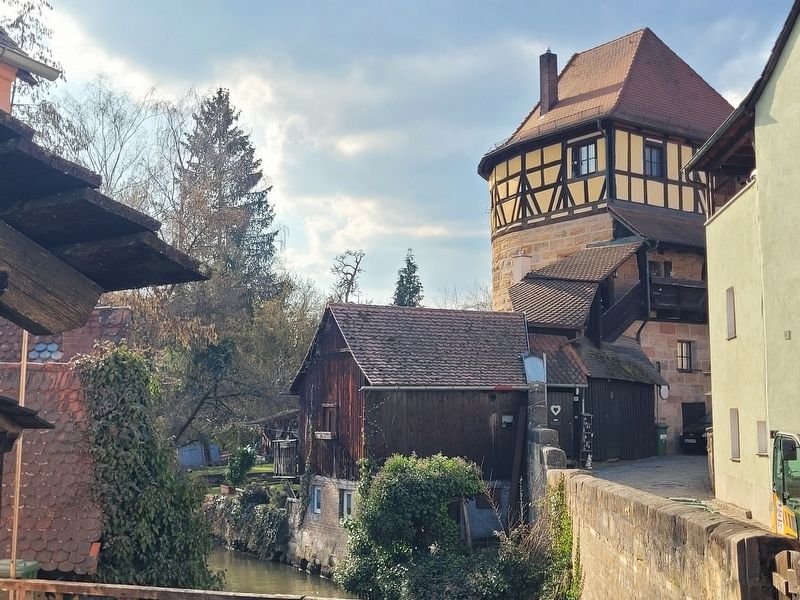
3. Judenturm / Jewish Tower Marker
The view of the tower from the Reichel Grinding Mill.
Photographed by James Hulse
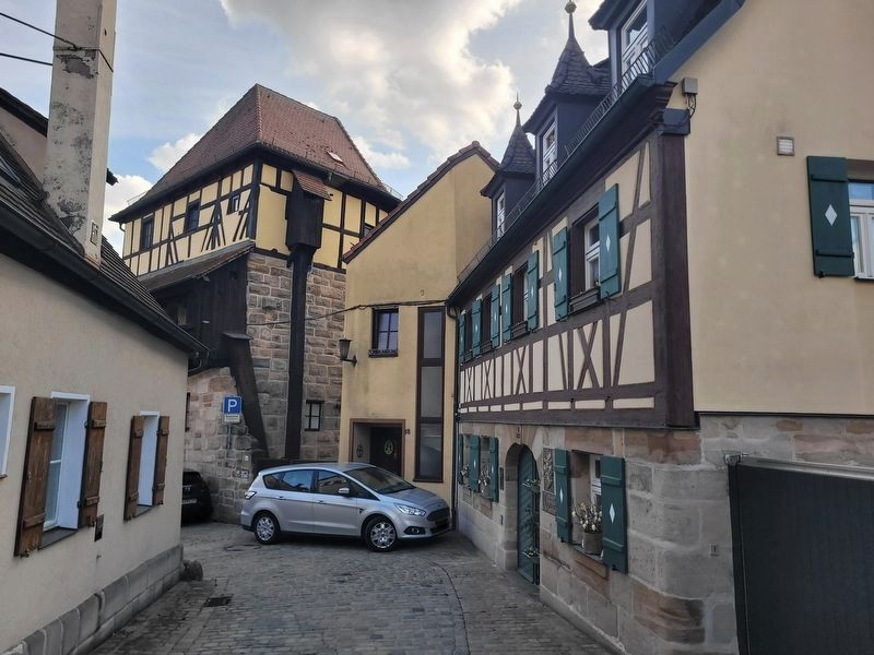
4. Judenturm / Jewish Tower Marker
The Judenturm is located behind the car in the photo.
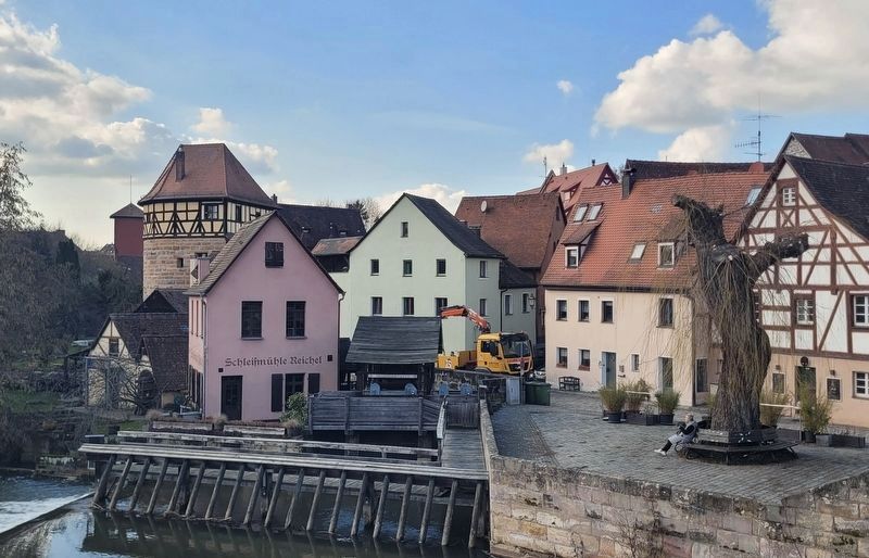
Photographed by James Hulse, March 3, 2026
5. Judenturm / Jewish Tower Marker
The Judenturm is the building on the far left of the buildings as seen from the bridge.
Credits. This page was last revised on March 26, 2026. It was originally submitted on March 25, 2026, by James Hulse of Medina, Texas. This page has been viewed 13 times since then. Photos: 1, 2, 3, 4, 5. submitted on March 26, 2026, by James Hulse of Medina, Texas.
