Coronado in San Diego County, California — The American West (Pacific Coastal)
Naiad Queen

Photographed by Connor Olson, March 29, 2026
1. Naiad Queen Marker
Topics. This historical marker is listed in this topic list: Arts, Letters, Music. A significant historical month for this entry is September 1887.
Location. 32° 40.855′ N, 117° 10.705′ W. Marker is in Coronado, California, in San Diego County. It is on Orange Avenue. Touch for map. Marker is at or near this postal address: 1500 Orange Avenue, Coronado CA 92118, United States of America. Touch for directions.

Regionally, this marker is in the Peninsular Ranges. It is also in the American Borderlands and on the Pacific Coast. Globally, it is in North America, on the Ring of Fire, on the Pacific Rim, in the Western Hemisphere, in the Western World, and in the Anglosphere. Historically, it finds itself in what was once New Spain and also Mexico’s
this page online
Other nearby markers. At least 8 other markers are within walking distance of this marker: Hotel del Coronado (within shouting distance of this marker); The Oxford (about 300 feet away, measured in a direct line); Windsor Cottage (about 300 feet away); Christmas Tree (about 300 feet away); Dragon Tree (about 400 feet away); Laundry (about 600 feet away); J.D. Spreckels House - 1908 (about 600 feet away); a different marker also named The Oxford (about 700 feet away). Touch for a list and map of all markers in Coronado.
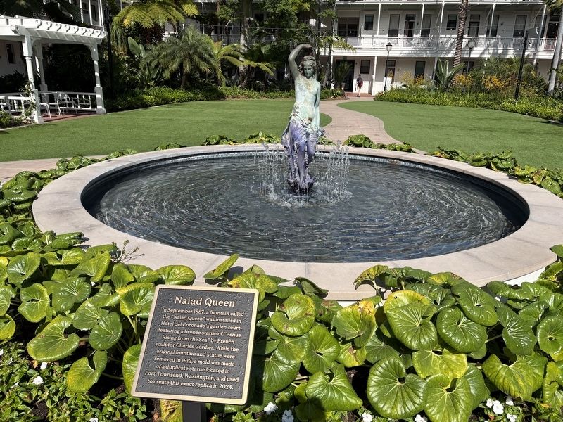
Photographed by Connor Olson, March 29, 2026
2. Naiad Queen Marker
Credits. This page was last revised on April 2, 2026. It was originally submitted on March 29, 2026, by Connor Olson of Menomonee Falls, Wisconsin. This page has been viewed 25 times since then. Photos: 1, 2. submitted on March 29, 2026, by Connor Olson of Menomonee Falls, Wisconsin. • Andrew Ruppenstein was the editor who published this page.
