Downtown West in Minneapolis in Hennepin County, Minnesota — The American Midwest (Upper Plains)
Foshay Tower
1929, 2006
| — | Historic Downtown | — |

Photographed by McGhiever, June 9, 2024
1. Foshay Tower Marker
The Foshay Tower has been a landmark in the City of Minneapolis since its opening in 1929. At 447 feet, it was Minnesota's tallest building until the completion of the IDS Tower in 1972. The Foshay, modeled after the Washington Monument, was built by Wilbur Foshay. Weeks after it was built, following the Crash of 1929, Wilbur Foshay went bankrupt and lost control of his tower.
Foshay spared no expense for his tower. The structure was built in the Art Deco style of fabricated steel and reinforced concrete and clad in Indiana Limestone. To emphasize the tower's name, "FOSHAY" is carved atop the building with ten-foot lighted letters. More elaborate was the inside of the tower, ornately decorated in marble, various woods, bronze, and with floors of terrazzo.
A three-day opening celebration in 1929, cost Foshay around $2 million in today's dollars. A march was written for the occasion by John Phillip Sousa. The Foshay became an icon of the city and a landmark for millions. In 2006, it was converted to a W Hotel with Wilbur Foshay's original apartment and offices on the twenty-seventh floor now playing host to Prohibition
this page online
Erected by Downtown Minneapolis Neighborhood Association.
Topics. This historical marker is listed in these topic lists: Architecture • Arts, Letters, Music • Industry & Commerce. A significant historical year for this entry is 1929.
Location. 44° 58.482′ N, 93° 16.326′ W. Marker is in Minneapolis, Minnesota, in Hennepin County. It is in Downtown West. It is on S. Marquette Avenue north of S. 9th Street, on the right when traveling north. Touch for map. Marker is at or near this postal address: 821 S Marquette Avenue, Minneapolis MN 55402, United States of America. Touch for directions.

Regionally, this marker is in the Twin Cities Metropolitan Area. It is also in the American Midwest, in the Corn Belt, and in the Great River Road Region. Globally, it is in North America, the Western Hemisphere, the Western World, and the Anglosphere. Historically, it finds itself in what was once Rupert’s Land, the territory of the Mississippian Culture, and the Louisiana Purchase.
Other nearby markers. At least 8 other markers are within walking distance of this marker: Former Site of Plymouth Congregational Church
Photographed by McGhiever, June 9, 2024
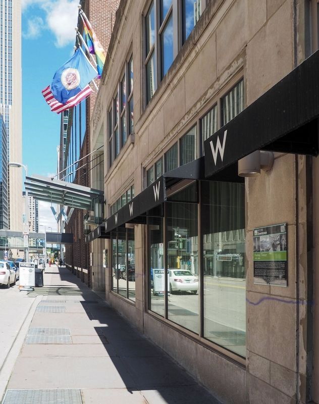
2. Foshay Tower Marker (right) on the Marquette Avenue façade of the Foshay Tower
Also see . . . Foshay Tower (QR code on marker). (Submitted on May 6, 2026, by McGhiever of Minneapolis, Minnesota.)
Credits. This page was last revised on May 6, 2026. It was originally submitted on March 31, 2026, by McGhiever of Minneapolis, Minnesota. This page has been viewed 19 times since then. Photos: 1, 2. submitted on March 31, 2026, by McGhiever of Minneapolis, Minnesota.
