Athens in Athens-Clarke County, Georgia — The American South (South Atlantic)
Georgia Railroad Trestle
Photographed by Darren Jefferson Clay, March 30, 2026
1. Georgia Railroad Trestle Marker
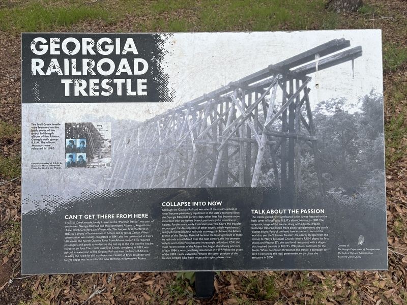
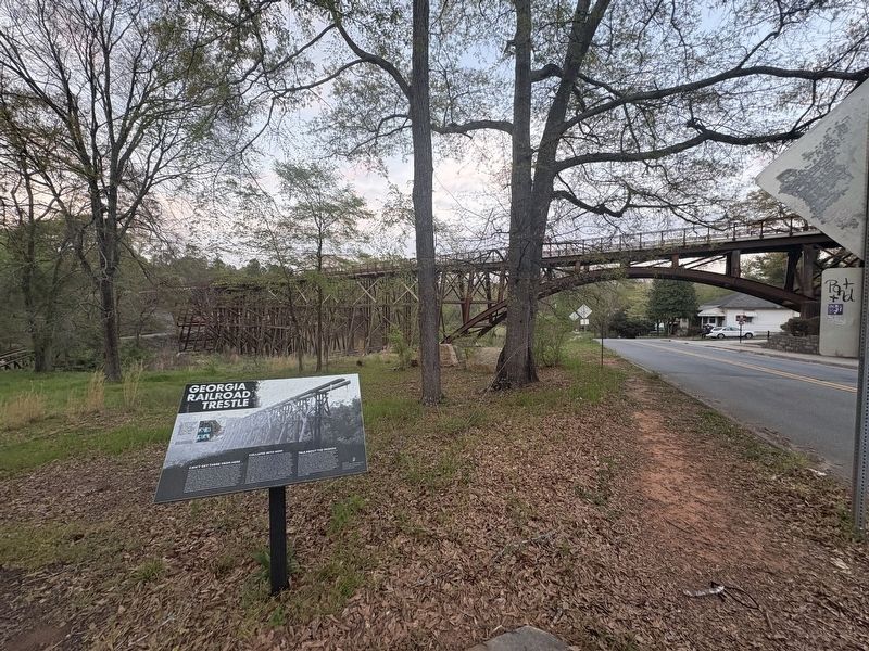
The Trail Creek trestle, fondly known as the "Murmur Trestle" was part of the former Georgia Railroad line that connected Athens to Augusta via Union Point, Crawford, and Winterville. The line was first chartered in 1833 by a group of businessmen in Athens led by James Camak. When construction was initially completed in 1841, the line terminated at Carr's Hill across the North Oconee River from Athens proper. This required passengers and goods to undertake the last leg of the trip into the city by horse or on foot. The trestle over Trail Creek, completed in 1883, was part of an extension of the Georgia Railroad into the heart of Athens, avoiding the need for this cumbersome transfer. A brick passenger and freight depot was located at the new terminus in downtown Athens.
Collapse Into Now
Although the Georgia Railroad was one of the state's earliest, it never became particularly significant to the state's economy. Since the Georgia Railroad's earliest days, other lines had become more important than the Athens branch, particularly the main line to Atlanta. Furthermore, early frustration over
this page online
Talk About The Passion
The trestle gained new significance when it was featured on the back cover of local band R.E.M.'s album, Murmur, in 1983. The enigmatic image of the trestle, along with a kudzu-draped landscape featured on the front cover, complemented the band's distinct sound. Fans of the band have come from around the world to see the "Murmur Trestl," the nearby steeple from the former St. Mary's Espicopal Church (where R.E.M. played its first show); and Weaver D's, the soul food restaurant with a slogan that inspired the
Photographed by Darren Jefferson Clay, March 30, 2026
2. Georgia Railroad Trestle Marker
(Photo caption)
The Troll Creek trestle was featured on the back cover of the debut full-length album of the Athens, Georgia rock group, R.E.M. The album Murmur, was released in 1983.
Topics. This historical marker is listed in these topic lists: Bridges & Viaducts • Entertainment • Railroads & Streetcars. A significant historical year for this entry is 1883.
Location. 33° 57.249′ N, 83° 21.877′ W. Marker is in Athens, Georgia, in Athens-Clarke County. It is on South Poplar Street 0.1 miles north of Oak Street, on the left when traveling north. Touch for map. Marker is at or near this postal address: 274 S Poplar St, Athens GA 30601, United States of America. Touch for directions.

Regionally, this marker is in the Classic City Area and in the Piedmont. It is also in the American South and specifically in the Deep South. Globally, it is in North America, the Western Hemisphere, the Western World, and the Anglosphere. Historically, it finds itself in what was once the territory of the Mississippian Culture, one of the original Thirteen Colonies, one of the Confederate States of America, and the Antebellum South.
Other nearby markers. At least 8 other markers are within walking distance of this marker: Carr's Hill (about 400 feet away, measured in a direct line); Original Oconee Street Methodist Episcopal Church bell (about 600 feet away); Dudley Park (approx. 0.2 miles away); a different marker also named Dudley Park (approx. 0.2 miles away); Oconee River (approx. 0.2 miles away); Modern Development (approx. 0.2 miles away); A City Gets on Track (approx. 0.2 miles away); a different marker also named A City Gets on Track (approx. 0.2 miles away). Touch for a list and map of all markers in Athens.
Credits. This page was last revised on April 4, 2026. It was originally submitted on March 31, 2026, by Darren Jefferson Clay of Duluth, Georgia. This page has been viewed 41 times since then. Photos: 1, 2. submitted on March 31, 2026, by Darren Jefferson Clay of Duluth, Georgia. • Bernard Fisher was the editor who published this page.
