Victoria in City of Westminster in Greater London, England, United Kingdom — Northwestern Europe (the British Isles)
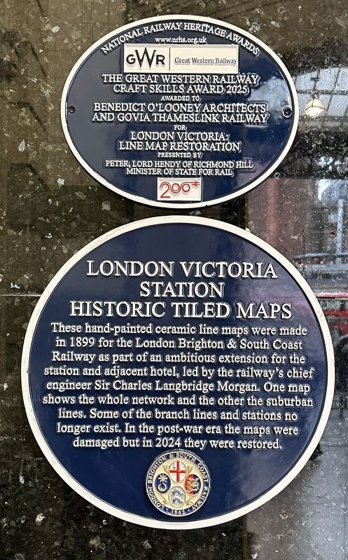
London Victoria Station Historic Tiled Maps
Photographed by Andrew Ruppenstein, March 27, 2026
1. London Victoria Station Historic Tiled Maps Marker
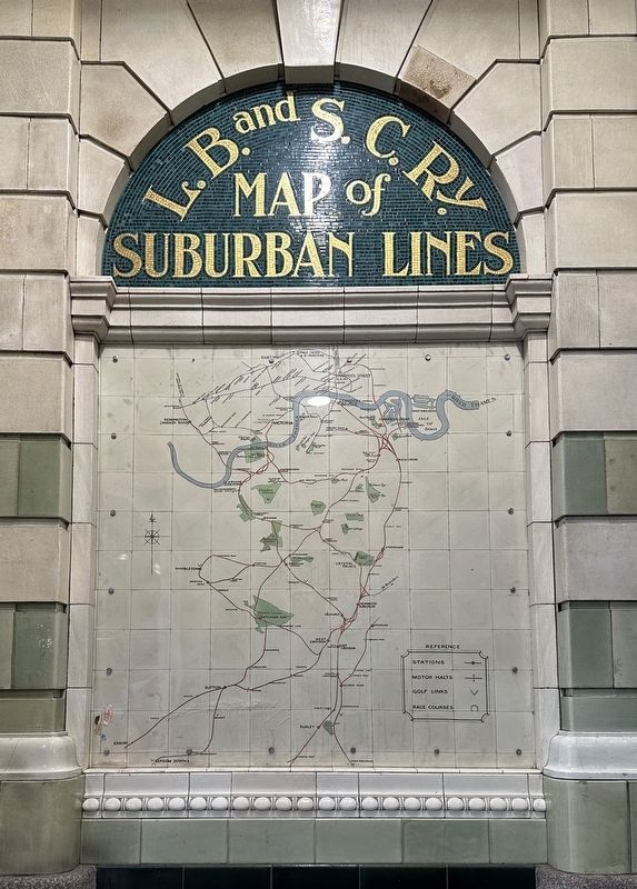
These hand-painted ceramic line maps were made in 1899 for the London Brighton & South Coast Railway as part of an ambitious extension for the station and adjacent hotel, led by the railway's chief engineer Sir Charles Langbridge Morgan. One map shows the whole network and the other the suburban lines. Some of the branch lines and stations no longer exist. In the post-war era the maps were damaged but in 2024 they were restored.
Erected 2025.
Topics. This historical marker is listed in this topic list: Railroads & Streetcars. A significant historical year for this entry is 1899.
Location. 51° 29.743′ N, 0° 8.658′ W. Marker is in City of Westminster, England, in Greater London. It is in Victoria. It can be reached from Victoria Station. The marker is located on the north side (Victoria Street side) of Victoria Station, about 2 steps into the station entryway. Touch for map. Marker is in this post office area: City of Westminster, England SW1V 1JU, United Kingdom. Touch for directions.

Regionally, this marker is in London and in the Greater South East. Globally, it is on the Atlantic Ocean, in the North Atlantic Region, in Europe, in Atlantic Europe, on one of the British Isles, in the Western World, and in the Anglosphere. Historically, it finds itself in what was once the Roman Empire.
Other nearby markers. At least 8 other markers are within walking distance of this marker: Foch (about 90 meters away, measured in a direct line); Queen Wilhelmina (approx. 0.3 kilometers away); Winston and Clementine Churchill (approx. 0.3 kilometers away); Joseph Conrad (approx. 0.3 kilometers away); Lioness and Lesser Kudu (approx. 0.3 kilometers away); Rifle Brigade War Memorial (approx. 0.3 kilometers away); Matthew Arnold (approx. 0.3 kilometers away); Augustus Pitt-Rivers (approx. 0.3 kilometers
this page online
Also see . . . …Victorian Station Maps… (INVVU). Full title: “Craftsmanship and Collaboration bring exquisite Victorian Station maps back to life for all to enjoy”. Excerpt:
Two exquisite ceramic Victorian maps at London’s Victoria Station have recently undergone meticulous restoration, preserving the rich history of the London, Brighton, and South Coast Railway, a gateway to the south coast, dating back to 1899.(Submitted on April 7, 2026.)
Originally created in the Victorian era, these maps illustrate London’s layout, showcasing the grandeur and complexity of the city and surrounding network in the 19th Century, evoking memories of journeys to stations long since disappeared.
The restoration project was undertaken by expert conservators from Restore London Ltd, who employed traditional techniques to meticulously clean, repair, and enhance the visual appeal of the maps. Each tile was carefully hand-cleaned, with missing tiles cast to match the originals, and damaged areas restored to maintain authenticity while rejuvenating these historical artifacts.
Significant portionsof the original material, including the granite sections, had suffered extensive deterioration over the years. To achieve the closest possible match, the Restore team conducted thorough research using historic photographs from Historic England. This research led to a detailed process of sampling and approvals between Restore London and Conservation Architect Benedict O’Looney, resulting in a seamless and faithful restoration.Photographed by Andrew Ruppenstein, March 27, 20262. London Victoria Station Historic Tiled Maps Marker - wide view

Additional keywords. blue plaque
Photographed by Andrew Ruppenstein, March 27, 2026
3. Tiled map - suburban lines (see Photo 2)

Photographed by Andrew Ruppenstein, March 28, 2026
4. Tiled Map - whole system
This map is on the same wall as the suburban tiled map, but a fürther 6-7 meters into the station.
Credits. This page was last revised on April 7, 2026. It was originally submitted on April 7, 2026, by Andrew Ruppenstein of Lamorinda, California. This page has been viewed 22 times since then. Photos: 1, 2, 3, 4. submitted on April 7, 2026, by Andrew Ruppenstein of Lamorinda, California.
