Jefferson City in Cole County, Missouri — The American Midwest (Upper Plains)
The Bolivar Street Neighborhood
Photographed by Wayne Johnson, April 9, 2026
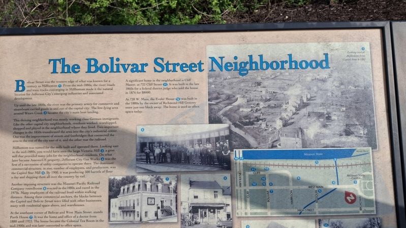
1. The Bolivar Street Neighborhood Marker
Bolivar Street was the western edge of what was known for a century as Millbottom ①. From the mid-1880s, the river, roads and train tracks converging in Millbottom made it a natural location for Jefferson City's emerging industries and associated development.
Up until the late 1860s, the river was the primary artery for commerce and steamboats carried goods in and out of the capital city. The low-lying area around Wears Creek ② became the city's main boat landing.
This thriving neighborhood was mostly working class German immigrants. Like the other capital city neighborhoods, residents worked, worshipped, shopped and played in the neighborhood where they lived. Two important changes in the 1850s transformed the area into the city's industrial center. One was the improvement of streets and footbridges that connected the area to the rest of the city east of it, and the other was the railroad.
Millbottom was name for the mills built and operated there. Looking east in the mid-1880s, on would have seen the large Victoria Mill ③, a grist mill that provided many jobs for the neighborhood residents.
this page online
Another imposing structure was the Missouri Pacific Railroad Company roundhouse ⑥ erected in the 1880s and razed in the 1970s. Many employees of the railroad lived within walking distance. Among these commercial anchors, the blocks between the Capitol and Bolivar Street were filled with other businesses, many with residential space above, and warehouses.
At the southeast corner of Bolivar and West Main Streets, stands Porth House ⑦. It was the home and office of a doctor from 1888 until 1923. The house became the Colonial Tea Room in the mid-1900s and was later converted to office space.
A significant home in the neighborhood is Cliff Manor, at 722 Cliff Street ⑪. It was built in the late 1860s for a federal district judge who sold the house in 1876
Photographed by Wayne Johnson, April 9, 2026
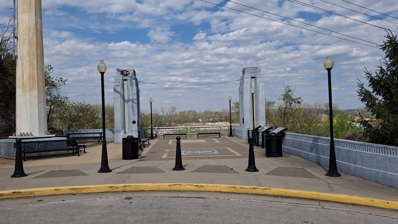
2. The Bolivar Street Bridge Remains
At 728 W. Main, the Eveler House ⑫ was built in the 1880s by the owner of Richmond Hill Grocery store just one block away. The home is used as office space today.
Topics. This historical marker is listed in these topic lists: Industry & Commerce • Settlements & Settlers. A significant historical year for this entry is 1900.
Location. 38° 35.082′ N, 92° 10.665′ W. Marker is in Jefferson City, Missouri, in Cole County. It is on Bolivar Street north of West Water Street, on the right when traveling north. Touch for map. Marker is at or near this postal address: 102 Bolivar St, Jefferson City MO 65101, United States of America. Touch for directions.

Regionally, this marker is in the Missouri River Corridor. It is also in the American Midwest, in the Lewis & Clark Corridor, and in the Corn Belt. Globally, it is in North America, the Western Hemisphere, the Western World, and the Anglosphere. Historically, it finds itself in what was once the territory of the Mississippian Culture, the Louisiana Purchase, and the Antebellum South.
Other nearby markers. At least 8 other markers are within walking distance of this marker: The Bolivar Street Bridge (here, next to this marker); Jefferson City (about 700 feet away, measured in a direct line); Gold Star Memorial (approx. 0.4 miles away); Dedicated to You, A Free Citizen in a Free Land (approx. 0.4 miles away); Thomas Jefferson (approx. half a mile away); Gold Star Families Memorial Monument (approx. half a mile away); The State Capital During The Civil War (approx. half a mile away); Site of Price Mansion (approx. half a mile away). Touch for a list and map of all markers in Jefferson City.
Credits. This page was last revised on April 10, 2026. It was originally submitted on April 9, 2026. This page has been viewed 39 times since then. Photos: 1, 2. submitted on April 9, 2026, by Wayne Johnson of Jefferson City, Missouri. • Devry Becker Jones was the editor who published this page.
Editor’s want-list for this marker. A close-up photo of the entire marker. • Transcription of the missing text. • Can you help?
