Buffalo in Dallas County, Missouri — The American Midwest (Upper Plains)
Operation Desert Shield and Desert Storm
Dallas County Veterans Memorial
Photographed by Cosmos Mariner, September 24, 2025
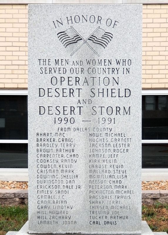
1. Operation Desert Shield and Desert Storm Marker
the men and women who
served our country in
Operation Desert Shield
and
Desert Storm
1990 — 1991
from Dallas County
Ahart, Mac • Barker, Craig • Bradley, Terry • Brown, Arthur • Carpenter, Chad • Cooksey, Randy • Cowden, Kevin • Crisman, Mark • Downing, Sheillia • Durington, Dan • Erickson, Dale Jr. • Finley, Sandi • Gamble, J.C. • Gann, Brian • Gray, Timothy • Hill, Howard • Hill, Zachary • Lambeth, Jonna • Howe, Michael • Hughes, Garnett • Jackson, Lester • Johnson, Roger • Kampe, Jeff • Kirk, Kevin • La Rose, Kevin • Mallard, Steve • McMillian, Lisa • Nelson, Chad • Peterson, Mark • Pilkington, Michael • Ragsdale, Travis • Sharp, Terri • Thiesen, Michael • Trevino, Joe • Tucker, Arthur • Carl Davis
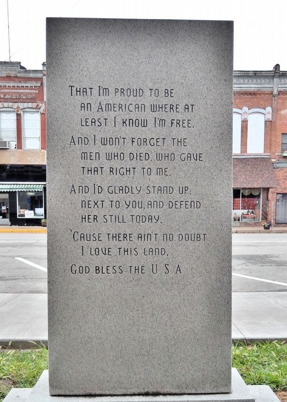
[east/back side]
That I’m proud to be an American where at least I know I’m free.
And I won’t forget the men who died, who gave that right to me.
And I’d gladly stand up next to you, and defend her still today.
’Cause there ain’t no doubt I love this land, God bless the U. S. A.
Topics. This memorial is listed in these topic lists: Patriots & Patriotism • War, 1st Iraq & Desert Storm • War, 2nd Iraq.
Location. 37° 38.626′ N,
this page online

Regionally, this memorial is in South-Central Missouri and in Greater Springfield. It is also in the American Ozarks, in the Lewis & Clark Corridor, and in the Corn Belt. Globally, it is in North America, the Western Hemisphere, the Western World, and the Anglosphere. Historically, it finds itself in what was once the territory of the Mississippian Culture, the Louisiana Purchase, and the Antebellum South.
Other nearby markers. At least 4 other markers are within 17 miles of this marker, measured as the crow flies: Veterans Memorial (within shouting distance of this marker); Dallas County (within shouting distance of this marker); Beckner Building (within shouting distance
Photographed by Cosmos Mariner, September 24, 2025
2. Operation Desert Shield and Desert Storm Marker (east/back side)

Photographed by Cosmos Mariner, September 24, 2025
3. Operation Desert Shield and Desert Storm Memorial
Looking east from South Maple Street. The marker is beside the Dallas County Courthouse.
Photographed by Cosmos Mariner, September 24, 2025
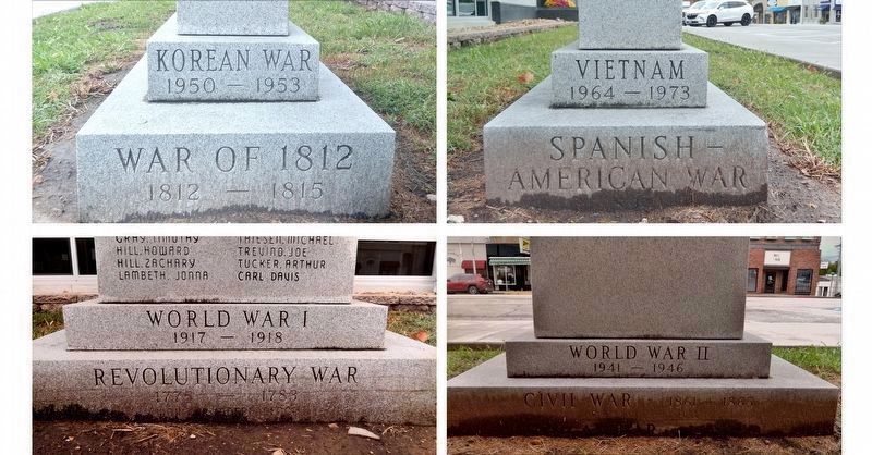
4. Operation Desert Shield and Desert Storm Memorial Base
Revolutionary War • 1775-1783
War of 1812 • 1812-1815
Civil War • 1861-1865
Spanish-American War • 1898
World War I • 1917-1918
World War II • 1941-1946
Korean War • 1950-1953
Vietnam • 1964-1973
War of 1812 • 1812-1815
Civil War • 1861-1865
Spanish-American War • 1898
World War I • 1917-1918
World War II • 1941-1946
Korean War • 1950-1953
Vietnam • 1964-1973

Photographed by Cosmos Mariner, September 24, 2025
5. Operation Desert Shield and Desert Storm Memorial
The northwest corner of the Dallas County Courthouse is in the background.
Credits. This page was last revised on April 13, 2026. It was originally submitted on April 11, 2026, by Cosmos Mariner of Cape Canaveral, Florida. This page has been viewed 21 times since then. Photos: 1, 2, 3, 4, 5. submitted on April 12, 2026, by Cosmos Mariner of Cape Canaveral, Florida.
