Port Dalhousie in St. Catharines in Niagara Region, Ontario — Central Canada (North America)
Dalhousie House circa 1850
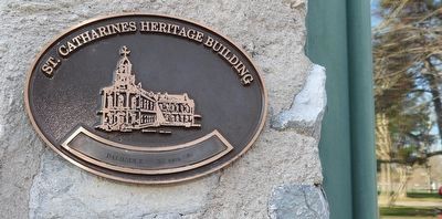
Photographed by Kevin Westell, April 11, 2026
1. Dalhousie House circa 1850 - Marker
Erected by City of St. Catharines.
Topics. This historical marker is listed in this topic list: Notable Buildings. A significant historical year for this entry is 1850.
Location. 43° 12.061′ N, 79° 16.012′ W. Marker is in St. Catharines, Ontario, in Niagara Region. It is in Port Dalhousie. It is on Lakeport Road, on the right when traveling south. Touch for map. Marker is at or near this postal address: 56 Lakeport Rd, St Catharines ON L2N 4S7, Canada. Touch for directions.

Regionally, this marker is on the Golden Horseshoe and in Niagara Canada. It is also in Central Canada. Globally, it is in North America, on the Great Lakes, in the Western Hemisphere, in the Western World, and in the Anglosphere. Historically, it finds itself in what was once a British colony, the Viceroyalty of New France, the Haudenosaunee (Iroquois) Confederacy, and Rupert’s Land.
Other nearby markers. At least 8 other markers are within walking distance of this marker: Muir Bros. Dry Dock Shipbuilders (here, next to this marker); The Muir Brother's Dry Docks
this page online
Regarding Dalhousie House circa 1850. For this 19th century industrial canal building, StCatharines.ca claims these building uses:
- 1850-1946: Muir Brother's Dry Dock (started by five Muir brothers)
- 1946-1953: Port Dalhousie Shipyard
- Garmont Supply
- ... into early 1960s: part of Port Weller Dry Dock Limited
- the City took ownership at some point
The building has these original building components: roof, windows, opening for the former loading doors, the stone and brick materials, the six diamond shapes in darker brick on its facade.
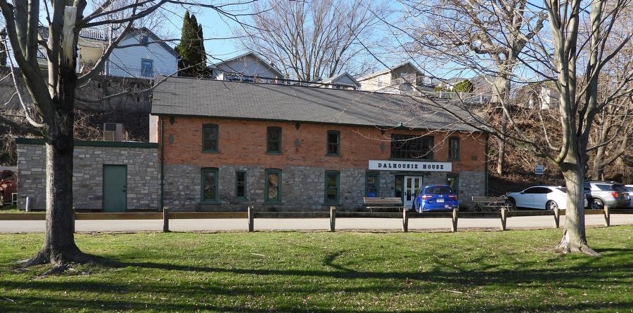
Photographed by Kevin Westell, April 11, 2026
2. Dalhousie House
This marker is mounted on the gray stone wall, left of the white entrance door.
Credits. This page was last revised on May 15, 2026. It was originally submitted on April 12, 2026, by Kevin Westell of St. Catharines, Ontario. This page has been viewed 30 times since then. Photos: 1, 2. submitted on April 12, 2026, by Kevin Westell of St. Catharines, Ontario. • J. J. Prats was the editor who published this page.
