Mansfield in Tarrant County, Texas — The American South (West South Central)
Wyatt's Chapel Church/School Site
Photographed by Cajun Scrambler, April 7, 2026
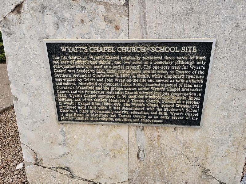
1. Wyatt's Chapel Church/School Site Marker
The site known as Wyatt's Chapel originally contained three acres of land: one acre of church and school, and two acres as a cemetery (although only one-quarter acre was used as a burial ground). The one-acre tract for Wyatt's Chapel was deeded to EDL Tims, a Methodist circuit rider, as Trustee of the Southern Methodist Conference in 1879. A single, white clapboard structure was erected by Calvin and John Wyatt on the site and served as both a church and school. Mansfield co-founder, Julian Feild, donated a parcel of land near downtown Mansfield and the groups known as the Wyatt's Chapel Methodist Church and the Poindexter Methodist Church merged into one congregation in 1885. Wyatt's Chapel continued to be used for school and Captain Enoch Harding, one of the earliest assessors in Tarrant County, worked as a teacher at Wyatt's Chapel from 1880-1888. The Wyatt's Chapel School District #75 continued until 1916 when it was consolidated with the Bludworth School District. A place of community activity, education, and faith, Wyatt's Chapel is significant in Mansfield sad Tarrant County as an early record of the pioneer
this page online
Topics. This historical marker is listed in these topic lists: Religion & Religious Structures • Settlements & Settlers. A significant historical year for this entry is 1879.
Location. 32° 35.802′ N, 97° 8.976′ W. Marker is in Mansfield, Texas, in Tarrant County. It is on U.S. 287 Frontage Road. Touch for map. Marker is at or near this postal address: 2011 U.S 287 Frontage Rd, Mansfield TX 76063, United States of America. Touch for directions.

Regionally, this marker is in the Prairies & Lakes Region and in the Dallas-Fort Worth Metropolitan Area. It is also in the American South. Globally, it is in North America, a Gulf of Mexico state, the Western Hemisphere, the Western World, and the Anglosphere. Historically, it finds itself in what was once New Spain, the Republic of Texas, and one of the Confederate States of America.
Other nearby markers. At least 8 other markers are within 3 miles of this marker, measured as the crow flies: Wyatt's Chapel Cemetery (here, next to this marker); Earle C. Driskell (approx. 1.6 miles away); a different marker also named Earle C. Driskell
Photographed by Cajun Scrambler, April 7, 2026
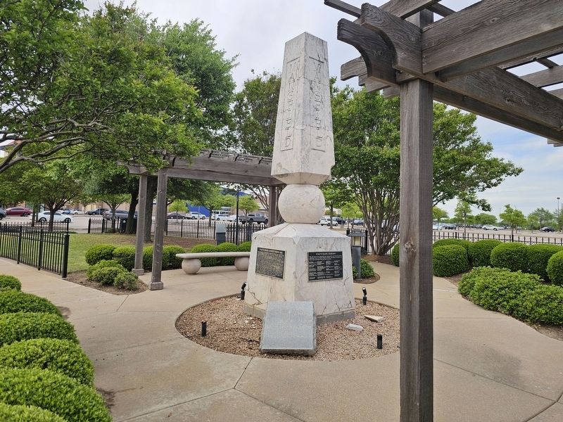
2. Wyatt's Chapel Church/School Site Marker
More about this marker. Located in the Mansfield Town Center shopping center parking lot.
Credits. This page was last revised on April 12, 2026. It was originally submitted on April 12, 2026, by Cajun Scrambler of Assumption, Louisiana. This page has been viewed 49 times since then. Photos: 1, 2. submitted on April 12, 2026, by Cajun Scrambler of Assumption, Louisiana.
