Gloucester in Gloucester County, Virginia — The American South (Mid-Atlantic)
Rosewell
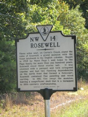
Photographed by Laura Troy, October 13, 2007
1. Rosewell Marker
Three miles west, on Carter’s Creek, stand the ruins of Rosewell, a grand mansion with the finest brickwork in the English colonies. Begun in 1725 by Mann Page I, and home to the Page family for more than one hundred years, Rosewell stood three stories tall. It was crowned with a parapet and twin octagonal cupolas and had two flanking dependencies on the north front that formed a forecourt. Rosewell contained fine paneling and wood carving. In 1916, fire swept the mansion, leaving a magnificent shell that is a testament to 18th-century craftsmanship.
Erected 1997 by Department of Historic Resources. (Marker Number NW-14.)
Topics and series. This historical marker is listed in this topic list: Notable Buildings. In addition, it is included in the Virginia Department of Historic Resources (DHR) series list. A significant historical year for this entry is 1725.
Location. 37° 20.535′ N, 76° 31.225′ W. Marker is in Gloucester, Virginia, in Gloucester County. It is on George Washington Memorial Highway (U.S. 17) south of Piney Swamp Road, on the right when traveling north. Touch for map. Marker is at or near this postal
this page online

Regionally, this marker is on the Middle Peninsula and in the Hampton Roads Metropolitan Area. It is also in the American South, specifically in the Upper South, in the Tidewater, in the Chesapeake Bay Region, and on the Eastern Seaboard. Globally, it is in the North Atlantic Region, North America, the Western Hemisphere, the Western World, and the Anglosphere. Historically, it finds itself in what was once the territory of the Mississippian Culture, one of the original Thirteen Colonies, one of the Confederate States of America, and the Antebellum South.
Other nearby markers. At least 8 other markers are within walking distance of this marker: Fairfield (here, next to this marker); Robert Russa Moton (approx. ¼ mile away); United Negro College Fund (approx. ¼ mile away); Warner Hall (approx. 0.6 miles away); Abingdon Church (approx. 0.7 miles away); These Page Family Tombs (approx. 0.7 miles away); The Page Family (approx. 0.7 miles away); Confederate Soldiers Memorial (approx. 0.7 miles away). Touch for a list and map
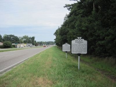
Photographed by Kevin W., July 21, 2010
2. Rosewell Marker
Other markers no longer nearby. Rosewell and Werowocomoco (was approx. ¼ mile away but has been confirmed missing); Dr. Walter Reed’s Birthplace (was approx. ¼ mile away but has been confirmed missing).
More about this marker. This marker sits with NW-22 and is yards from NW-8 and NW-6
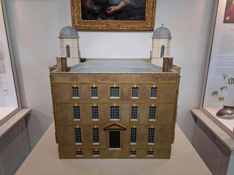
Photographed by Evan Dwyer, April 11, 2026
3. Rosewell Model
This model, built for display at the White House during the USA's bicentennial, shows Rosewell as it was originally constructed. The roof was modified and cupolas removed in the 1840s, after the house passed out of Page family ownership. The model is the centerpiece of the exhibit within the Rosewell visitor center.

Photographed by Evan Dwyer, April 11, 2026
4. Rosewell in 1890
This photo on the wall in the visitor center at Rosewell shows the house before it burned.
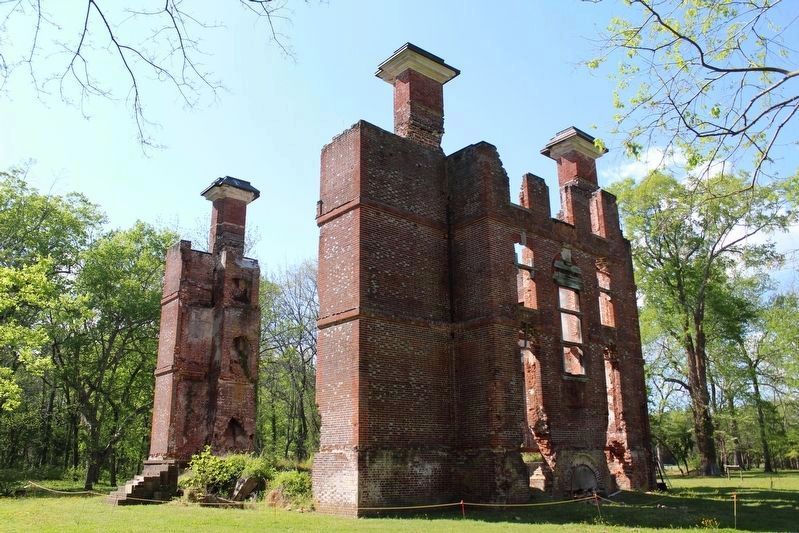
Photographed by Evan Dwyer, April 11, 2026
5. Rosewell in 2026
Credits. This page was last revised on April 19, 2026. It was originally submitted on October 14, 2007, by Laura Troy of Burke, Virginia. This page has been viewed 1,594 times since then and 44 times this year. Last updated on April 17, 2026, by Evan Dwyer of Richmond, Virginia. Photos: 1. submitted on October 14, 2007, by Laura Troy of Burke, Virginia. 2. submitted on July 27, 2010, by Kevin W. of Stafford, Virginia. 3, 4, 5. submitted on April 17, 2026, by Evan Dwyer of Richmond, Virginia. • Devry Becker Jones was the editor who published this page.
