
Near Port Lavaca in Calhoun County, Texas — The American South (West South Central)
Chocolate Community
Photographed by Jeff Leichsenring, April 10, 2026
1. Chocolate Community Marker
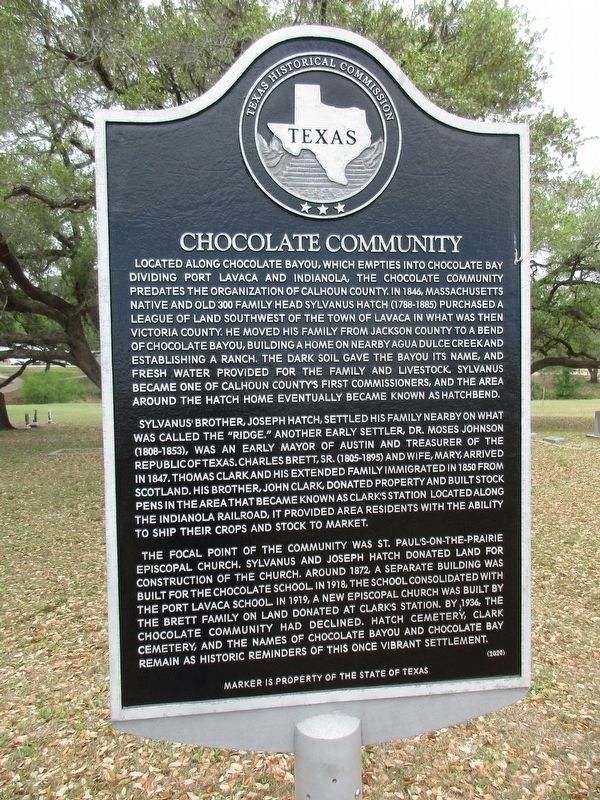
Located along Chocolate Bayou, which empties into Chocolate Bay dividing Port Lavaca and Indianola, the Chocolate Community predates the organization of Calhoun County. In 1846, Massachusetts native and Old 300 family head Sylvanus Hatch (1788-1885) purchased a league of land southwest of the town of Lavaca in what was then Victoria County. He moved his family from Jackson County to a bend of Chocolate Bayou, building a home on nearby Agua Dulce Creek and establishing a ranch. The dark soil gave the bayou its name, and fresh water provided for the family and livestock. Sylvanus became one of Calhoun County's first commissioners, and the area around the Hatch home eventually became known as Hatchbend.
Sylvanus brother, Joseph Hatch, settled his family nearby on what was called the "Ridge." Another early settler, Dr. Moses Johnson (1808-1853), was an early mayor of Austin and treasurer of the Republic of Texas. Charles Brett, Sr. (1805-1895) and wife, Mary, arrived in 1847. Thomas Clark and his extended family immigrated in 1850 from Scotland. His brother, John Clark, donated property and built stock pens
this page online
The focal point of the community was St. Paul's-On-The-Prairie Episcopal Church. Sylvanus and Joseph Hatch donated land for construction of the church. Around 1872, a separate building was built for the Chocolate school. In 1918, the school consolidated with the Port Lavaca school. In 1919, a new Episcopal church was built by the Brett family on land donated at Clark's Station. By 1936, the Chocolate Community had declined. Hatch Cemetery, Clark Cemetery, and the names of Chocolate Bayou and Chocolate Bay remain as historic reminders of this once vibrant settlement.
Erected 2020 by Texas Historical Commission. (Marker Number 22744.)
Topics. This historical marker is listed in this topic list: Settlements & Settlers. A significant historical year for this entry is 1846.
Location. 28° 35.342′ N, 96° 42.1′ W. Marker is near Port Lavaca, Texas, in Calhoun County. It is on Meadowview Lane half a mile north of Texas Route 35. Marker is in Hatchbend Country
Photographed by Jeff Leichsenring, April 10, 2026
2. Chocolate Community Marker
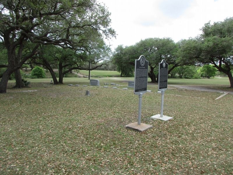
Marker is on the right; Hatch Cemetery (15875) marker is on the left.

Regionally, this marker is in the American South and on the Gulf Coast. Globally, it is in North America, a Gulf of Mexico state, the Western Hemisphere, the Western World, and the Anglosphere. Historically, it finds itself in what was once New Spain, the Republic of Texas, and one of the Confederate States of America.
Other nearby markers. At least 8 other markers are within 4 miles of this marker, measured as the crow flies: Hatch Cemetery (a few steps from this marker); Sylvanus Hatch (within shouting distance of this marker); Clark Cemetery (approx. one mile away); Calhoun County (approx. 2.6 miles away); Moses Johnson, M.D. (approx. 2.6 miles away); Battle of Norris Bridge (approx. 3.2 miles away); Edward Fred Knipling (approx. 3½ miles away); Kamey Community (approx. 4 miles away). Touch for a list and map of all markers in Port Lavaca.
Credits. This page was last revised on April 15, 2026. It was originally submitted on April 13, 2026, by Jeff Leichsenring of Garland, Texas. This page has been viewed 27 times since then. Photos: 1. submitted on April 13, 2026, by Jeff Leichsenring of Garland, Texas. 2. submitted on April 14, 2026, by Jeff Leichsenring of Garland, Texas. • James Hulse was the editor who published this page.
