Hingham Town Center in Plymouth County, Massachusetts — The American Northeast (New England)
Almshouse
Photographed by G.W.Bartlett, April 15, 2026
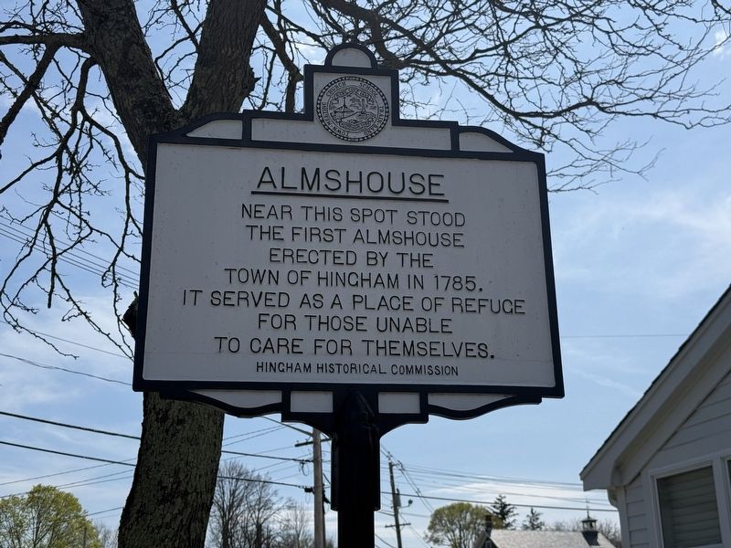
1. Almshouse Marker
Near this spot, the first Almshouse was erected by the Town of Hingham in 1785. It served as a place of refuge for those unable to care for themselves
Erected by Hingham Historical Commission.
Topics. This historical marker is listed in this topic list: Charity & Public Work. A significant historical year for this entry is 1785.
Location. 42° 14.028′ N, 70° 52.761′ W. Marker is in Hingham, Massachusetts, in Plymouth County. It is in Hingham Town Center. It is at the intersection of Short Steet (Massachusetts Route 228) and Leavitt Street, on the left when traveling north on Short Steet. Touch for map. Marker is at or near this postal address: 15 Short Steet, Hingham MA 02043, United States of America. Touch for directions.

Regionally, this marker is on the South Shore. It is also in the American Northeast, in New England, and on the Eastern Seaboard. Globally, it is in the North Atlantic Region, North America, the Western Hemisphere, the Western World, and the Anglosphere. Historically, it finds itself in what was once one of the original Thirteen Colonies.
Other nearby markers. At least 8 other markers
this page online
Related markers. Click here for a list of markers that are related to this marker.
Also see . . .
1. Poorhouse - Wikipedia.
Poorhouses were public institutions used from the seventeenth through the early twentieth centuries to provide relief for people unable to support themselves, including the elderly, the sick, people with disabilities, widows, and others. In North America—particularly in the United States and Canada—they were usually operated by local governments and often took the form of “poor farms,” where residents who were able to work were expected to contribute labor.(Submitted on April 24, 2026, by G.W.Bartlett of Hingham, Massachusetts.)
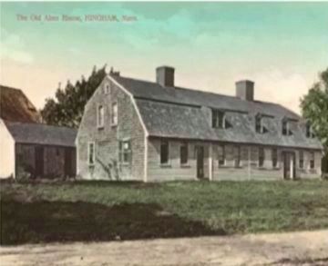
2. The Old Alms House, Hingham, Mass.
Photographed by G.W.Bartlett, April 15, 2026
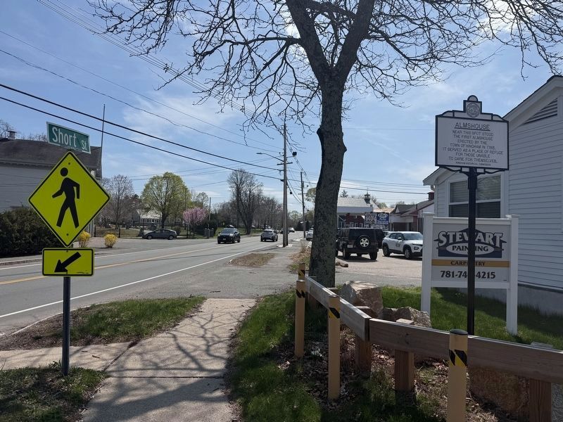
2. Almshouse Marker
Postcard with colorized image of the Almshouse on Short Street. Hingham Historical Society.(Submitted on May 9, 2026, by G.W.Bartlett of Hingham, Massachusetts.)

Photographed by G.W.Bartlett, May 9, 2026
3. Almshouse Marker
Almshouse Marker with signs for Leavitt Street, Route 228 and Short Street.
Photographed by G.W.Bartlett
4. The Old Almshouse, Hingham, Mass.
A picture postcard of Hingham's first almshouse
Credits. This page was last revised on May 11, 2026. It was originally submitted on April 15, 2026, by G.W.Bartlett of Hingham, Massachusetts. This page has been viewed 48 times since then. Photos: 1, 2. submitted on April 15, 2026, by G.W.Bartlett of Hingham, Massachusetts. 3. submitted on May 9, 2026, by G.W.Bartlett of Hingham, Massachusetts. 4. submitted on May 5, 2026, by G.W.Bartlett of Hingham, Massachusetts. • Michael Herrick was the editor who published this page.
