Near Huntsville in Madison County, Alabama — The American South (East South Central)
Joe B. Shirley Fire Tower
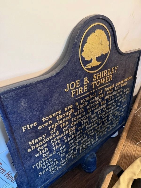
Photographed by Jennifer Chou
1. Joe B. Shirley Fire Tower Marker
The marker is located in storage.
Fire towers are a symbol of forest conservation even though their original role has been replaced with aircraft surveillance. Many of the towers across the U.S. have been abandoned or destroyed making ours one of the few remaining. The 100 ft Aermotor model with 7 ft x 7 ft metal cab constructed in 1968 by the Alabama Forestry Commission. It replaced an earlier wooden tower dating to the 1940s. The Lookout was used in the 1950s by NASA to track and record telemetry from Sputnik I and Explorer I satellites. Listed on the National Historic Lookout Register. October 18, 2006- NHLR #US 680.AL3.
Erected 2007 by Jane Barr. (Marker Number 680.AL3.)
Topics. This historical marker is listed in this topic list: Horticulture & Forestry. A significant historical date for this entry is October 18, 1968.
Location. Marker is missing. It was located near 34° 43.882′ N, 86° 30.268′ W. Marker was near Huntsville, Alabama, in Madison County. It could be reached from Cabin Drive. Marker is located at the Fire Tower. Touch for map. Marker was at or near this postal address: 35 Cabin Drive, Huntsville AL 35801, United States of America. Touch for directions.

Regionally,
this page online
Other nearby markers. At least 8 other markers are within 2 miles of this location, measured as the crow flies: Robert Fearn Home (approx. ¼ mile away); Classroom at the Lake (approx. 0.4 miles away); James O'Shaughnessy Home (approx. 0.6 miles away); Monte Sano Railway (approx. 1.2 miles away); Schrimsher Farm (approx. 1½ miles away); Lowell M. Anderson (approx. 1½ miles away); Camp Monte Sano (approx. 1.6 miles away); Monte Sano Elementary School (approx. 1.6 miles away). Touch for a list and map of all markers in Huntsville.
More about this marker. The marker and fire tower have been sold and are being moved to Crane Hill, Alabama area.
Also see . . . A Historic Fire Tower Finds New Life at Smith Lake. Alabama Living Magazine
The fire tower was deconstructed and is currently being rebuilt at Fire Tower Camp. Moving and reconstructing a 100-foot fire tower made of galvanized steel is no easy feat, but it’s a labor of love for Claunch. He’s sincerely thankful for those in the local community who have been instrumental in helping with the reconstruction, saying, “All of the work that has been done on the tower and at Fire Tower Camp has been by people I met at the Crane Hill Food Mart.”(Submitted on August 20, 2026, by James Hulse of Medina, Texas.)
Credits. This page was last revised on August 20, 2026. It was originally submitted on April 16, 2026, by Jennifer Chou of Decatur, Alabama. This page has been viewed 27 times since then. Photo 1. submitted on April 16, 2026, by Jennifer Chou of Decatur, Alabama. • James Hulse was the editor who published this page.
Editor’s want-list for this marker. New photos of the marker at the new location with the fire tower. • Can you help?
