Mantorville in Dodge County, Minnesota — The American Midwest (Upper Plains)
Mantorville Brewery
1857-1939
Photographed by McGhiever, October 3, 2025
1. Mantorville Brewery Marker
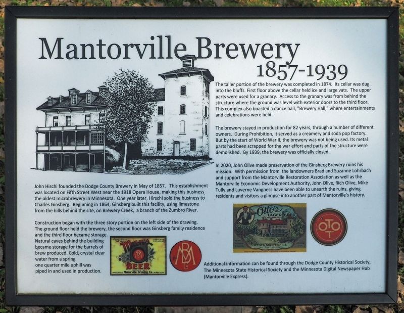
John Hischi founded the Dodge County Brewery in May of 1857. This establishment was located on Fifth Street West near the 1918 Opera House, making this business the oldest microbrewery in Minnesota. One year later, Hirschi sold the business to Charles Ginsberg. Beginning in 1864 Ginsberg built this facility, using limestone from the hills behind the site, on Brewery Creek, a branch of the Zumbro River.
Construction began with the three story portion on the left side of the drawing. The ground floor held the brewery, the second floor was Ginsberg family residence and the third floor became storage. natural caves behind the building became storage for the barrels of brew produced. Cold, crystal clear water from a spring one quarter mile uphill was piped in and used in production.
The taller portion of the brewery was completed in 1874. Its cellar was dug into the bluffs. First floor above the cellar held ice and large vats. The upper parts were used for a granary. Access to the granary was from behind the structure where the ground was level with exterior doors to the third floor. This complex also boasted a dance
this page online
The brewery stayed in production for 82 years, through a number of different owners. During Prohibition, it served as a creamery and soda pop factory. But by the start of World War II, the brewery was not being used. Its metal parts had been scrapped for the war effort and parts of the structure were demolished. By 1939, the brewery was officially closed.
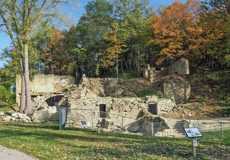
In 2020, John Olive made preservation of the Ginsberg Brewery ruins his mission. With permission from the landowners Brad and Suzanne Lohrbach and support from the Mantorville Restoration Association as well as the Mantorville Economic Development Authority, John Olive, Rich Olive, Mike Tully and Luverne Vangness have been able to unearth the ruins, giving residents and visitors a glimpse into another part of Mantorville's history.
Additional information can be found through the Dodge County Historical Society, The Minnesota State Historical Society and the Minnesota Digital Newspaper Hub (Mantorville Express).
Topics. This historical marker is listed in these topic lists: Charity & Public Work •
Photographed by McGhiever, October 3, 2025
2. Mantorville Brewery ruins and marker
Location. 44° 4.018′ N, 92° 45.196′ W. Marker is in Mantorville, Minnesota, in Dodge County. It is at the intersection of 5th Street E. and Bluff Street, on the right when traveling east on 5th Street E.. Touch for map. Marker is in this post office area: Mantorville MN 55955, United States of America. Touch for directions.

Regionally, this marker is in Southeast Minnesota and in Greater Rochester. It is also in the American Midwest and in the Corn Belt. Globally, it is in North America, the Western Hemisphere, the Western World, and the Anglosphere. Historically, it finds itself in what was once Rupert’s Land and also the territory of the Mississippian Culture.
Other nearby markers. At least 8 other markers are within walking distance of this marker: Log House (about 400 feet away, measured in a direct line); Hubbell House (about 500 feet away); Restoration House (about 500 feet away); Dodge County Veterans Memorial (about 600 feet away); Gold Star Families Memorial Monument (approx. 0.2 miles away); Zumbro Watershed (approx. 0.2 miles away); 1869 School Bell and Cornerstone (approx. ¼ mile away); Normal School (approx. ¼ mile away). Touch for a list and map of all markers in Mantorville.
Credits. This page was last revised on April 17, 2026. It was originally submitted on April 17, 2026, by McGhiever of Minneapolis, Minnesota. This page has been viewed 18 times since then. Photos: 1, 2. submitted on April 17, 2026, by McGhiever of Minneapolis, Minnesota.
