Richland in Benton County, Washington — The American West (Northwest)
In Honor of Central United Protestant Church (2016)

Photographed by Clayton Pickett, April 15, 2026
1. In Honor of Central United Protestant Church Marker
With the influx of 25,000 people into Richland in 1943, Colonel Franklin Matthias proposed the construction of two army style chapels, one Catholic, the other to be shared by the 11 Protestant congregations, each with one hour service on Sunday. This problem was taken to the denominational leaders of the Washington State Council of Churches where they determined the 11 denominations join together in a single Sunday service and establish a full time church program. The 11 congregations established in the area since 1905 and with the largest congregation,
this page online
Erected 2016.
Topics. This historical marker is listed in these topic lists: Architecture • Religion & Religious Structures. A significant historical year for this entry is 1964.
Location. 46° 17.043′ N, 119° 17.028′ W. Marker is in Richland, Washington, in Benton County. It can be reached from Stevens Drive 0.3 miles north of Swift Boulevard, on the right when traveling north. Touch for map. Marker is at or near this postal address: 1124 Stevens Drive, Richland WA 99352, United States of America. Touch for directions.

Regionally, this marker is in the Columbia Basin and in Yakima Valley. It is also in the American Mountain West and in the Lewis & Clark Corridor. Globally, it is in North America, on the Pacific Rim, in the Western Hemisphere, in the Western World, and in the Anglosphere.
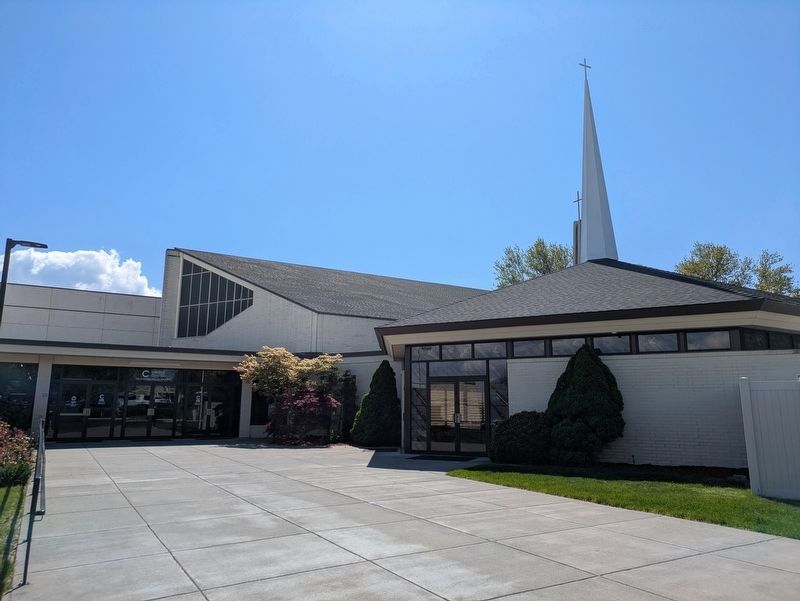
Photographed by Clayton Pickett, April 15, 2026
2. Central United Protestant Church
Other nearby markers. At least 8 other markers are within 2 miles of this marker, measured as the crow flies: Col. Thomas William Symons (approx. 0.4 miles away); Historic Amon Park Arch (approx. 0.9 miles away); The Columbia River (approx. 0.9 miles away); The City of Richland (approx. 0.9 miles away); Howard Amon Park (approx. 0.9 miles away); VFW Post 7952 Vietnam Veterans Memorial (approx. 1.2 miles away); Peace And Friendship (approx. 1.6 miles away); F.A. Friermood House (approx. 1.7 miles away). Touch for a list and map of all markers in Richland.
Credits. This page was last revised on April 21, 2026. It was originally submitted on April 17, 2026, by Clayton Pickett of Richland, Washington. This page has been viewed 17 times since then. Photos: 1, 2. submitted on April 17, 2026, by Clayton Pickett of Richland, Washington. • Andrew Ruppenstein was the editor who published this page.
