Keachi in De Soto Parish, Louisiana — The American South (West South Central)
Town of Keachi, LA
Photographed by Cajun Scrambler, April 12, 2026
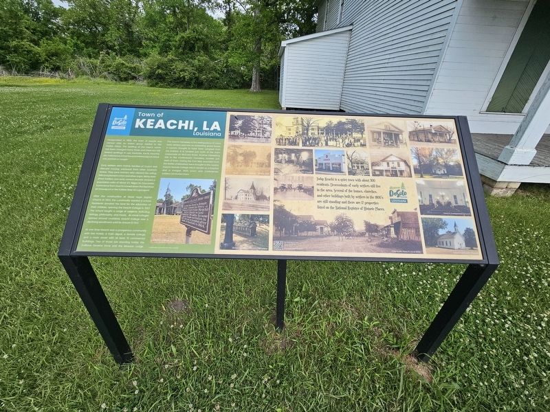
1. Town of Kachi, LA Marker
Incorporated in 1858, the town of Keachi was named after an Indian group related to the Caddo tribes. The spelling of the town's name has been changed many times and there are still several spellings in use: Keatchie, Kechi, Keachie, etc. Folklore has it that the word means big cat, black cat, panther or cougar.
Early settlers were mainly families of Scotch Irish descent moving westward from other southern states. They were farmers who cleared the rolling hills and planted cotton and other crops. Many were slave holders and early census records showed a population ratio of about 2:1, Negro to Caucasian. Commerce from Keachi moved down the Red River at Shreveport or the Sabine River at Logansport.
After the construction of Good Hope Baptist Church in 1852, the community wanted a school. Residents donated the land for the education of their children, opening the Keachi College in 1857. The school taught a range of subjects, including biology, philosophy, and music. As more colleges opened around Louisiana, Keachi College saw a declining enrollment until its closure in 1912.
At one time Keachi was a
this page online
The Keachi Cemetery is the resting place of many early settlers and has an interesting grave house, a custom thought to have been adopted from the Indians. It is located just north of the main crossroads on McCann Road. Another interesting site is the Confederate Cemetery located just west of town. During the Civil War, wounded from the Battle of Mansfield were brought to the nearby Keachi Female College which served as a hospital and a morgue. Both Union and Confederate soldiers are buried there.
Today Keachi is a quiet town with about 300 residents. Descendants of early settlers still live in the area. Several of the homes, churches and other buildings built by settlers in the 1800's are still standing and there are 12 properties listed on the National Register of Historic Places.
Erected by Discover DeSoto Parish.
Topics. This historical marker is listed in this topic list: Settlements & Settlers.
Location. 32° 11.3′ N,
Photographed by Cajun Scrambler, April 12, 2026
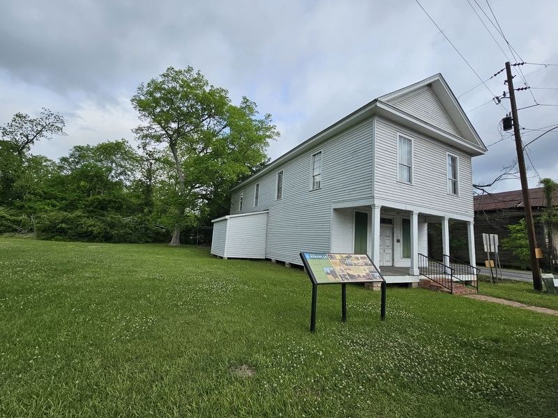
2. Town of Keachi, LA Marker

Regionally, this marker is in North Louisiana. It is also in the American South, specifically in the Deep South, and in the Piney Woods. Globally, it is in North America, a Gulf of Mexico state, the Western Hemisphere, the Western World, and the Anglosphere. Historically, it finds itself in what was once the territory of the Mississippian Culture, the Louisiana Purchase, one of the Confederate States of America, and the Antebellum South.
Other nearby markers. At least 8 other markers are within 16 miles of this marker, measured as the crow flies: Keachi College (approx. ¼ mile away); Confederate Cemetery (approx. half a mile away); Centennial Afro American Cemetery (approx. 10 miles away in Texas); Keithville Methodist Church (approx. 11.1 miles away); Adams Cemetery (approx. 12.3 miles away in Texas); International Boundary Marker (approx. 13.4 miles away in Texas); a different marker also named International Boundary Marker (approx. 13.4 miles away in Texas); Site of Bethany (approx. 15.2 miles away in Texas).
Another marker is no longer nearby. International Boundary (was approx. 13.4 miles away but has been confirmed missing).
Credits. This page was last revised on April 18, 2026. It was originally submitted on April 18, 2026, by Cajun Scrambler of Assumption, Louisiana. This page has been viewed 32 times since then. Photos: 1, 2. submitted on April 18, 2026, by Cajun Scrambler of Assumption, Louisiana.
