
Near Manchester in Red River County, Texas — The American South (West South Central)
Jesse B. Bowman
Photographed by Morgan Petermann, April 17, 2026
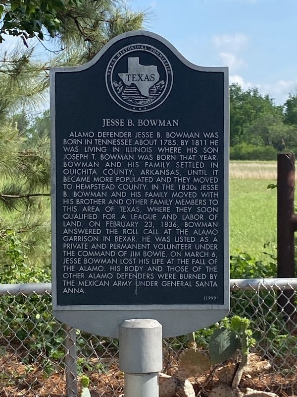
1. Jesse B. Bowman Marker
Alamo defender Jesse B. Bowman was born in Tennessee about 1785. By 1811 he was living in Illinois where his son Joseph T. Bowman was born that year. Bowman and his family settled in Ouichita County, Arkansas, until it became more populated and they moved to Hempstead County. In the 1830s Jesse B. Bowman and his family moved with his brother and other family members to this area of Texas, where they soon qualified for a league and labor of land. On February 23, 1836, Bowman answered the roll call at the Alamo garrison in Bexar. He was listed as a private and permanent volunteer under the command of Jim Bowie. On March 6, Jesse Bowman lost his life at the fall of the Alamo. His body and those of the other Alamo defenders were burned by the Mexican army under General Santa Anna.
Erected 1999 by Texas Historical Commission. (Marker Number 12166.)
Topics. This historical marker is listed in this topic list: War, Texas Independence. A significant historical date for this entry is February 23, 1836.
Location. 33° 55.352′ N, 95° 8.245′ W. Marker is near Manchester, Texas, in Red River County. It is on Farm to Market Road 410 6.7 miles
this page online

Regionally, this marker is in the American South and in the Piney Woods. Globally, it is in North America, a Gulf of Mexico state, the Western Hemisphere, the Western World, and the Anglosphere. Historically, it finds itself in what was once New Spain, the Republic of Texas, one of the Confederate States of America, and the Antebellum South.
Other nearby markers. At least 8 other markers are within 9 miles of this marker, measured as the crow flies: Jane Chandler Gill (here, next to this marker); Jonesboro (here, next to this marker); Near Here at the Old Jonesboro Crossing Sam Houston (a few steps from this marker); Arnold E. A. Roitsch Archeological Site (approx. 1.9 miles away); Clear Creek Water Mill (approx. 5.9 miles away in Oklahoma); Elliott Academy (approx. 5.9 miles away in Oklahoma); The Choctaw Nation of Oklahoma (approx. 8.3 miles away in Oklahoma); Tuggle Springs Cemetery (approx. 9 miles away).

Photographed by Morgan Petermann, April 17, 2026
2. Jesse B. Bowman Marker is the marker on the left of this picture

Photographed by Morgan Petermann, April 17, 2026
3. Jesse B. Bowman Marker
Credits. This page was last revised on April 18, 2026. It was originally submitted on April 18, 2026, by Morgan Petermann of Hurst, Texas. This page has been viewed 17 times since then. Photos: 1, 2, 3. submitted on April 18, 2026, by Morgan Petermann of Hurst, Texas. • James Hulse was the editor who published this page.
