Regierungsvierte in Berlin in Friedrichshain-Kreuzberg, Germany — Northeast German Plain (The European Plain)
Außenansicht der Synagoge Lindenstraße
⎯⎯⎯
Exterior view of the Synagogue on Lindenstraße

Photographed by James Hulse, March 7, 2026
1. Außenansicht der Synagoge Lindenstraße / Exterior view of the Synagogue on Lindenstraße Marker

Die 1891 fertiggestellte und am 27. September des Jahres eingeweihte Liberale Synagoge Lindenstraße 48–50 wurde nach einem Entwurf des Architekturbüros Cremer & Wolffenstein realisiert. Das Gebetshaus war im Hinterhof gelegen. Im Vorderhaus befanden sich die Rabbinerwohnung, eine Religionsschule sowie verschiedene Büros jüdischer Organisationen.
Die Fassade der Synagoge war von der Straße her nur zum Teil sichtbar. Die Außenarchitektur war mit romanischen sowie spätgotischen Formelementen versehen. Den Mittelraum überdachte ein Rippengewölbe mit einer Lichtkuppel. Die Synagoge in der Lindenstraße gehörte zu den ersten großen Berliner Synagogen, deren Bauweise sich bewusst den Zeittendenzen der Architektur anzupassen versuchte.
In der Pogromnacht vom 9. zum 10. November 1938 wurde auch diese Synagoge in Brand gesteckt, der Innenraum demoliert und teilweise zerstört. Das Gebäude blieb jedoch weitgehend erhalten. Ende des Jahres 1939 wurde es beschlagnahmt und als Getreidespeicher zweckentfremdet. Im Kriege stark beschädigt, wurde das Synagogengebäude nach Verkauf des Grundstückes an das Land Berlin 1956
this page online
Die heutige Form der Gedenkstätte, in der sich die Erinnerung an den Ort und seine Geschichte spiegelt, ist einer Wettbewerbsinitiative der Barmer Ersatzkasse zu verdanken.
The Liberal Synagogue at Lindenstraße 48–50, completed in 1891 and inaugurated on September 27 of that year, was built according to designs by the architectural firm Cremer & Wolffenstein. The prayer hall was located in the rear courtyard. The front building contained the rabbi’s residence, a religious school, and various offices of Jewish organizations.
The synagogue’s façade was only partially visible from the street. Its exterior architecture featured Romanesque and late Gothic design elements. The central hall was covered by a ribbed vault with a skylight dome. The Lindenstraße synagogue was among the first large Berlin synagogues whose design consciously sought to align with contemporary architectural trends.
During the pogrom night of November 9–10, 1938, the synagogue was set on fire, and the interior was vandalized and partially destroyed. However, the structure itself largely remained intact. At the end of 1939,

Photographed by James Hulse, March 7, 2026
2. Außenansicht der Synagoge Lindenstraße / Exterior view of the Synagogue on Lindenstraße Marker
The first marker on the left side.
The present form of the memorial, which reflects the memory of the site and its history, is the result of a design competition initiative by the Barmer Ersatzkasse.
Topics and series. This historical marker is listed in this topic list: Religion & Religious Structures. In addition, it is included in the Synagogues series list. A significant historical date for this entry is November 10, 1938.
Location. 52° 30.526′ N, 13° 23.991′ E. Marker is in Berlin, in Friedrichshain-Kreuzberg. It is in Regierungsvierte. It is on Axel-Springer-Straße just south of Kommandantenstraße, on the right when traveling north. Touch for map. Marker is at or near this postal address: Axel-Springer-Straße 51, Berlin 10969, Germany. Touch for directions.

Regionally, it is in Europe, the European Union, Atlantic Europe, Central Europe, the Schengen Area, Western Europe, and the Western World. Historically, it finds itself in what was once the Holy Roman Empire, the
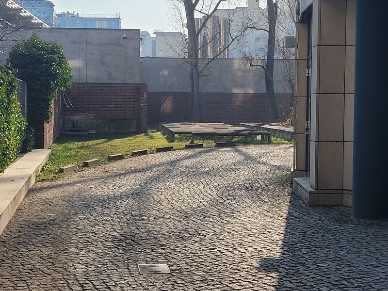
Photographed by James Hulse, March 7, 2026
3. Außenansicht der Synagoge Lindenstraße / Exterior view of the Synagogue on Lindenstraße Marker
A view of benches where the synagogue was located.
Other nearby markers. At least 8 other markers are within walking distance of this marker: Innenbereich der Synagoge Lindenstraße / Interior of the Synagogue on Lindenstraße (here, next to this marker); Zerstörte Synagoge / Destroyed Synagogue (here, next to this marker); Lotte Rotholz (a few steps from this marker); Siegbert Rotholz (a few steps from this marker); Ludwig Roth (about 120 meters away, measured in a direct line); Kurt Roth (about 120 meters away); Ruth Käthe Roth (about 120 meters away); „Balanceakt“ von Stephan Balkenhol / „Balancing Act“ by Stephan Balkenhol (about 120 meters away). Touch for a list and map of all markers in Berlin.

Photographed by James Hulse, March 7, 2026
4. Außenansicht der Synagoge Lindenstraße / Exterior view of the Synagogue on Lindenstraße Marker
The view of the marker along the street.
Credits. This page was last revised on April 20, 2026. It was originally submitted on April 19, 2026, by James Hulse of Medina, Texas. This page has been viewed 30 times since then. Photos: 1, 2, 3, 4. submitted on April 20, 2026, by James Hulse of Medina, Texas.
