Regierungsvierte in Berlin in Mitte, Germany — Northeast German Plain (The European Plain)
Siegbert Rotholz

Photographed by James Hulse, March 7, 2026
1. Siegbert Rotholz Marker

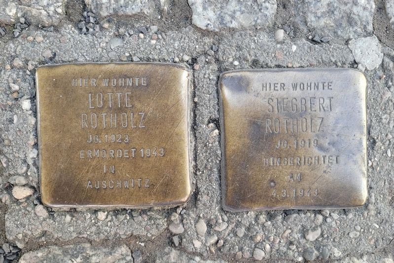
Siegbert Rotholz
Jg. 1919
Hingerichtet am
4.3.1943
Siegbert Rotholz, born in 1919, lived here. He was executed on 4 Mar. 1943.
Topics and series. This historical marker is listed in this topic list: War, World II. In addition, it is included in the Stolpersteine series list. A significant historical date for this entry is March 4, 1943.
Location. 52° 30.523′ N, 13° 23.981′ E. Marker is in Berlin, in Mitte. It is in Regierungsvierte. It is on Axel-Springer-Straße just south of Kommandantenstraße, on the right when traveling north. Touch for map. Marker is at or near this postal address: Axel-Springer-Straße 51-52, Berlin 10969, Germany. Touch for directions.

Regionally, it is in Europe, the European Union, Atlantic Europe, Central Europe, the Schengen Area, Western Europe, and the Western World. Historically, it finds itself in what was once the Holy Roman Empire, the former West Germany, and at the Berlin Wall.
Other nearby markers. At least 8 other markers are within walking distance of this marker: Lotte Rotholz (here, next to this marker); Außenansicht der Synagoge Lindenstraße / Exterior view of the Synagogue on Lindenstraße (a few steps from this marker); Innenbereich der Synagoge Lindenstraße / Interior of the Synagogue on Lindenstraße (a few steps from this marker); Zerstörte Synagoge / Destroyed Synagogue (a few steps from this marker); „Balanceakt“ von Stephan Balkenhol / „Balancing Act“ by Stephan Balkenhol (about 90 meters away, measured in a direct line); Ludwig Roth (about 90 meters away); Kurt Roth (about 90 meters away); Ruth Käthe Roth (about
this page online
Also see . . . Stolperstein. Wikipedia
A Stolperstein (in English "stumbling block") is a ten-centimetre (four-inch) concrete cube bearing a brass plate inscribed with the name and life dates of victims of Nazi extermination or persecution. The Stolpersteine project, initiated by the German artist Gunter Demnig in 1992, aims to commemorate persons at the last place that they chose freely to reside, work or study (with exceptions possible on a case-by-case basis) before they fell victim to Nazi terror, forced euthanasia, eugenics, deportation to a concentration or extermination camp, or escaped persecution by emigration or suicide. As of June 2023, 100,000 Stolpersteine have been laid, making the Stolpersteine project the world's largest decentralized memorial.(Submitted on April 20, 2026, by James Hulse of Medina, Texas.)
Additional keywords. Holocaust
Photographed by James Hulse, March 7, 2026
2. Siegbert Rotholz Marker
The Stolpersteine (Stumbling Stones) for the Rotholz family consist of two individual stones placed together.

Photographed by James Hulse, March 7, 2026
3. Siegbert Rotholz Marker
The view of the Stolpersteine (Stumbling Stones) along the street in front of the building.

Photographed by James Hulse, March 7, 2026
4. Siegbert Rotholz Marker
The markers are located along the ground on the sidewalk.
Credits. This page was last revised on April 20, 2026. It was originally submitted on April 19, 2026, by James Hulse of Medina, Texas. This page has been viewed 11 times since then. Photos: 1, 2, 3, 4. submitted on April 20, 2026, by James Hulse of Medina, Texas.
