Old Town in San Diego in San Diego County, California — The American West (Pacific Coastal)
La Casa de Machado y Silvas

Photographed by Craig Baker, March 9, 2026
1. La Casa de Machado y Silvas Marker
c. 1843 · Small adobe built by Machado family for daughter María Antonia and husband José Antonio Nacasio Silvas.
1854-64 · Several businesses, including Wall's Saloon, The Commercial Restaurant, and Antonia's Restaurant, were operated in this building.
1932 · Listed as California Historical Landmark.
1942 · Opened as Machado Memorial Chapel.
1975 · Rehabilitated by California State Parks as an historic house museum.
The Machado de Silvas Building
Built circa 1843, restored 1976.
This sturdy adobe building embodies the historic influences of both Mexican and American styles with the materials in popular use between the 1840s and 1870s.
The building began as a simple rectangular structure with a low pitched tile roof. Through the years it was progressively enlarged, assuming the "L” configuration you see today. The original red tile roof was removed and covered with wooden shakes, and the window openings were filled with glass panes.
Beginning as the home of the Machado de Silvas family in the 1840's, it has matured to the present, reflecting the changing needs
this page online
Erected by California State Parks. (Marker Number 71.)
Topics and series. This historical marker is listed in these topic lists: Architecture • Industry & Commerce • Settlements & Settlers. In addition, it is included in the California Historical Landmarks series list. A significant historical year for this entry is 1843.
Location. 32° 45.266′ N, 117° 11.859′ W. Marker is in San Diego, California, in San Diego County. It is in Old Town. It can be reached from San Diego Avenue near Mason Street. Located in Old Town San Diego State Historic Park. Touch for map. Marker is at or near this postal address: 2767 San Diego Ave, San Diego CA 92110, United States of America. Touch for directions.

Regionally, this marker is in the Peninsular Ranges. It is also in the American Borderlands and on the Pacific Coast. Globally, it is in North America, on the Ring of Fire, on

Photographed by Craig Baker, March 9, 2026
2. The Machado de Silvas Building
Other nearby markers. At least 8 other markers are within walking distance of this marker: First Raising of U.S. Flag (a few steps from this marker); La Casa de Rodriguez (within shouting distance of this marker); La Casa de Machado y Wrightington (within shouting distance of this marker); First San Diego Courthouse (within shouting distance of this marker); Old Town San Diego (within shouting distance of this marker); Kearney Trail (within shouting distance of this marker); El Pico Dining Room (within shouting distance of this marker); Estudillo House (within shouting distance of this marker). Touch for a list and map of all markers in San Diego.
Regarding La Casa de Machado y Silvas. This is California Historical Landmark No. 71, declared in 1932.
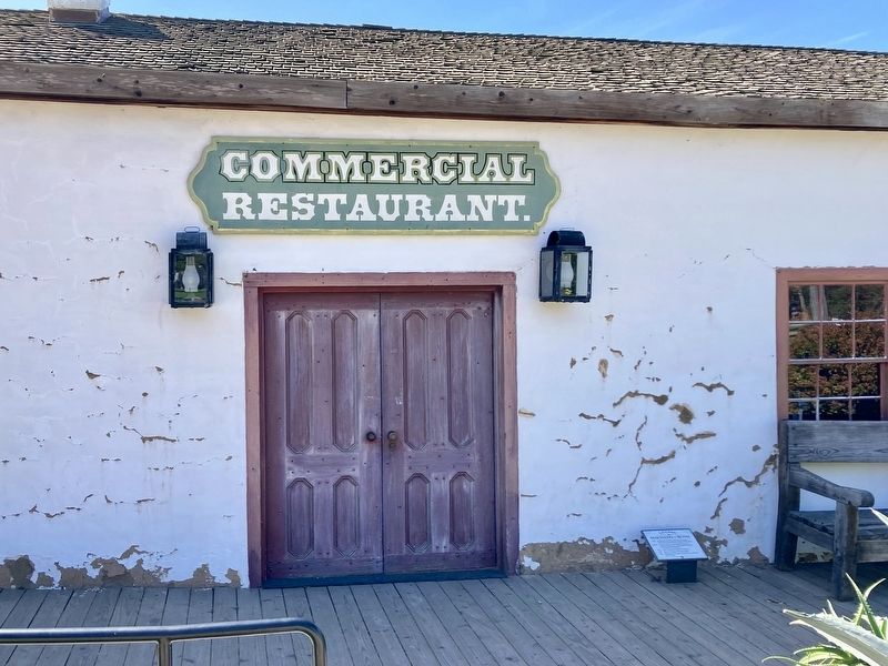
Photographed by Craig Baker, March 9, 2026
3. La Casa de Machado y Silvas Marker

Photographed by Craig Baker, March 9, 2026
4. Machado y Silvas Building
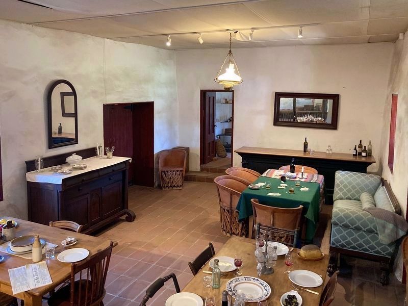
Photographed by Craig Baker, March 9, 2026
5. Machado y Silvas Building
Credits. This page was last revised on April 20, 2026. It was originally submitted on April 20, 2026, by Craig Baker of Sylmar, California. This page has been viewed 22 times since then. Photos: 1, 2, 3, 4, 5. submitted on April 20, 2026, by Craig Baker of Sylmar, California.
