Northwest Harwinton in Litchfield County, Connecticut — The American Northeast (New England)
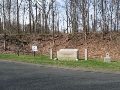
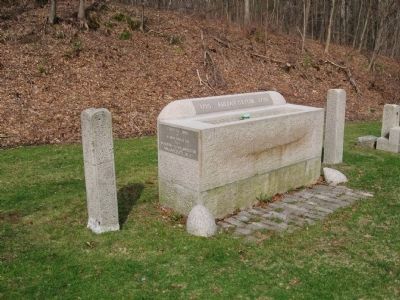
Watering Trough & Fountain
Circa Early 1900s
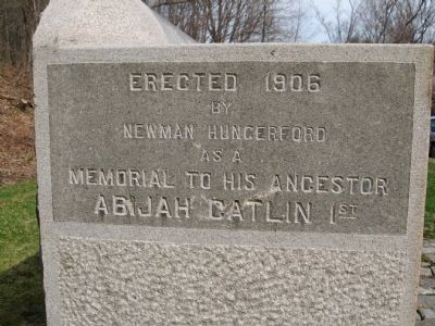
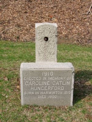
Memorial by Catlin Family Descendants
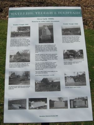
Originally donated by Catlin family descendants to honor their ancestors and to benefit their fellow man, these monuments had been located at the top of "Meeting House Hill" near "Catlin Corners," where Harmony Hill and Locust Roads intersect Burlington Road.
The ever increasing volume of motor vehicle traffic throughout the decades had finally dictated that changes be made to improve the highway site lines throughout the immediate area where the spring-fed monuments had originally served.
They have been moved to this location for the safe keeping and viewing.
[ By Lloyd T. Shanley, Jr., Harwinton Historian – June 27, 2005 ]
Erected 2005 by Catlin Family Descendants.
Topics. This historical marker is listed in these topic lists: Roads & Vehicles • Settlements & Settlers. A significant historical date for this entry is June 27, 1941.
Location. 41° 46.058′ N, 73° 4.337′ W. Marker is in Harwinton, Connecticut, in Litchfield County. It is in Northwest Harwinton. Marker is on Bentley Drive, 0.1 miles south of Litchfield Road (Connecticut Route 118), on the right when traveling south. Touch for map. Marker is in this post office area: Harwinton CT 06791, United States of America. Touch for directions.
Other nearby markers. At least 8 other markers are within 4 miles of this marker, measured as the crow flies. Liberty Tree Memorial (approx. ¼ mile away); Harwinton Veterans Memorial (approx. 0.7 miles away); Harwinton (approx. 0.7 miles away); Forever Mourned / Forever Honored (approx. 2½ miles away); Torrington Vietnam Monument (approx. 3.3 miles away); VFW 155mm Howitzer (approx. 3.3 miles away); Torrington Veterans Memorial (approx. 3.4 miles away); Coe Memorial Park (approx. 3.4 miles away). Touch for a list and map of all markers in Harwinton.
Photographed By Michael Herrick, April 8, 2010
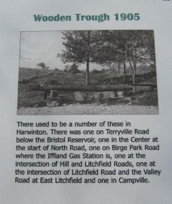
2. Wooden Trough 1905
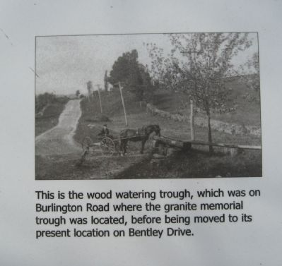
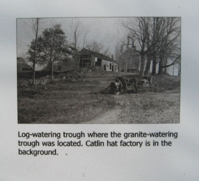
There used to be a number of these in Harwinton. There was one on Terryville Road below the Bristol Reservoir, one in the Center at the start of North Road, one on Birge Park Road where the Iffland Gas Station is, one at the intersection of Hill and Litchfield Roads, one at the intersection of Litchfield Road and the Valley Road at East Litchfield and one in Campville.
(detail from marker)
Photographed By Michael Herrick, April 8, 2010
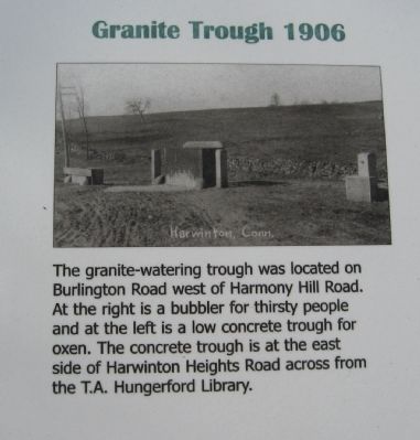
5. Granite Trough 1906
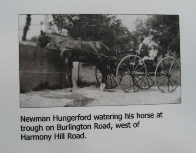
The granite-watering trough was located on Burlington Road west of Harmony Hill Road. At the right is a bubbler for thirsty people and at the left is a low concrete trough for oxen. The concrete trough is at the east side of Harwinton Heights Road across from the T.A. Hungerford Library.(detail from marker)
Credits. This page was last revised on February 10, 2023. It was originally submitted on April 14, 2010, by Michael Herrick of Southbury, Connecticut. This page has been viewed 1,893 times since then and 52 times this year. Photos: 1, 2, 3, 4, 5, 6, 7, 8, 9, 10. submitted on April 14, 2010, by Michael Herrick of Southbury, Connecticut.
