Hanover Township near Loudonville in Ashland County, Ohio — The American Midwest (Great Lakes)
Wolf Creek (Pine Run) Grist Mill
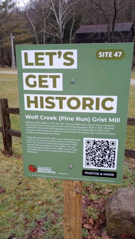
Let's Get Historic
Photographed by Craig Doda, January 27, 2024
1. Wolf Creek (Pine Run) Grist Mill Marker
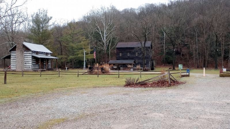
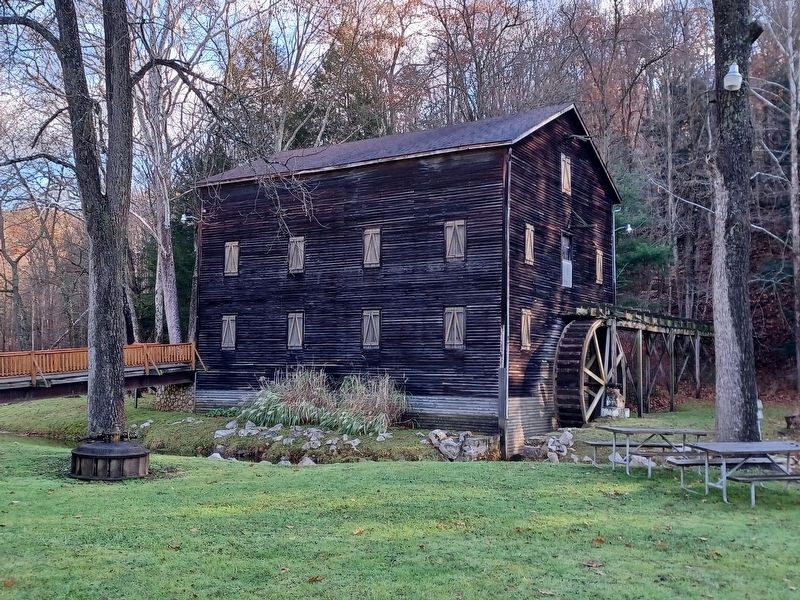
Milling in Ohio began in the late 18th century. Mills were used in many industries around the state, such as grist mills used to process grain. Built in 1831, the Wolf Creek (Pine Run) Grist Mill originally stood north of Loudonville at Wolf Creek. pioneers ground grain into flour. This grist mill features an overshot waterwheel that powers two millstones where pioneers ground grain into flour.
Originally named Wolf's Mill, it was dismantled and moved to its present location next to Pine Run in 1971. The reconstruction was completed in 1975, and the mill was opened to the public. The mill remained open until the mid-1980s and was later purchased by the Ohio Department of Natural Resources.
Erected 2022 by Ohio Department of Natural Resources. (Marker Number 47.)
Topics. This historical marker is listed in this topic list: Industry & Commerce. A significant historical year for this entry is 1831.
Location. 40° 36.068′ N, 82° 15.722′ W. Marker is near Loudonville, Ohio, in Ashland County. It is in Hanover Township. It is on Ohio 3, on the right when traveling north. Touch for map. Marker is at or near this postal address: 3175 OH-3, Loudonville OH 44842, United States of America. Touch for directions.

Regionally, this marker is in Amish Country. It is also in the American Midwest. Globally, it is in North America, the Western Hemisphere, the Western World, and the Anglosphere. Historically, it finds itself in what was once the Haudenosaunee (Iroquois) Confederacy, the territory of the Mississippian Culture, and the Northwest Territory.
Other nearby markers. At least 8 other markers are within walking distance of this marker: The Old Mill (within shouting distance of this marker); A Brief History of the Mill (within shouting distance of this marker); The Plow (about 400 feet away, measured in
this page online
Also see . . . Road Trip From Cleveland To Mohican State Park To Check Out A Working 1830s Mil. Only in Your State website entry (Submitted on March 29, 2024, by Larry Gertner of New York, New York.)
Photographed by Craig Doda, January 27, 2024
2. Wolf Creek (Pine Run) Grist Mill
Ohio Department of Natural Resources website entry
Click for more information.
Click for more information.
Photographed by Joel Seewald, November 11, 2024
3. Wolf Creek (Pine Run) Grist Mill
Credits. This page was last revised on April 24, 2026. It was originally submitted on January 28, 2024, by Craig Doda of Napoleon, Ohio. This page has been viewed 460 times since then and 48 times this year. Last updated on April 24, 2026, by Raquel Mack of Oberlin, Ohio. Photos: 1, 2. submitted on January 28, 2024, by Craig Doda of Napoleon, Ohio. 3. submitted on November 15, 2024, by Joel Seewald of Madison Heights, Michigan. • Devry Becker Jones was the editor who published this page.
