Riverton in Barkhamsted in Litchfield County, Connecticut — The American Northeast (New England)
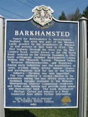
Barkhamsted
The town suffered a severe decline in its population during the late 1800's when better farmland became available in the Midwest. Metropolitan District Commission reservoirs and three state forests now provide open space and recreational land. The book Barkhamsted Heritage, Culture and Industry in a Rural Connecticut Town offers further information.
Erected by the Town of Barkhamsted
The Barkhamsted Historical Society
and the Connecticut Historical Commission
1980
Erected 1980 by the Town of Barkhamsted, Barkhamsted Historical Society, Connecticut Historical Commission.
Topics. This historical marker is listed in these topic lists: Colonial Era • Settlements & Settlers. A significant historical year for this entry is 1732.
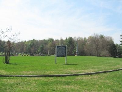
Location. 41° 55.487′ N, 72° 57.92′ W. Marker is in Barkhamsted, Connecticut, in Litchfield County. It is in Riverton. Marker is at the intersection of Pleasant Valley Road (Route 318) and Beach Rock Road, on the right when traveling north on Pleasant Valley Road. Located next to the Barkhamsted Center Cemetery. Touch for map. Marker is in this post office area: Barkhamsted CT 06063, United States of America. Touch for directions.
Other nearby markers. At least 8 other markers are within 3 miles of this marker, measured as the crow flies. Hollow Church Bell (within shouting distance of this marker); Barkhamsted Soldiers Memorial (within shouting distance of this marker); Barkhamsted Center Cemetery (about 300 feet away, measured in a direct line); Squire's Tavern (approx. 1.6 miles away); The Charcoal Industry (approx. 1.6 miles away); Demonstration Charcoal Mound (approx. 1.6 miles away); Austin Hawes Memorial Campground (approx. 2 miles away); Barkhamsted Lighthouse Village Stone Quarry (approx. 2.4 miles away). Touch for a list and map of all markers in Barkhamsted.
Also see . . .
1. Barkhamsted, Connecticut on Wikipedia. (Submitted on April 17, 2010, by Michael Herrick of Southbury, Connecticut.)
2. Barkhamsted Historical Society
. (Submitted on April 17, 2010, by Michael Herrick of Southbury, Connecticut.)
Credits. This page was last revised on February 10, 2023. It was originally submitted on April 17, 2010, by Michael Herrick of Southbury, Connecticut. This page has been viewed 1,182 times since then and 26 times this year. Photos: 1, 2. submitted on April 17, 2010, by Michael Herrick of Southbury, Connecticut.

