Danville, Virginia — The American South (Mid-Atlantic)
Railroad History Preserved
Photographed by C. Ryan Dodson, April 17, 2024
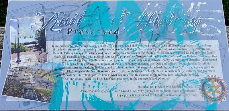
1. Railroad History Preserved Marker
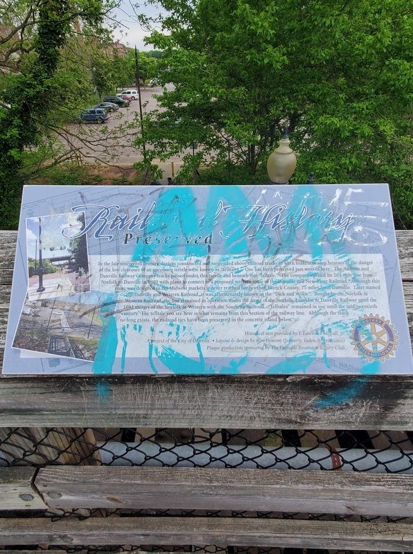
In the late nineteenth century, devices constructed and suspended above railroad tracks to warn brakeman atop boxcars of the danger of the low clearance of an upcoming trestle were known as "telltales." One has been preserved just west of here. The Atlantic and Danville Railway Company-tracks passed under this trestle and beneath this "telltale." The company opened its 203 mile-line from Norfolk to Danville in 1890 with plans to connect to a proposed western route of the Danville and New River Railroad. Although this route was designed to tap Midwest markets it never reached further than Patrick County, 75 miles fom Danville. Later named the Danville and Western Railroad, it was affectionately known as the "Dick and Willie". Bought by the Norfolk & Western Railroad, the line remained in operation under the name of the Norfolk, Franklin & Danville Railway until the 1982 merger of the Norfolk & Western with the Southern Railroad. "Telltales" remained in use until the mid-twentieth century. The telltale you see here is what remains from this section of the railway line. Although the track no longer exists the railroad ties
this page online
Historical text provided by F Lawrence McFall, Jr.
A project of the City of Danville. • Layout & design by Kim Demont (formerly Vaden & Associates).
Plaque production sponsored by The Danville Riverview Rotary Club.
Erected by City of Danville and the Danville Riverview Rotary Club.
Topics and series. This historical marker is listed in these topic lists: Architecture • Bridges & Viaducts • Railroads & Streetcars. In addition, it is included in the Rotary International series list. A significant historical year for this entry is 1890.
Location. This marker has been replaced by another marker nearby. It was located near 36° 35.173′ N, 79° 23.021′ W. Marker was in Danville, Virginia. It could be reached from Bridge Street east of Colquhoun Street, on the left when traveling east. The Marker is located upon a pedestrian bridge along the Riverwalk Trail near the Crossing at the Dan. Touch for map. Marker was at or near this postal address: 629 Craghead Street, Danville VA 24541, United States of America. Touch for directions.

Regionally, this marker was in Southside
Photographed by C. Ryan Dodson, April 17, 2024
2. Railroad History Preserved Marker
Other nearby markers. At least 8 other markers are within walking distance of this location: Human Use of the Dan River (within shouting distance of this marker); The Historic Dan River (about 300 feet away, measured in a direct line); Richmond & Danville Railroad (about 300 feet away); a different marker also named Richmond & Danville Railroad (about 300 feet away); a different marker also named Richmond & Danville Railroad (about 400 feet away); The Pepsi Building (about 700 feet away); Danville Rail Passenger Station (about 800 feet away); The Worsham Street Bridge (approx. ¼ mile away). Touch for a list and map of all markers in Danville.
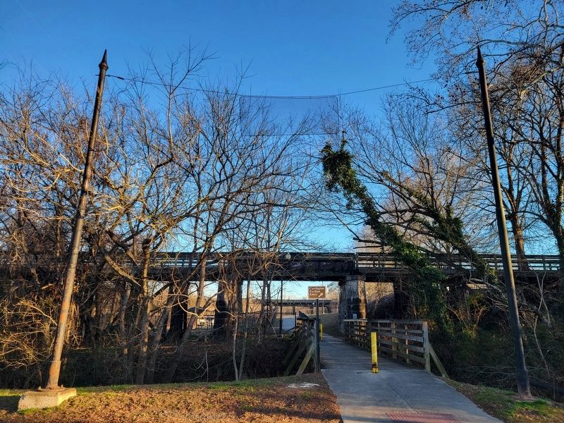
Regarding Railroad History Preserved. The former railroad telltale
Photographed by C. Ryan Dodson, January 2, 2025
3. Former Railroad Telltale
As described in the Marker
Photographed by C. Ryan Dodson, January 2, 2025
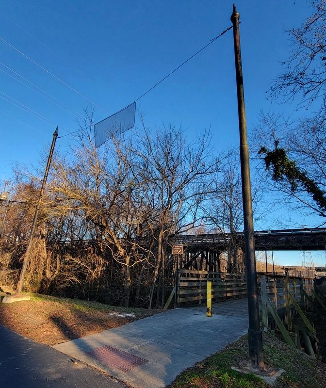
4. Former Railroad Telltale
The mesh ropes suspended between the two posts alerted railroad crews of the low bridge clearance.
Photographed by C. Ryan Dodson, January 2, 2025
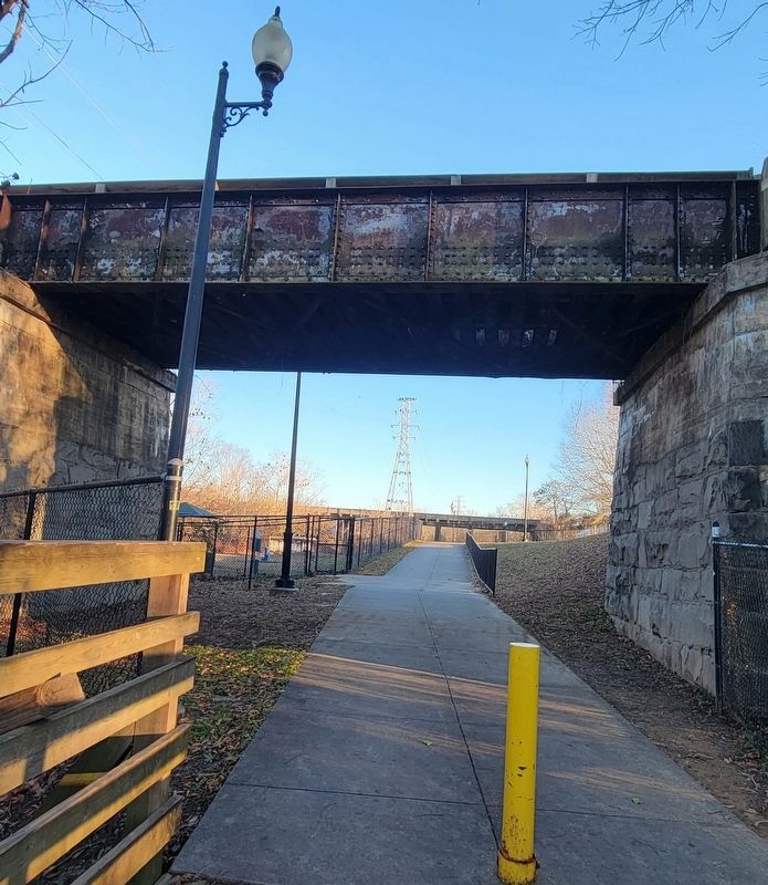
5. Low Clearance Rail Bridge
The telltale alerted trains of the low clearance of this former rail bridge that is now a converted pedestrian walkway.
Photographed by C. Ryan Dodson, January 2, 2025
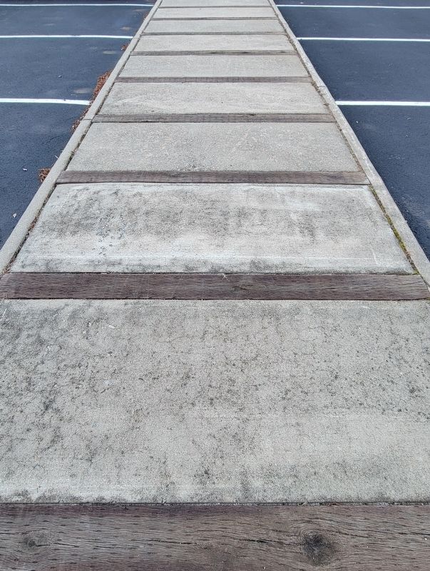
6. Railroad Ties
Former railroad ties from the rail line that previously ran beneath the bridge have been incorporated into the design of a median in the public parking lot now located upon the site.
Photographed by C. Ryan Dodson, January 2, 2025
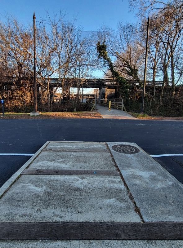
7. Railroad History Preserved
This angle helps to show the layout of the former rail line, with the median representing the tracks as they approached the low clearance bridge behind the telltale.
Credits. This page was last revised on April 30, 2026. It was originally submitted on January 2, 2025, by C. Ryan Dodson of Danville, Virginia. This page has been viewed 263 times since then and 30 times this year. Last updated on April 29, 2026, by C. Ryan Dodson of Danville, Virginia. Photos: 1, 2, 3, 4, 5, 6. submitted on January 2, 2025, by C. Ryan Dodson of Danville, Virginia. 7. submitted on January 4, 2025, by C. Ryan Dodson of Danville, Virginia. • Devry Becker Jones was the editor who published this page.
