Near Burbank in Walla Walla County, Washington — The American West (Northwest)
Lewis and Clark Trail
Photographed by Shirley A Stirling, December 10, 2016
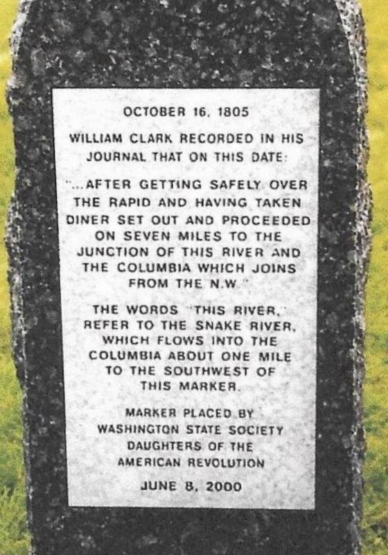
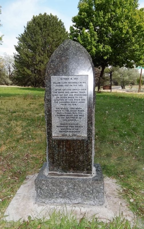
1. Lewis and Clark Trail Marker (Rear)
William Clark recorded in his journal that on this date:
"After getting safely over the rapid and having taken diner set out and proceeded on seven miles to the junction of this river and the Columbia which joins from the N.W.”
The words "this river" refer to the Snake River, which flows into the Columbia about one mile to the southwest of this marker.
Erected 2000 by Washington State Society Daughters of the American Revolution.
Topics and series. This historical marker is listed in this topic list: Exploration. In addition, it is included in the Daughters of the American Revolution (DAR), and the Lewis & Clark Expedition series lists. A significant historical date for this entry is October 6, 1805.
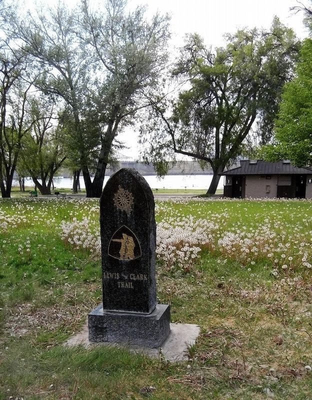
Location. 46° 12.883′ N, 119° 0.889′ W. Marker is near Burbank, Washington, in Walla Walla County. It can be reached from Ice Harbor Road, on the left when traveling east. Marker is located in Hood Park. Tucked between the Snake River, Highways 12 and 124, both highways are official Lewis and Clark Trail highways. The marker is inside the park in a picnic area near a utility building and by a parking lot.
this page online

Regionally, this marker is in the Columbia Basin. It is also in the American Mountain West and in the Lewis & Clark Corridor. Globally, it is in North America, on the Pacific Rim, in the Western Hemisphere, in the Western World, and in the Anglosphere.
Other nearby markers. At least 8 other markers are within 2 miles of this marker, measured as the crow flies: Before This Was a Park (a few steps from this marker); Mayor A. P. Gray (approx. 1.6 miles away); "Sah-cah-ga-weah" (approx. 1.6 miles away); "great Columbia river" (approx. 1.6 miles away); Lewis and Clark National Historic Trail (approx. 1.6 miles away); Snake River Passage & Columbia Plains Crossing (approx. 1.6 miles away); Columbia River (approx. 1.6 miles away); At the Confluence (approx. 1.6 miles away).
Other markers no longer nearby. Ainsworth (was approx. 0.6 miles away but has been confirmed missing); Sacagawea (was approx. 0.6 miles away but has been confirmed
Photographed by Barry Swackhamer, June 13, 2026
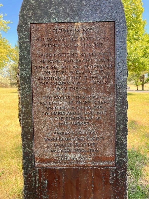
2. Lewis and Clark Trail Marker
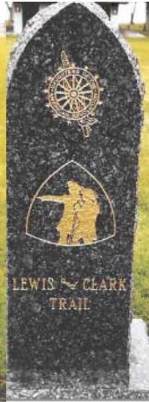
More about this marker. The marker is tucked between the Snake River, Highways 12 and 124, both highways are official Lewis and Clark Trail highways. The marker is inside the park in a picnic area near a utility building, and by a parking lot. Made of Lake Superior green granite, it is the third Lewis & Clark marker in a series of four. The front of the marker displays the NSDAR insignia, the Lewis & Clark Corps of Discovery logo, and the words “Lewis and Clark Trail” highlighted in gold leaf. The back of the marker quotes William Clark in his journal.
Between September 1999 and October 2000, the Washington State Society Daughters of the American Revolution placed a series of four markers commemorating the Lewis and Clark Expedition in what is now Washington State. The markers are located in or near the cities of Ilwaco, Clarkston, Stevenson, and Burbank, Washington.
Excerpt from: Lewis & Clark Trail Heritage Foundation WA Chapter Newsletter, August 2000 edition: On June 8, 2000, the Washington State Society, Daughters of the American Revolution, dedicated their third Lewis and Clark trail marker. Master of Ceremonies for the event was new State Regent, Barbara Herbst-Anderson. Shirley Wagers, under whose Regency this project was started and who is now a Vice President General of the National Society, DAR, gave the dedicatory address. Sgt. Patrick Gass of the Corps of Discovery was expected to attend, but his canoe must have swamped on the way up river because he didn't arrive. He has been a long-time house guest of Gary Lentz, manager of the Lewis and Clark Trail State Park near Dayton.
Photographed by Shirley A Stirling, July 20, 2016
3. Lewis and Clark Trail Marker (Front)
Related markers. Click here for a list of markers that are related to this marker.
Additional keywords. NSDAC WSSDAC
Photographed by Shirley A Stirling, April 27, 2018
4. Lewis and Clark Trail Marker
Photographed by Shirley A Stirling, April 27, 2018
5. Lewis and Clark Trail Marker
Credits. This page was last revised on September 13, 2026. It was originally submitted on July 25, 2018, by Shirley A Stirling of Lacey, Washington. This page has been viewed 989 times since then and 111 times this year. Last updated on April 29, 2026, by Clayton Pickett of Richland, Washington. Photos: 1. submitted on July 25, 2018, by Shirley A Stirling of Lacey, Washington. 2. submitted on September 13, 2026, by Barry Swackhamer of Brentwood, California. 3, 4, 5. submitted on July 25, 2018, by Shirley A Stirling of Lacey, Washington. • Devry Becker Jones was the editor who published this page.
