
Mariposa in Mariposa County, California — The American West (Pacific Coastal)
John Trabucco Building
Photographed by Ron Bonvie
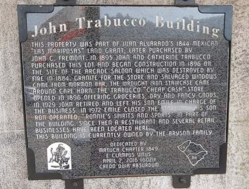
1. John Trabucco Building Marker
This property was part of Juan Alvarado's 1844 Mexican "Las Mariposas” land grant, later purchased by John C. Fremont. In 1895 John and Catherine Trabucco purchased this lot and began construction in 1896 on the site of the Arcade Saloon which was destroyed by fire in 1884. Granite for the store and salvaged windows came from Mormon Bar, the wrought iron staircase came around Cape Horn. The Trabucco "cheap cash" store opened in 1896 offering groceries, dry and fancy goods. In 1929 John retired and left his son Emile in charge of the business. In 1972 Emile closed the store and his son Ron operated, "Ronnie's Spirits and Sports" in part of the building. Since then a restaurant and several retail businesses have been located here.
This building is currently owned by the Bryson Family.
Erected by Matuca Chapter 1849 E Clampus Vitus.
Topics and series. This historical marker is listed in these topic lists: Industry & Commerce • Settlements & Settlers. In addition, it is included in the E Clampus Vitus series list. A significant historical year for this entry is 1844.
Location. 37° 29.073′ N, 119° 57.898′ W. Marker
this page online

Regionally, this marker is in California’s Gold Country and in the Sierra Nevada. It is also in the American Mountain West. Globally, it is in North America, the Pacific Rim, the Western Hemisphere, the Western World, and the Anglosphere. Historically, it finds itself in what was once New Spain and also Mexico’s Alta California.
Other nearby markers. At least 8 other markers are within walking distance of this marker: Mariposa Meat Market (a few steps from this marker); Mariposa Restaurant (a few steps from this marker); Capital Saloon (a few steps from this marker); Bogan & Company (a few steps from this marker); Fremont Adobe (a few steps from this marker); California Highway Patrol and Department of Motor Vehicles (within shouting distance of this marker); Mariposa Bakery (within shouting distance
Photographed by Liam Williams, April 27, 2026
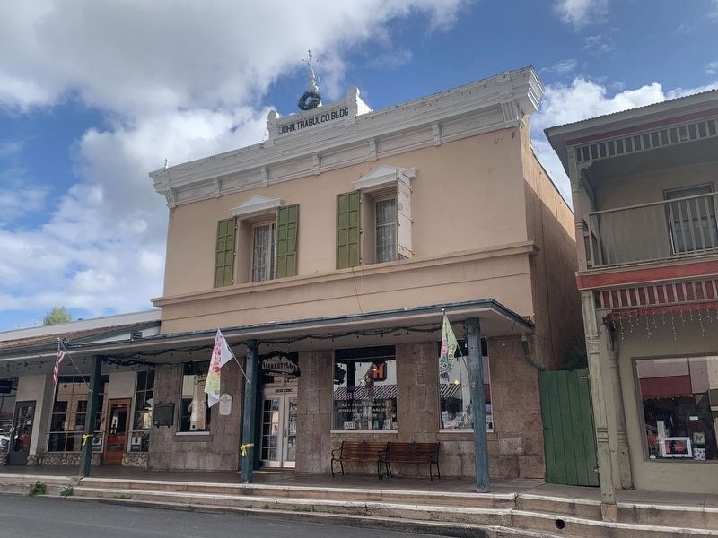
2. John Trabucco Building
Marker is visible on the left-hand side of the building
Credits. This page was last revised on May 4, 2026. It was originally submitted on October 19, 2020, by Frank Gunshow Sanchez of Hollister, California. This page has been viewed 863 times since then and 76 times this year. Last updated on April 30, 2026, by Liam Williams of Irvine, California. Photos: 1. submitted on October 19, 2020, by Frank Gunshow Sanchez of Hollister, California. 2. submitted on April 30, 2026, by Liam Williams of Irvine, California. • Devry Becker Jones was the editor who published this page.
