Annapolis in Anne Arundel County, Maryland — The American Northeast (Mid-Atlantic)
Homewood’s Lot
| — | Maryland Historic Place | — |
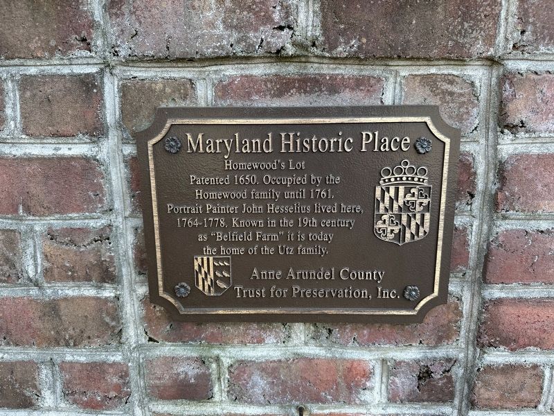
Photographed by Pete Skillman, May 1, 2026
1. Homewood’s Lot Marker
Erected by Anne Arundel County Trust for Preservation, Inc.
Topics. This historical marker is listed in these topic lists: Arts, Letters, Music • Settlements & Settlers. A significant historical year for this entry is 1650.
Location. 39° 1.431′ N, 76° 25.838′ W. Marker is in Annapolis, Maryland, in Anne Arundel County. It is on Whitehall Road, on the right when traveling east. Touch for map. Marker is at or near this postal address: 1514 Whitehall Rd, Annapolis MD 21409, United States of America. Touch for directions.

Regionally, this marker is in Central Maryland. It is also in the American Mid-Atlantic, in the Chesapeake Bay Region, and on the Eastern Seaboard. Globally, it is in the North Atlantic Region, North America, the Western Hemisphere, the Western World, and the Anglosphere. Historically, it finds itself in what was once one of the original Thirteen Colonies and also the Antebellum
this page online
Other nearby markers. At least 8 other markers are within 4 miles of this marker, measured as the crow flies: Tense Time (approx. 1.8 miles away); Sandy Point Farmhouse - Circa 1815 (approx. 1.8 miles away); The Fight for Freedom (approx. 2 miles away); Sandy Point Shoal Lighthouse (approx. 2 miles away); Gold Star Families Monument (approx. 3.2 miles away); Annapolis Laboratory (approx. 3.2 miles away); Fort Nonsense (approx. 3.2 miles away); Battle of the Severn (approx. 3.3 miles away). Touch for a list and map of all markers in Annapolis.
Other markers no longer nearby. Sandy Point Farm (was approx. 2 miles away but has been replaced with another marker now near it); John Wilkes Booth (was approx. 2 miles away but has been replaced with another marker now near it).

Photographed by Pete Skillman, May 1, 2026
2. Homewood’s Lot Marker - wide view
Credits. This page was last revised on May 1, 2026. It was originally submitted on May 1, 2026, by Pete Skillman of Wilmington, Delaware. This page has been viewed 21 times since then. Photos: 1, 2. submitted on May 1, 2026, by Pete Skillman of Wilmington, Delaware.
