Forestville/Mystery Cave State Park near Preston in Fillmore County, Minnesota — The American Midwest (Upper Plains)
Bridges
Photographed by McGhiever, October 4, 2025
1. Bridges Marker
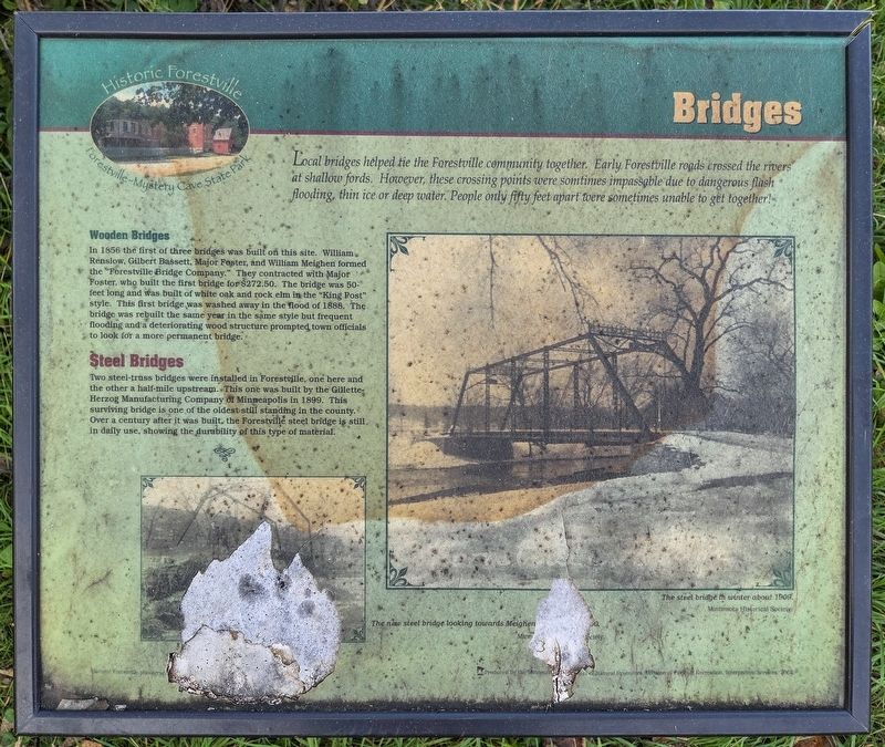
Local bridges helped tie the Forestville community together. Early Forestville roads crossed the rivers at shallow fords. However, these crossing points were somtimes [sic] impassable due to dangerous flash flooding, thin ice or deep water. People only fifty feet apart were sometimes unable to get together!
Wooden Bridges
In 1856 the first of three bridges was built on this site. William Renslow, Gilbert Bassett, Major Foster, and William Meighen formed the "Forestville Bridge Company." They contracted with Major Foster, who built the first bridge for $272.50. The bridge was 50-feet long and was built of white oak and rock elm in the "King Post" style. This first bridge was washed away in the flood of 1888. The bridge was rebuilt the same year in the same style but frequent flooding and a deteriorating wood structure prompted town officials to look for a more permanent bridge.
Steel Bridges
Two steel-truss bridges were installed in Forestville, one here and the other a half-mile upstream. This one was built by the Gillete-Herzog Manufacturing Company of Minneapolis in 1899. This surviving bridge is one of the
this page online
The new steel bridge looking towards Meighen [text missing].
The steel bridge in winter about 1909.
Erected 2004 by the Minnesota Department of Natural Resources.
Topics. This historical marker is listed in this topic list: Bridges & Viaducts. A significant historical year for this entry is 1856.
Location. 43° 38.52′ N, 92° 12.912′ W. Marker is near Preston, Minnesota, in Fillmore County. It is in Forestville/Mystery Cave State Park. It is on County Road 118, on the left when traveling north. The marker is on the south bank of the Root River, just north of the parking lot for the Forestville historic site. Touch for map. Marker is in this post office area: Preston MN 55965, United States of America. Touch for directions.

Regionally, this marker is in Southeast Minnesota and in Greater Rochester. It is also in the American Midwest, in the Corn Belt, and in the Driftless Area — Bluff Country. Globally, it is in North America, the Western Hemisphere,

Photographed by McGhiever, October 4, 2025
2. Bridges Marker to the west of County Road 118
Other nearby markers. At least 8 other markers are within walking distance of this marker: Forestville Sawmill (within shouting distance of this marker); Bridges at Forestville (within shouting distance of this marker); Historic Forestville (within shouting distance of this marker); Meighen Icehouse (within shouting distance of this marker); South Branch of the Root River (within shouting distance of this marker); Forestville (within shouting distance of this marker); Meighen Store (about 300 feet away, measured in a direct line); Forestville Gristmill (approx. 0.2 miles away). Touch for a list and map of all markers in Preston.
Credits. This page was last revised on May 1, 2026. It was originally submitted on May 1, 2026, by McGhiever of Minneapolis, Minnesota. This page has been viewed 8 times since then. Photos: 1, 2. submitted on May 1, 2026, by McGhiever of Minneapolis, Minnesota.
