Columbia in Monroe County, Illinois — The American Midwest (Great Lakes)
Piggot's Fort Great Run
Kaskaskia Cahokia Trail
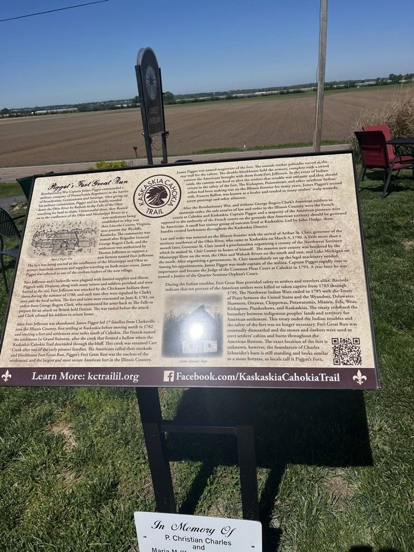
Photographed by Thomas Smith, April 22, 2026
1. Piggot's Fort Great Run Marker
Revolutionary War Captain James Piggot commanded a military company of Pennsylvania Regulators in the battle of Brandywine against British General Cornwallis. After giving up his military commission, Piggot and his family traveled down the Ohio River by flatboat to the Falls of the Ohio searching for land to claim. Unsuccessful there, they floated on to the confluence of the Ohio and Mississippi Rivers to a new settlement being established in what is now Illinois County, Virginia, near present day Kaskaskia, Kentucky. The community was named after Brigadier General George Rogers Clark, and the settlement was authorized by Thomas Jefferson to support a new fortress named Fort Jefferson. The fort was being created at the confluence of the Mississippi and Ohio to protect American interests and supplies traveling on both major rivers. James Piggot was selected as one of the civilian leaders of the new village.
Fort Jefferson and Clarksville were plagued with limited supplies and illness. Piggot’s wife, Eleanor, along with many settlers and soldiers perished and were buried at the site. Fort Jefferson was attacked by the
this page online
After Fort Jefferson was abandoned, James Piggot led 17 families from Clarksville into the Illinois Country, first settling at Kaskaskia before moving north in 1782 and erecting a fort and settlement nine miles south of Cahokia. The French named the settlement Le Grand Ruisseau, after the creek that formed a hollow where the Kaskaskia-Cahokia Trail descended through the bluff. This creek was renamed Carr Creek after one of the early pioneer families. The Americans called their stockade and blockhouse Fort Great Run. Piggot’s Fort Great Run was the nucleus of the settlement, and the largest and most secure American fort in the Illinois Country.
James Piggot was named magistrate of the fort. The outside timber palisade served as the rear
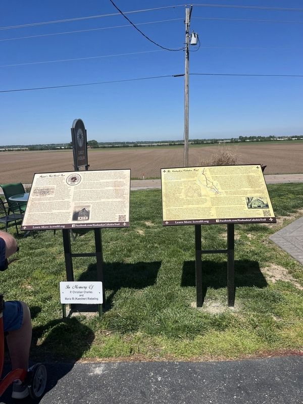
Photographed by Thomas Smith, April 24/
2. Piggot's Fort Great Run Marker
After the Revolutionary War, and without George Rogers Clark’s American soldiers to oppose their order, the old laws and order in the Illinois Country were the French courts at Cahokia and Kaskaskia. Captain Piggot and a majority of the American pioneers were opposed to the authority of the French courts on the grounds that American territory should be governed by Americans. A small but sinister group of outcasts lived at Kaskaskia. Led by John Dodge, these bandits created lawlessness throughout the Kaskaskia District.
Law and order was restored on the Illinois frontier with the arrival of Arthur St. Clair, governor of the territory northwest of the Ohio River, who came to Kaskaskia on March 5, 1790. A little more than a month later, Governor St. Clair issued a proclamation organizing a county of the Northwest Territory which he named St. Clair County in honor of himself. The massive new county was bordered by the Mississippi River on the west, the Ohio and Wabash Rivers on the south and east, and Lake Michigan on the north. After organizing a government, St. Clair immediately set up the legal machinery needed. Among his appointments, James Piggot was made captain of the militia. Captain Piggot rapidly rose to importance and became the Judge of the Common Pleas Court at Cahokia in 1795. A year later he was named a Justice of the Quarter Sessions Orphan’s Court.
During the Indian troubles, Fort Great Run provided safety to settlers and travelers alike. Records indicate that ten percent of the American settlers were killed or taken captive from 1783 through 1795. The Northwest Indian Wars ended in 1795 with the Treaty of Peace between the United States and the Wyandots, Delawares, Shawnees, Ottawas, Chippewas, Potawatomis, Miamis, Eel, Weas, Kickapoos, Piankashaws, and Kaskaskias. The treaty redefined the boundary between indigenous peoples’ lands and territory for American settlement. This treaty ended the Indian troubles and the safety of the fort was no longer necessary. Fort Great Run was eventually dismantled and the stones and timbers were used to erect settlers’ cabins and barns throughout the American Bottom. The exact location of the fort is unknown, however, the foundation of Charles Schneider’s barn is still standing and looks similar to a stone fortress, so locals call it Piggot’s Fort.
Topics. This historical marker is listed in these topic lists: Forts and Castles • Settlements & Settlers • War, US Revolutionary. A significant historical year for this entry is 1782.
Location. 38° 27.065′ N, 90° 13.72′ W. Marker is in Columbia, Illinois, in Monroe County. It is on Bluff Road (County Road 6) south of Old Bluff Road, on the right when traveling north. The marker stands at the Sunset Overlook. Touch for map. Marker is at or near this postal address: 11604 Bluff Rd, Columbia IL 62236, United States of America. Touch for directions.

Regionally, this marker is in Greater St. Louis. It is also in the American Midwest, in the Lewis & Clark Corridor, in the Corn Belt, and in the Great River Road Region. Globally, it is in North America, the Western Hemisphere, the Western World, and the Anglosphere. Historically, it finds itself in what was once the territory of the Mississippian Culture and also the Northwest Territory.
Other nearby markers. At least 8 other markers are within walking distance of this marker: The Kaskaskia-Cahokia Trail (a few steps from this marker); Adam’s Road Patrol #4 (about 300 feet away, measured in a direct line); Fort Piggott / Land Grants / Piggotts Ferry (approx. 0.2 miles away); Sand Bank School (approx. 0.7 miles away); American Freedom Fighter and Palestinian Girl (approx. ¾ mile away); Four-Bent Pile trestle (approx. 0.9 miles away); Admiral Carlisle A. H. Trost (approx. 0.9 miles away); Admiral John P. Weinel (approx. 0.9 miles away). Touch for a list and map of all markers in Columbia.
Credits. This page was last revised on May 6, 2026. It was originally submitted on May 1, 2026, by Thomas Smith of Waterloo, Ill. This page has been viewed 39 times since then. Photos: 1, 2. submitted on May 1, 2026, by Thomas Smith of Waterloo, Ill. • Devry Becker Jones was the editor who published this page.
