Orinda in Contra Costa County, California — The American West (Pacific Coastal)
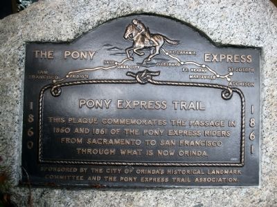
The Pony Express
This plaque commemorates the passage in 1860 and 1861 of the Pony Express riders from Sacramento to San Francisco through what is now Orinda.
Sponsored by the City of Orinda's Historical Landmark Committee and the Pony Express Trail Association.
Erected by City of Orinda Historical Landmark Committee and the Pony Express Trail Association.
Topics and series. This historical marker is listed in this topic list: Communications. In addition, it is included in the Pony Express National Historic Trail series list. A significant historical year for this entry is 1860.
Location. 37° 52.674′ N, 122° 10.93′ W. Marker is in Orinda, California, in Contra Costa County. Marker can be reached from the intersection of Camino Pablo and Brookwood Road. Touch for map. Marker is in this post office area: Orinda CA 94563, United States of America. Touch for directions.
Other nearby markers. At least 8 other markers are within walking distance of this marker. A different marker also named Pony Express (about 300 feet away, measured in a direct line); The Orinda Theatre, 1941 (about 400 feet away); Bryant Station Site (about 500 feet away); The Crossroads (about 500 feet away); Orinda Mural (about 500 feet away); The deLaveaga Station (about 800 feet away); The de Laveaga Station (approx. 0.2 miles away); The First Downtown (approx. 0.2 miles away). Touch for a list and map of all markers in Orinda.
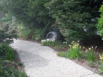
More about this marker. The marker is mounted on a low rock next to the sidewalk that cuts through the Crossroads Mini Park. Due to the surrounding shrubbery, the marker is not visible from a distance.
Regarding The Pony Express. Ordinarily Folsom or Sacramento served as the western terminus of the Pony Express route for horse-carried mail, with the remainder of the route being served by train and/or steamship. However, on approximately 20 occasions the mail was, due to scheduling difficulties, carried by horseback between Sacramento and San Francisco, using a route that took the riders through what is now the City of Orinda.
Credits. This page was last revised on June 16, 2016. It was originally submitted on April 18, 2010, by Andrew Ruppenstein of Lamorinda, California. This page has been viewed 1,761 times since then and 55 times this year. Photos: 1, 2. submitted on April 18, 2010, by Andrew Ruppenstein of Lamorinda, California. • Syd Whittle was the editor who published this page.

