Milam in Sabine County, Texas — The American South (West South Central)
Milam Masonic Institute
Photographed by Steve Gustafson, May 2, 2009
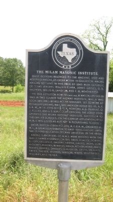
1. Milam Masonic Institute Marker
The Rev. Littleton Fowler (1803-46), a Mason, opened in 1845 in this county the Midway Institute, which was soon absorbed by Red Mount Seminary. Set to work at Red Mount (Milam), 1847, was Jackson Lodge No. 35, A.F. & A.M., with John Boyd, G.A. Norford, A.D. Oliphint, O.J. Polley, and J.T. Scruggs as officers. The lodge soon operated the Milam Masonic Institute, successor to the earlier schools. On the charter application (1853) M.M.I. was listed as already "a flourishing school."
Later, Sexton Lodge No. 251, A.F. & A.M., operated M.M.I., a great contributor to East Texas culture until tax-funded education became universal in the 1870s.
Among supporters of M.M.I. were Masons with the family names Anderson, Causey, Davis, Deweese, Dorsey, Elliott, Gellately, Halbert, Harper, Harris, Jacks, Low, McCloskey, McGown, McMahan, Mason, Nethery, Noble, Pratt, Reeves, Renfro, Sanders, Slaughter, Smith, Speights, Sweet, Tucker, Vickers, Watson, White, Whittlesey, Williams, and Yeiser.
Erected 1974 by Texas Historical Commission. (Marker Number 11045.)
Topics. This historical marker is listed in these topic lists: Fraternal or Sororal Organizations • Settlements & Settlers. A significant historical year for this entry is 1845.
Location. 31° 25.962′ N, 93° 50.766′ W. Marker is in Milam, Texas, in Sabine County. It is on State Highway 21 east of State Highway 87, on the right when traveling east. Touch for map. Marker is in this post office area: Milam TX 75959, United States of America. Touch for directions.

Regionally, this marker is in the American South,
this page online
Other nearby markers. At least 8 other markers are within walking distance of this marker: John C. Hale (here, next to this marker); The Old San Antonio Road (about 400 feet away, measured in a direct line); Milam (about 400 feet away); Kings Highway (about 400 feet away); a different marker also named Milam (about 400 feet away); Bethany Baptist Church (about 600 feet away); C.A. Nethery & Sons General Merchandise (approx. 0.2 miles away); Meador Cemetery (approx. 0.3 miles away). Touch for a list and map of all markers in Milam.
Photographed by Tom Bosse, July 4, 2017
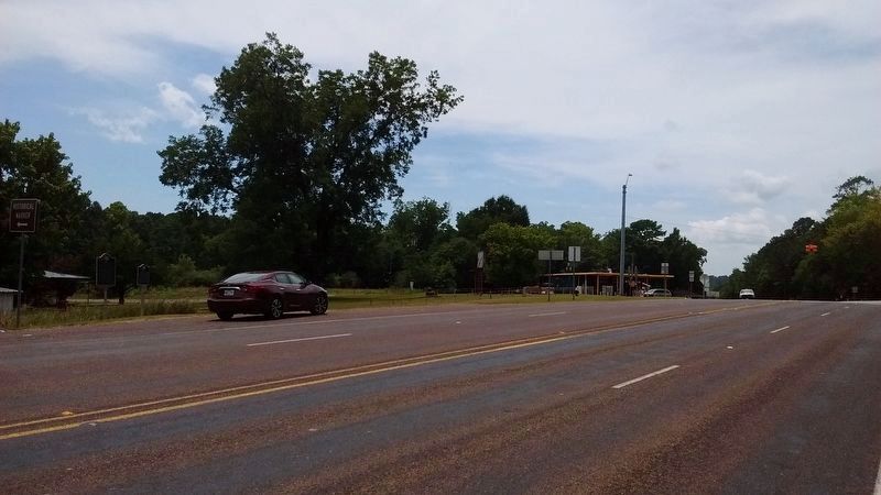
2. Milam Masonic Institute Marker
The marker is on the far left in this view, to the left of the "John C. Hale" marker.
Credits. This page was last revised on August 7, 2017. It was originally submitted on April 19, 2010, by Steve Gustafson of Lufkin, Texas. This page has been viewed 1,568 times since then and 62 times this year. Photos: 1. submitted on April 19, 2010, by Steve Gustafson of Lufkin, Texas. 2. submitted on August 6, 2017, by Tom Bosse of Jefferson City, Tennessee. • Syd Whittle was the editor who published this page.
