Bloomfield in Stoddard County, Missouri — The American Midwest (Upper Plains)
Major Amos Stoddard
Photographed by Craig Swain, September 28, 2022
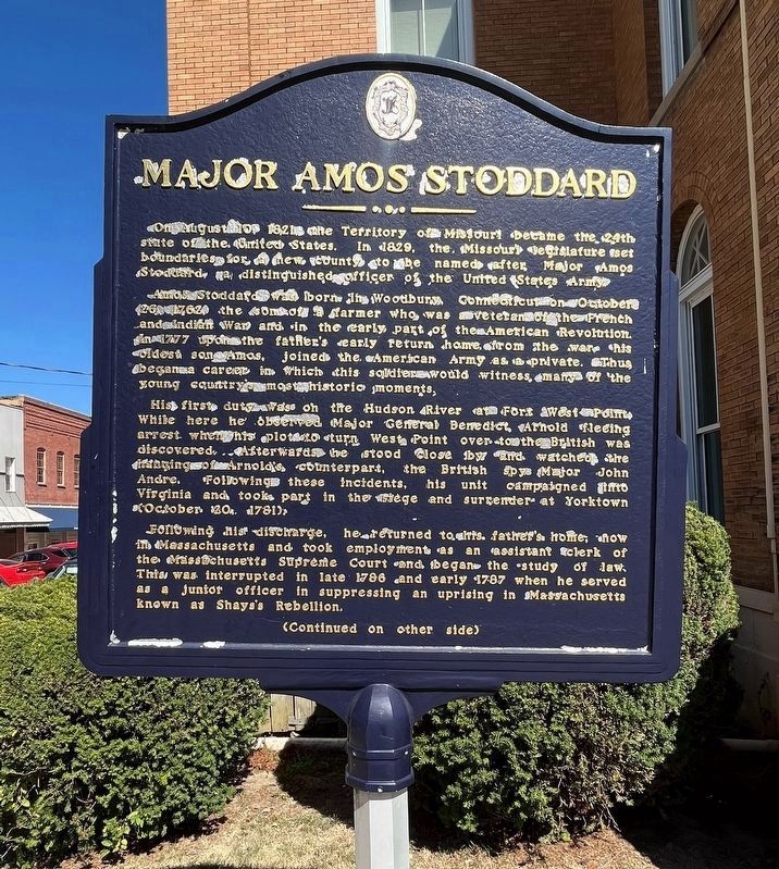
1. Major Amos Stoddard Marker (Front)
On August 10, 1821, the Territory of Missouri became the 24th state of the United States. In 1829, the Missouri legislature set boundaries for a new county to be named after Major Amos Stoddard, a distinguished officer of the United States Army.
Amos Stoddard was born in Woodbury, Connecticut on October 26, 1762, the son of a farmer who was a veteran of the French and Indian War and in the early part of the American Revolution. In 1777 upon the father's early return home from the war his oldest son Amos, joined the American Army as a private. Thus began a career in which this soldier would witness many of the young country's most historic moments.
His first duty was on the Hudson River at Fort West Point. While here he observed Major General Benedict Arnold fleeing arrest when his plot to turn West Point over to the British was discovered. Afterwards he stood close by and watched the hanging of Arnold's counterpart, the British spy Major John Andre. following these incidents, his unit campaigned into Virginia and took part in the siege and surrender at Yorktown (October 20, 1781).
Following his discharge, he
this page online
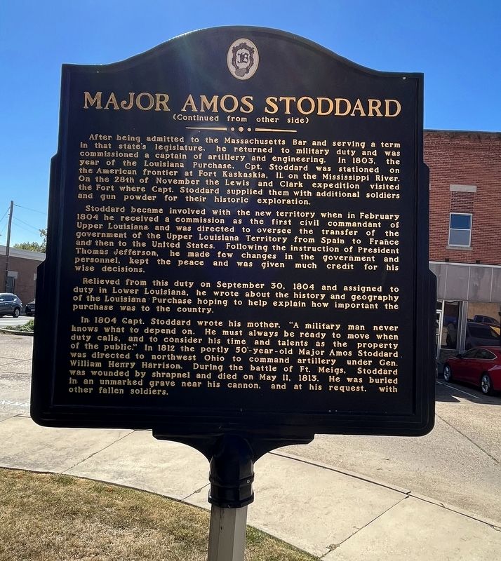
After being admitted to the Massachusetts Bar and serving a term in that state's legislature, he returned to military duty and was commissioned a captain of artillery and engineering. In 1803, the year of the Louisiana Purchase, Cpt. Stoddard was stationed on the American frontier at Fort Kaskaskia, IL on the Mississippi River. On the 28th of November the Lewis and Clark expedition visited the Fort where Capt. Stoddard supplied them with additional soldiers and gun powder for their historic exploration.
Stoddard became involved with the new territory when in February 1804 he received a commission as the first civil commandant of Upper Louisiana and was directed to oversee the transfer of the government of the Upper Louisiana Territory from Spain to France and then to the United States. Following the instruction of President
Photographed by Craig Swain, September 28, 2022
2. Major Amos Stoddard Marker (Back)
Relieved from duty on September 30, 1804 and assigned to duty in Lower Louisiana, he wrote about the history and geography of the Louisiana Purchase hoping to explain how important the purchase was to the country.
In 1804 Capt. Stoddard wrote his mother, "A military man never knows what to depend on. He must always be ready to move when duty calls, and to consider his time and talents as the property of the public." In 1812 the portly 50-year-old Major Amos Stoddard was directed to northwest Ohio to command artillery under Gen. William Henry Harrison. During the battle of Ft. Meigs, Stoddard was wounded by shrapnel and died on May 11, 1813. He was buried in an unmarked grave near his cannon, and at his request, with other fallen soldiers.
Topics and series. This historical marker is listed in these topic lists: Political Subdivisions • Settlements & Settlers • War, US Revolutionary. In addition, it is included in the Shays' Rebellion series list. A significant historical month for this entry is February 1804.
Location. 36° 53.072′ N,
Photographed by Craig Swain, September 28, 2022
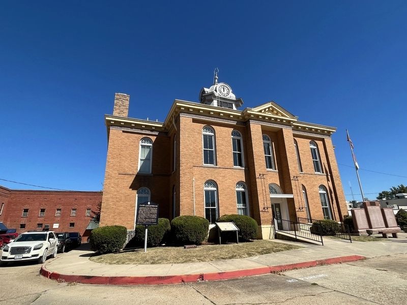
3. South Side of the Stoddard County Courthouse
The markers are on the left in this view. There is a veterans memorial on the right (southeast) corner.

Regionally, this marker is in Southeast Missouri and specifically in the Missouri Bootheel. It is also in the American Mississippi Delta, in the Ozarks, in the Lewis & Clark Corridor, and in the Corn Belt. Globally, it is in North America, the Western Hemisphere, the Western World, and the Anglosphere. Historically, it finds itself in what was once the territory of the Mississippian Culture, the Louisiana Purchase, and the Antebellum South.
Other nearby markers. At least 8 other markers are within walking distance of this marker: The Civil War in Bloomfield (here, next to this marker); The Execution of Asa V. Ladd (within shouting distance of this marker); Stoddard Countians Aboard the C.S. Arkansas (within shouting distance of this marker); The First Stars and Stripes (within shouting distance of this marker); Mutiny in Bloomfield (about 300 feet away, measured in a direct line); The History of Bloomfield High School (approx. 0.2 miles away); The Bloomfield Academy (approx. 0.2 miles away); The Civil War Hospitals of Bloomfield (approx. 0.2 miles away). Touch for a list and map of all markers in Bloomfield.
Related markers. Click here for a list of markers that are related to this marker.
Also see . . .
1. The Day St. Louis Became an American City. Article from the St. Louis Post Dispatch detailing the transition of the city from French to American control, in which Major Stoddard played an important role. (Submitted on October 10, 2022, by Craig Swain of Leesburg, Virginia.)
2. Amos Stoddard and the Lewis & Clark Expedition. (Submitted on October 10, 2022, by Craig Swain of Leesburg, Virginia.)
3. Major Amos Stoddard Memorial. HMDB entry for Major Stoddard's memorial at Fort Meigs. (Submitted on October 10, 2022, by Craig Swain of Leesburg, Virginia.)
4. Battery Amos Stoddard. A battery named for Major Stoddard, Fort Worden, covering Puget Sound. (Submitted on October 10, 2022, by Craig Swain of Leesburg, Virginia.)
Credits. This page was last revised on May 7, 2026. It was originally submitted on October 10, 2022, by Craig Swain of Leesburg, Virginia. This page has been viewed 690 times since then and 106 times this year. Last updated on May 6, 2026, by G.W.Bartlett of Hingham, Massachusetts. Photos: 1, 2, 3. submitted on October 10, 2022, by Craig Swain of Leesburg, Virginia. • Devry Becker Jones was the editor who published this page.
