Holborn in Camden in Greater London, England, United Kingdom — Northwestern Europe (the British Isles)
WWI Bomb Damage
Photographed by Andrew Ruppenstein, April 24, 2026
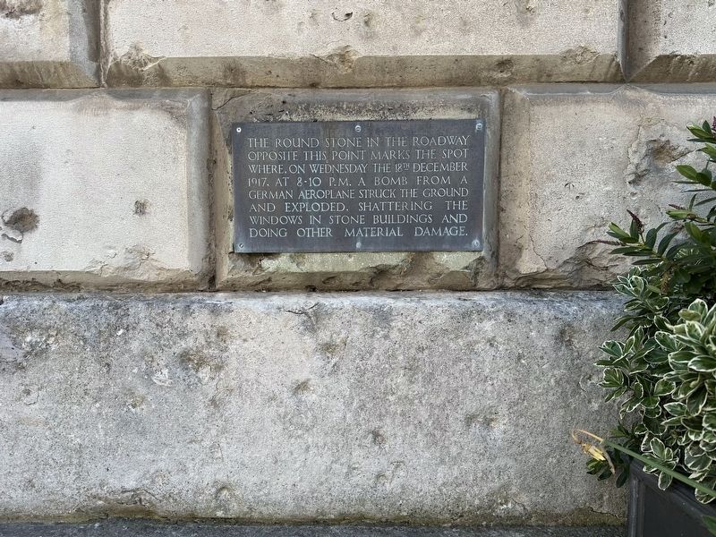
1. WWI Bomb Damage Marker
The round stone in the roadway opposite this point marks the spot where, on Wednesday the 18th December 1917, at 8-10 p.m. a bomb from a German aeroplane struck the ground and exploded, shattering the windows in stone buildings and doing other material damage.
Topics. This historical marker is listed in this topic list: War, World I. A significant historical date for this entry is December 18, 1917.
Location. 51° 31.042′ N, 0° 6.815′ W. Marker is in Camden, England, in Greater London. It is in Holborn. It is on Stone Buildings, on the left when traveling south. Touch for map. Marker is at or near this postal address: 8 Stone Buildings, Camden, England WC2A, United Kingdom. Touch for directions.

Regionally, this marker is in the Greater South East. Globally, it is on the Atlantic Ocean, in the North Atlantic Region, in Europe, in Atlantic Europe, on one of the British Isles, in the Western World, and in the Anglosphere. Historically, it finds itself in what was once the Roman Empire.
Other nearby markers. At least 8 other markers are within walking distance of this marker: Chancery Building (here, next to this marker); Zeppelin Bomb Damage (about 90 meters away, measured in a direct line); John Thurloe (about 150 meters away); Sun Yat-Sen (about 180 meters away); Royal Fusiliers Memorial
this page online
Also see . . . Strategic bombing: Gothas over London (Military History).
… On the 18 December, Walter led Bogohl 3 to London. Six Gothas fought their way through the barrage, as did a single Giant, and their bombs caused damage estimated at £225,000, the greatest in a single attack since the Zeppelin raid on central London on the night of 8/9 September 1915.(Submitted on May 8, 2026.)
The raiders did not have it all their own way. Captain G W Murlis Green, commanding officer of No.44 Squadron, shot down a Gotha after it had bombed Bermondsey, the first loss in air combat since the night offensive commenced. Seven others were lost or damaged in landing accidents back in Belgium.
Photographed by Andrew Ruppenstein, April 24, 2026
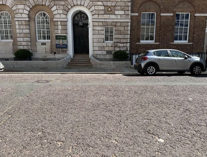
2. WWI Bomb Damage Marker - wide view
The marker is visible here, low and to the right of the doorway. To the extent that it is of any importance, it is unclear which of the white spots visible here, the one in the foreground or the one to its right in the midground, if either, are the “round stone” representing the point of the bomb’s impact.
Photographed by Andrew Ruppenstein, April 24, 2026
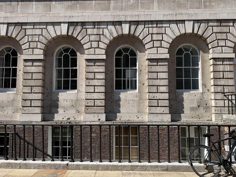
3. Bomb damage
The face of the building opposite the marker shows considerable shrapnel damage.
Credits. This page was last revised on May 8, 2026. It was originally submitted on May 8, 2026, by Andrew Ruppenstein of Lamorinda, California. This page has been viewed 18 times since then. Photos: 1, 2, 3. submitted on May 8, 2026, by Andrew Ruppenstein of Lamorinda, California.
