Vernon in Wilbarger County, Texas — The American South (West South Central)
Operation Desert Storm
1990-1991

Photographed by Cosmos Mariner, July 5, 2025
1. Operation Desert Storm Marker
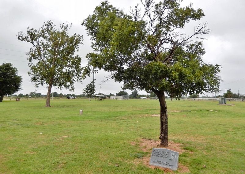
This oak tree is dedicated in tribute to those who served their country in Operation Desert Storm
Erected by Wilbarger County Desert Storm Support Group.
Topics. This memorial is listed in these topic lists: Patriots & Patriotism • War, 1st Iraq & Desert Storm.
Location. 34° 7.891′ N, 99° 18.043′ W. Memorial is in Vernon, Texas, in Wilbarger County. It can be reached from Sand Road just south of Cannon Avenue, on the left when traveling south. The memorial and tree are in Orbison Park, near the southwest corner of the Orbison Aquatic Center parking lot. Touch for map. Memorial is at or near this postal address: 4400 Sand Road, Vernon TX 76384, United States of America. Touch for directions.

Regionally, this memorial is in Big Country. It is also on the American Great Plains and specifically on the Southern Plains. Globally, it is in North America, a Gulf of Mexico state, the Western Hemisphere, the Western World, and the Anglosphere. Historically, it finds itself in what was once New Spain, the Comanchería, the Republic of Texas, and one of the
this page online
Other nearby markers. At least 8 other markers are within 2 miles of this marker, measured as the crow flies: Roy Orbison (within shouting distance of this marker); Waggoner-Hicks House (approx. 1.4 miles away); W. D. Berry Home (approx. 1.7 miles away); Vernon Texas Confederate Monument (approx. 1.8 miles away); Wilbarger County WWI Memorial (approx. 1.8 miles away); Early Wilbarger County (approx. 1.8 miles away); Napoleon 12 Pounder Bronze Field Gun Model 1857 (approx. 1.8 miles away); Wilbarger County Centennial Time Capsule (approx. 1.8 miles away). Touch for a list and map of all markers in Vernon.
Photographed by Cosmos Mariner, July 5, 2025
2. Operation Desert Storm Marker
Orbison Park is in the background.
Credits. This page was last revised on May 14, 2026. It was originally submitted on May 11, 2026, by Cosmos Mariner of Cape Canaveral, Florida. This page has been viewed 26 times since then. Photos: 1. submitted on May 13, 2026, by Cosmos Mariner of Cape Canaveral, Florida. 2. submitted on May 14, 2026, by Cosmos Mariner of Cape Canaveral, Florida.
