
Gold Hill in Rowan County, North Carolina — The American South (South Atlantic)
The Barnhardt Shaft
| — | Gold Hill Rail Trail | — |

Photographed by Mark Parker, April 25, 2026
1. The Barnardt Shaft Marker
"a blast was to be fired. We waited a few seconds in suspense—the match had failed—but another instant brought a convulsive shock, and a loud report as of rolling thunders. The noise, though almost deafening below, cannot be heard above ground."Most of the early partnerships, like that of Barnhardt, were quite profitable. About one third of the gold coined at Charlotte came from Gold Hill.
_Carolina Watchman, October 2, 1851
"The steam mills seem to partake of the general feeling of confidence and puff puff as deliberately and grand as if they knew every breath was worth a dollar."
_Carolina Watchman, September 14, 1854
The Barnhardt and Earnhardt Shafts were the core properties in building the reputation of Gold Hill as the South's most successful gold
this page online
Horse powered whims provided vertical access to deep shafts such as the Barnhardt Shaft. Heavy ropes wound around the whims raised and lowered metal buckets called "kibbles", which carried men, ore and equipment.
Miners used gun powder to blast ore loose from the walls of tunnels driven off from the shafts. Raising the ore to the surface in kibbles the men then had to break and grind it to a powder small enough to separate the gold. A favorite machine for this was the Chilean Mill (an example of which can be found in Gold Hill Mines Historic Park), which crushed ore pieces beneath two rolling granite stones running on a similar base. Chilean Mills, like other machinery at Gold Hill, used steam power by the 1850's.
(Captions)
George and Martha Barnhardt
This $2.50 gold coin from Charlotte has the mint mark "C" under the eagle.
Comish Kibbles (Ore Buckets) Similar to the ones displayed in the park nearby
Porte Crayon drew this miner, wheelbarrow and kibble at the top of a Gold Hill shaft in 1857 for Harper's Weekly Magazine
Barnhardt Mine Overview from the Miller Mine Shaft c. 1895
Topics.
Photographed by Mark Parker, April 25, 2026
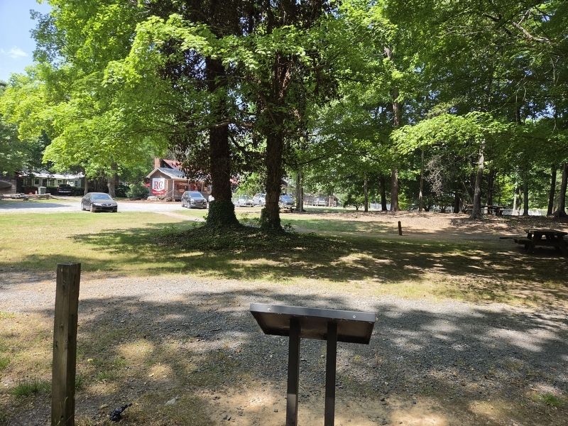
2. The Barnardt Shaft Marker reverse side looking towards parking for village shops
Location. 35° 30.621′ N, 80° 20.748′ W. Marker is in Gold Hill, North Carolina, in Rowan County. It can be reached from Saint Stephens Church Road 0.1 miles north of Old Beatty Ford Road, on the right when traveling north. The marker is along the trailhead of Gold Hill Rail Trail approximately 200 east of St Stephens Church Road. Touch for map. Marker is at or near this postal address: 775 St Stephens Church Rd, Gold Hill NC 28071, United States of America. Touch for directions.

Regionally, this marker is in North Carolina’s Piedmont. It is also in the American South and specifically in the Upper South. Globally, it is in North America, the Western Hemisphere, the Western World, and the Anglosphere. Historically, it finds itself in what was once the territory of the Mississippian Culture, one of the original Thirteen Colonies, one of the Confederate States of America, and the Antebellum South.
Other nearby markers. At least 8 other markers are within walking distance of this marker: Gold Hill Mining District

Photographed by Mark Parker, April 25, 2026
3. The Barnardt Shaft Marker at the Gold Hill Rail Trail trailhead
Related marker. Click here for another marker that is related to this marker.
Credits. This page was last revised on May 19, 2026. It was originally submitted on May 13, 2026, by Mark Parker of Hickory, North Carolina. This page has been viewed 15 times since then. Photos: 1, 2, 3. submitted on May 13, 2026, by Mark Parker of Hickory, North Carolina. • Bernard Fisher was the editor who published this page.
