
Medina in Medina County, Ohio — The American Midwest (Great Lakes)
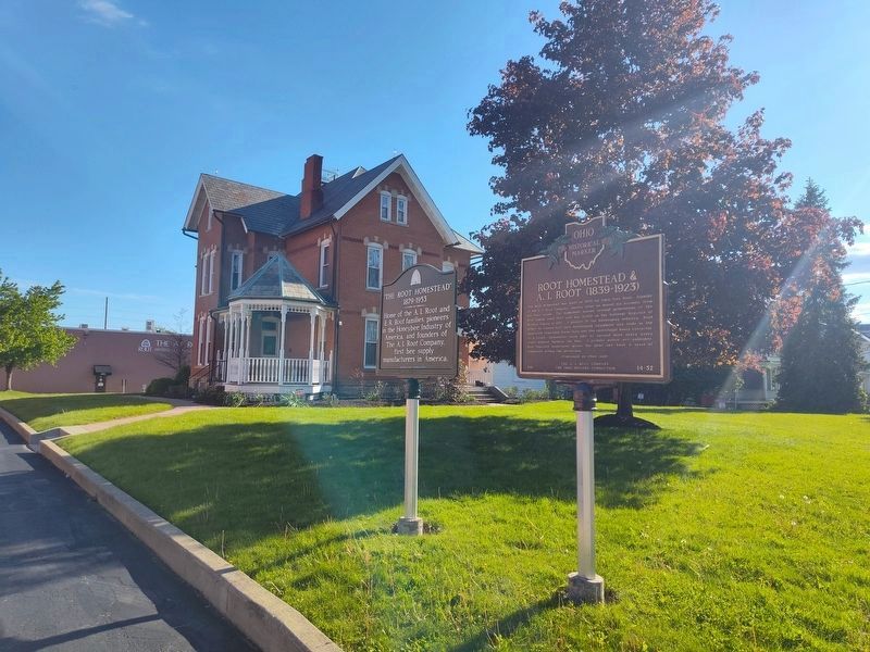
"The Root Homestead"
1879 - 1953

Photographed by Craig Doda, May 10, 2026
1. "The Root Homestead" Marker
Erected by The Medina County Historical Society.
Topics. This historical marker is listed in these topic lists: Animals • Industry & Commerce. A significant historical year for this entry is 1879.
Location. 41° 8.341′ N, 81° 52.496′ W. Marker is in Medina, Ohio, in Medina County. It is at the intersection of West Liberty Street (Ohio Route 57) and South Medina Street, on the right when traveling east on West Liberty Street. Touch for map. Marker is at or near this postal address: 640 W Liberty St, Medina OH 44256, United States of America. Touch for directions.

Regionally, this marker is in Greater Cleveland and in the Western Reserve. It is also in the American Midwest and in the Corn Belt. Globally, it is in North America, the Western Hemisphere, the Western World, and the Anglosphere. Historically, it finds itself in what was once the Haudenosaunee (Iroquois) Confederacy, the territory of the Mississippian Culture, and the
this page online
Other nearby markers. At least 8 other markers are within walking distance of this marker: Root Homestead & A. I. Root (1839-1923) (here, next to this marker); Donald J. Pease (approx. half a mile away); Original Court House (approx. 0.6 miles away); Original Court House and Jail (approx. 0.6 miles away); First Site of the A. I. Root Company (approx. 0.6 miles away); American House Hotel (approx. 0.6 miles away); The Cleveland Southwestern Electric Railway (approx. 0.6 miles away); Phoenix Block (approx. 0.6 miles away). Touch for a list and map of all markers in Medina.
Photographed by Craig Doda, May 10, 2026
2. "The Root Homestead" Marker
Credits. This page was last revised on May 18, 2026. It was originally submitted on May 15, 2026, by Craig Doda of Napoleon, Ohio. This page has been viewed 16 times since then. Photos: 1, 2. submitted on May 15, 2026, by Craig Doda of Napoleon, Ohio. • Devry Becker Jones was the editor who published this page.
