Fort Totten in Northeast Washington in Washington, District of Columbia — The American Northeast (Mid-Atlantic)
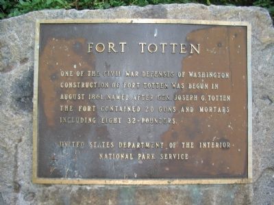
Fort Totten
Erected by National Park Service, U.S. Department of the Interior.
Topics and series. This historical marker is listed in these topic lists: Forts and Castles • War, US Civil. In addition, it is included in the Defenses of Washington series list. A significant historical year for this entry is 1861.
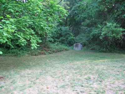
Location. 38° 56.842′ N, 77° 0.317′ W. Marker is in Northeast Washington in Washington, District of Columbia. It is in Fort Totten. Marker is on Fort Totten Drive Northeast north of Allison Street Northeast, on the right when traveling north. Located at the edge of the Fort Totten earthworks inside Fort Totten Park. Touch for map. Marker is at or near this postal address: 4670 Fort Totten Drive Northeast, Washington DC 20011, United States of America. Touch for directions.
Other nearby markers. At least 8 other markers are within walking distance of this marker. A different marker also named Fort Totten (about 500 feet away, measured in a direct line); a different marker also named Fort Totten (about 500 feet away); St. Paul's Episcopal Church and Rock Creek Cemetery (approx. 0.3 miles away); United States Soldiers' and Airmen's Home National Cemetery (approx. 0.3 miles away); Memorial Day Order (approx. 0.3 miles away); In Memory of Those Who Lost Their Lives on June 22, 2009 (approx. 0.4 miles away); St. Paul's Episcopal (approx. 0.4 miles away); St. Paul's Episcopal Church (approx. 0.4 miles away). Touch for a list and map of all markers in Northeast Washington.
Also see . . .
1. Fort Totten. National Park Service site. (Submitted on October 15, 2007, by Craig Swain of Leesburg, Virginia.)
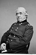
2. Joseph Gilbert Totten - Wikipedia. (Submitted on February 19, 2012, by Richard E. Miller of Oxon Hill, Maryland.)
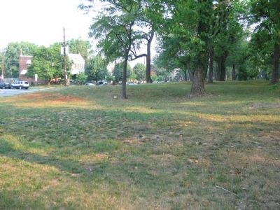
Photographed By Craig Swain, August 4, 2007
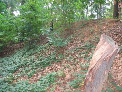
4. External Trenchworks
Some of the trenches outside the fort proper can be seen in traces today. During the Civil War, the area around the fort was cleared, with abatis and other obstacles placed along likely enemy approach routes. Outer trenchworks supported the main fort by protecting the blind sides from enemy advances.
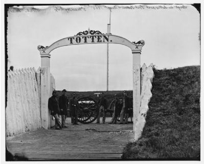
Civil War Photographs, Library of Congress
6. Civil War Photograph of Soldiers at the Gate to Fort Totten
This gate stood not far from where the marker is today, and was the only entrance to the fort. (Civil War photographs, 1861-1865 / compiled by Hirst D. Milhollen and Donald H. Mugridge, Washington, D.C. : Library of Congress, 1977. No. 0774)
Credits. This page was last revised on April 28, 2023. It was originally submitted on October 15, 2007, by Craig Swain of Leesburg, Virginia. This page has been viewed 2,502 times since then and 28 times this year. Photos: 1. submitted on October 15, 2007, by Craig Swain of Leesburg, Virginia. 2. submitted on February 19, 2012, by Richard E. Miller of Oxon Hill, Maryland. 3, 4, 5, 6. submitted on October 15, 2007, by Craig Swain of Leesburg, Virginia.
