Taneytown in Carroll County, Maryland — The American Northeast (Mid-Atlantic)
Taneytown Memorial Park
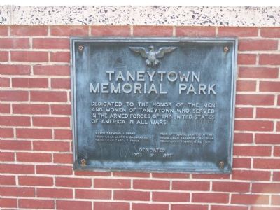
Photographed by William Pfingsten, October 14, 2007
1. Taneytown Memorial Park Marker
Councilman James C. Baumgardner
Councilman Carel E. Frock
Pres of Council James C. Myers
Councilman Raymond F. Davidson
Councilman George W. Motter
Dedicated
1953 * 1957
Topics. This historical marker is listed in these topic lists: Military • Patriots & Patriotism. A significant historical year for this entry is 1953.
Location. 39° 39.781′ N, 77° 10.851′ W. Marker is in Taneytown, Maryland, in Carroll County. It is on Playground Road near West Baltimore Street (Maryland Route 140), in the median. Monument is in Memorial Park. Touch for map. Marker is in this post office area: Taneytown MD 21787, United States of America. Touch for directions.

Regionally, this marker is in the Baltimore Metro Region and in Central Maryland. It is also in the American Mid-Atlantic. Globally, it is in North America, the Western Hemisphere, the Western World, and the Anglosphere. Historically, it finds itself in what was once one of the original Thirteen Colonies and
this page online
Other nearby markers. At least 8 other markers are within walking distance of this marker: "9 11 A Day To Remember" (a few steps from this marker); Taneytown (within shouting distance of this marker); Army of the Potomac (within shouting distance of this marker); a different marker also named Army of the Potomac (within shouting distance of this marker); 1st Lieutenant John E. Buffington (approx. ¼ mile away); Adam Good Tavern (approx. 0.3 miles away); "Steps of the Sisters" (approx. 0.3 miles away); Everyone is Welcome (approx. 0.3 miles away). Touch for a list and map of all markers in Taneytown.
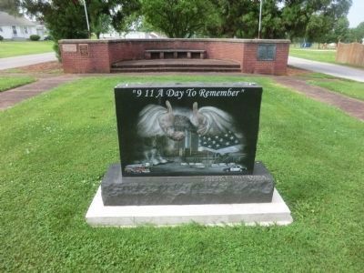
Photographed by Don Morfe, May 30, 2015
2. Taneytown Memorial Park-9/11 A Day to Remember
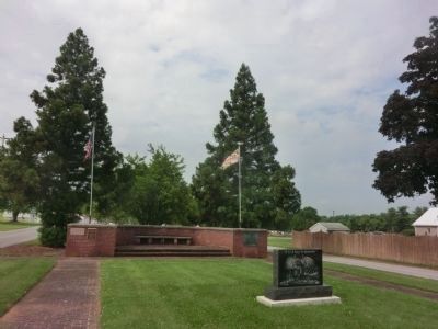
Photographed by Don Morfe, May 30, 2015
3. Taneytown Memorial Park Marker-distant shot
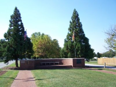
Photographed by William Pfingsten, October 14, 2007
4. Full view of Monument
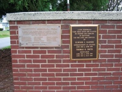
Photographed by Craig Swain, July 27, 2008
5. Plaques on the Left Side of the Memorial
Taneytown Memorial Park
In honor of the original board directors of the Taneytown Recreational Association which was formed on January 5, 1949 and whose vision and dedication made this park possible.
In honor of the original board directors of the Taneytown Recreational Association which was formed on January 5, 1949 and whose vision and dedication made this park possible.
Credits. This page was last revised on June 16, 2016. It was originally submitted on October 15, 2007, by Bill Pfingsten of Bel Air, Maryland. This page has been viewed 2,731 times since then and 95 times this year. Photos: 1. submitted on October 15, 2007, by Bill Pfingsten of Bel Air, Maryland. 2, 3. submitted on June 1, 2015, by Don Morfe of Baltimore, Maryland. 4. submitted on October 15, 2007, by Bill Pfingsten of Bel Air, Maryland. 5. submitted on August 29, 2008, by Craig Swain of Leesburg, Virginia. • J. J. Prats was the editor who published this page.
