Near Danville in Halifax County, Virginia — The American South (Mid-Atlantic)
Pittsylvania County
Area 1,015 square miles
⎯⎯⎯
North Carolina

Pittsylvania County. Area 1,015 square miles. Formed in 1766 from Halifax and named for William Pitt, Earl of Chatham, British statesman. This is the largest county in Virginia. The home of Claude A. Swanson, Governor of Virginia, 1906-1910.
North Carolina. North Carolina was one of the original thirteen states. The first settlement was made on Roanoke Island, 1585, but was not permanent. Settlers from Virginia occupied the Albemarle region before 1663, in which year the Colony of Carolina was founded.
Erected 1940 by Virginia Conservation Commission. (Marker Number Z-208.)
Topics and series. This historical marker is listed in these topic lists: Government & Politics • Political Subdivisions • Settlements & Settlers. In addition, it is included in the Virginia Department of Historic Resources (DHR) series list. A significant historical year for this entry is 1766.
Location. 36° 32.516′ N, 79° 13.042′ W. Marker is near Danville, Virginia, in Halifax County. It is at the intersection of North Broad Street (Virginia Route 62) and River Bend Road ( Route 1527), on the left when traveling west on North Broad
this page online

Regionally, this marker is in the Piedmont, in Southside Virginia, and specifically in Central Virginia. It is also in the American South and specifically in the Upper South. Globally, it is in North America, the Western Hemisphere, the Western World, and the Anglosphere. Historically, it finds itself in what was once the territory of the Mississippian Culture, one of the original Thirteen Colonies, one of the Confederate States of America, and the Antebellum South.
Other nearby markers. At least 8 other markers are within walking distance of this marker: African American Cemetery Site (approx. 0.4 miles away in North Carolina); Cedars Cemetery (approx. half a mile away in North Carolina); Fairview (approx. half a mile away in North Carolina); Walker House (approx. half a mile away in North Carolina); Clay-Lewis-Irvine House (approx. half a mile away in North Carolina); Patterson-Dodson House (approx. half a mile away in North Carolina); Episcopal Church (approx. half a
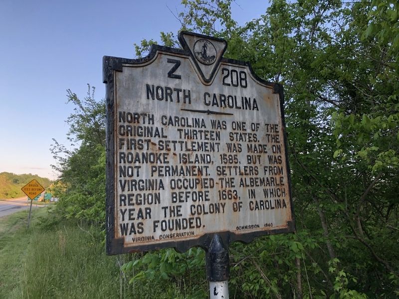
More about this marker. Oddly, this marker is neither in Pittsylvania County nor North Carolina. Just north of the borderline, Route 62 passes through Halifax County (where the marker stands) for about a block before continuing into Pittsylvania County.
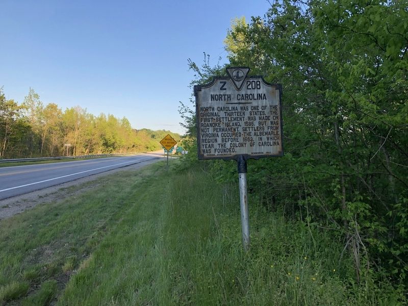
Photographed by Devry Becker Jones (CC0), April 22, 2021
3. Pittsylvania County / North Carolina Marker
Credits. This page was last revised on May 20, 2026. It was originally submitted on April 25, 2021, by Devry Becker Jones of Washington, District of Columbia. This page has been viewed 815 times since then and 105 times this year. Last updated on May 19, 2026, by C. Ryan Dodson of Danville, Virginia. Photos: 1, 2, 3. submitted on April 25, 2021, by Devry Becker Jones of Washington, District of Columbia.
