Englishtown in Limerick in County Limerick, Munster, Ireland — Irish South-West ((Éire) North Atlantic Ocean)
Bourke House
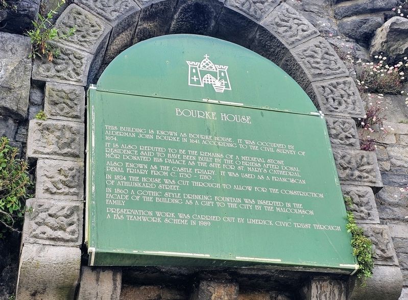
Photographed by Ian Lefkowitz, May 13, 2026
1. Bourke House Marker
It is also reputed to be the remains of a medieval stone residence said to have been built by the O’Briens after Donal Mór donated his palace as the site for St. Mary’s Cathedral.
Also known as the Castle Friary. It was used as a Franciscan penal friary from c. 1730–1780.
In 1824 the house was cut through to allow for the construction of Athlunkard Street.
In 1860 a Gothic style drinking fountain was inserted in the facade of the building as a gift to the city by the Malcolmson family.
Preservation work was carried out by Limerick Civic Trust through a FÁS Teamwork Scheme in 1989
Erected by Limerick Civic Trust.
Topics. This historical marker is listed in this topic list: Notable Buildings. A significant historical year for this entry is 1641.
Location. 52° 40.095′ N, 8° 37.333′ W. Marker is in Limerick, Munster, in County Limerick. It is in Englishtown. It is on Athlunkard Street east of Nicholas Street, on the left when traveling east. Touch for map. Marker is at or near this postal address: 1
this page online

Regionally, this marker is in the Ancient East. Globally, it is on the Atlantic Ocean, in the North Atlantic Region, in Europe, on the Island of Ireland, on the Celtic Fringe, in the European Union, in Atlantic Europe, on one of the British Isles, in the Western World, and in the Anglosphere.
Other nearby markers. At least 8 other markers are within walking distance of this marker: Athlunkard Street (a few steps from this marker); St. Mary’s Cathedral (within shouting distance of this marker); The Graveyard (within shouting distance of this marker); The Exchange Wall (within shouting distance of this marker); The Barrington Vault (within shouting distance of this marker); Willow Sculpture (about 90 meters away, measured in a direct line); The Sexten Family Vault (about 90 meters away); Maidenhair Fern (about 90 meters away). Touch for a list and map of all markers in Limerick.
Also see . . . Bourke House is Limerick’s oldest mediaeval house (Patrick Comerford).
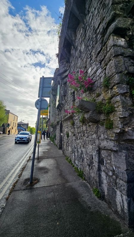
Only one wall of Bourke House survived this major development in(Submitted on May 24, 2026, by Ian Lefkowitz of New York, New York.)town planning in Limerick, with the internal façade facing onto Athlunkard Street. Work began on laying out Athlunkard Street on 26 April 1824. The new road cut through two mediaeval houses on Mary Street that had been built in the style of fortified tower houses. One of these houses was fully demolished, while only the north gable of Bourke House remained.Photographed by Ian Lefkowitz, May 13, 20262. Bourke House MarkerThe marker can be seen in this photo facing Athlunkard Street.
Credits. This page was last revised on May 27, 2026. It was originally submitted on May 24, 2026, by Ian Lefkowitz of New York, New York. This page has been viewed 14 times since then. Photos: 1, 2. submitted on May 24, 2026, by Ian Lefkowitz of New York, New York. • Andrew Ruppenstein was the editor who published this page.
