Englishtown in Limerick in County Limerick, Munster, Ireland — Irish South-West ((Éire) North Atlantic Ocean)
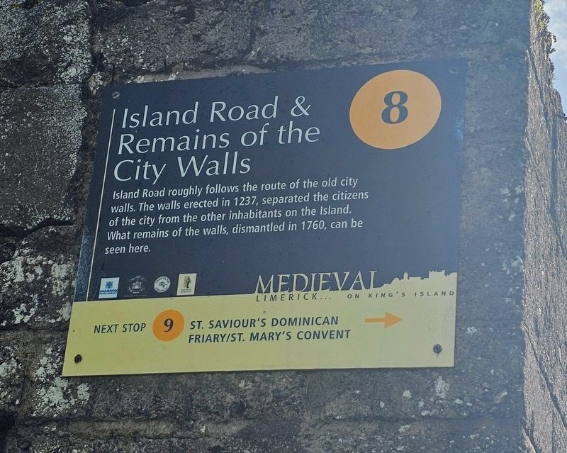
Island Road & Remains of the City Walls
| — | Medieval Limerick… on King’s Island | — |
Photographed by Ian Lefkowitz, May 13, 2026
1. Island Road & Remains of the City Walls Marker
Medieval Limerick… on King’s Island (Marker Number 8.)
Topics. This historical marker is listed in this topic list: Forts and Castles. A significant historical year for this entry is 1237.
Location. 52° 40.16′ N, 8° 37.305′ W. Marker is in Limerick, Munster, in County Limerick. It is in Englishtown. It is at the intersection of Island Road and Saint Peter Street, on the left when traveling north on Island Road. Touch for map. Marker is at or near this postal address: 40 Island Road, Limerick, Munster V94 W673, Ireland. Touch for directions.

Regionally, this marker is in the Ancient East. Globally, it is on the Atlantic Ocean, in the North Atlantic Region, in Europe, on the Island of Ireland, on the Celtic Fringe, in the European Union, in Atlantic Europe, on one of the British Isles, in the Western World, and in the Anglosphere.
Other nearby markers. At least 8 other markers are
this page online
Also see . . . Limerick (Irish Walled Towns Network).
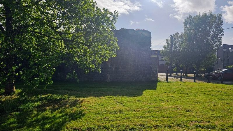
Murage grants were given to fund Limerick's town walls in 1237 and 1310. Limerick at this time was actually two towns, there was an ‘English town’ (Anglo-Norman) which was walled first and an ‘Irish town’ which was only walled in the 15th century. The stone walls of English town and Irish town had a combined perimeter of 3,025m, they had stone battlements, towers and wall walks. Gates into the city were added and removed over long periods of time. English town had three main gates and eight postern gates, whereas Irish town had four main gates and two postern gates. Their names include Thomond(Submitted on May 24, 2026, by Ian Lefkowitz of New York, New York.)Gate and St John's Gate...The walls were maintained until 1760, when Limerick ceased to be a garrison town and so the demolition began.Photographed by Ian Lefkowitz, May 13, 20262. Island Road & Remains of the City Walls MarkerThe marker is affixed to the remains of the city walls.
Credits. This page was last revised on May 27, 2026. It was originally submitted on May 24, 2026, by Ian Lefkowitz of New York, New York. This page has been viewed 11 times since then. Photos: 1, 2. submitted on May 24, 2026, by Ian Lefkowitz of New York, New York. • Andrew Ruppenstein was the editor who published this page.
