King's Island in Limerick in County Limerick, Munster, Ireland — Irish South-West ((Éire) North Atlantic Ocean)
The Toll House
| — | Medieval Limerick… on King’s Island | — |
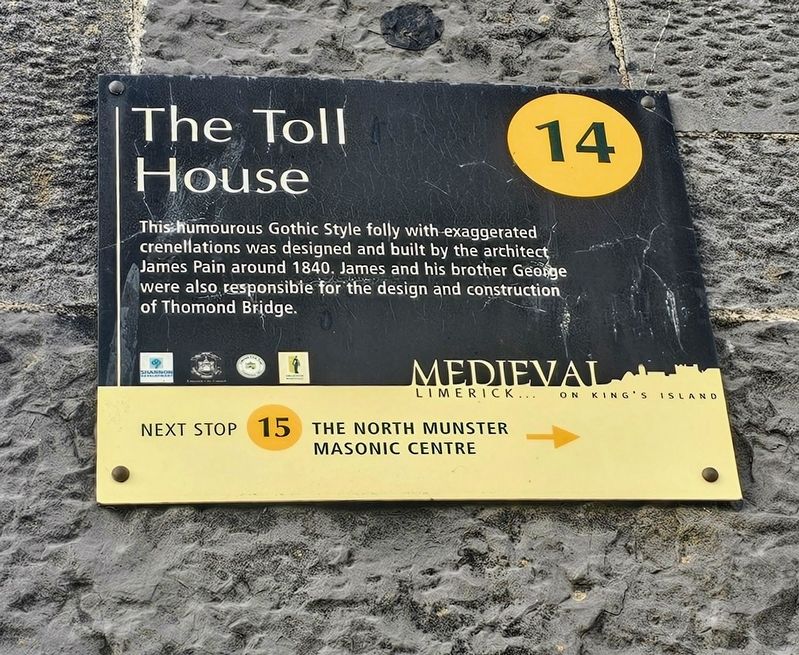
Photographed by Ian Lefkowitz, May 13, 2026
1. The Toll House Marker
(Marker Number 14.)
Topics. This historical marker is listed in these topic lists: Architecture • Bridges & Viaducts. A significant historical year for this entry is 1840.
Location. 52° 40.216′ N, 8° 37.575′ W. Marker is in Limerick, Munster, in County Limerick. It is on King's Island. It is at the intersection of Castle Street and Verdant Place, on the left when traveling east on Castle Street. Touch for map. Marker is at or near this postal address: 1 Castle St, Limerick, Munster, Ireland. Touch for directions.

Regionally, this marker is in the Ancient East. Globally, it is on the Atlantic Ocean, in the North Atlantic Region, in Europe, on the Island of Ireland, on the Celtic Fringe, in the European Union, in Atlantic Europe, on one of the British Isles, in the Western World, and in the Anglosphere.
Other nearby markers. At least 8 other markers are within walking distance of
this page online
Also see . . . The Toll House, 1 Castle Street, Verdant Place, Limerick (Buildings of Ireland).
A well constructed, almost folly-like, toll house, it replaces an earlier one, which stood on this site. It was erected to receive tolls entering the city from Thomond to the west of the Shannon. The composition, for which the Pain Brothers, architects of Thomond Bridge, are responsible, marries a functional loosely fortified defensive character with the nineteenth-century romantic and Gothic Revival tradition.(Submitted on May 25, 2026, by Ian Lefkowitz of New York, New York.)It forms part of the ensemble, which includes such historic structures as Thomond Bridge, King John's Castle and Saint Munchin's Church of Ireland Church.Photographed by Ian Lefkowitz, May 13, 20262. The Toll HouseThe exaggerated Toll House. The marker can be seen on the Castle St. side of the building.
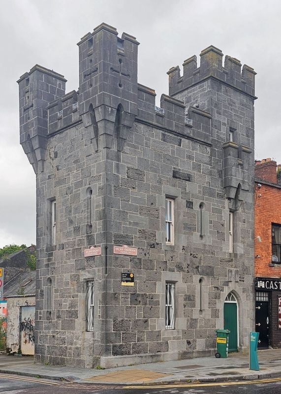
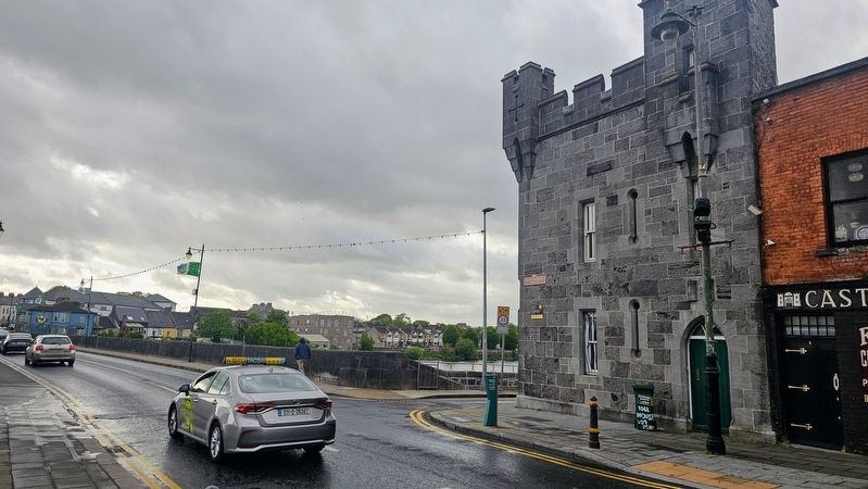
Photographed by Ian Lefkowitz, May 13, 2026
3. The Toll House Marker
The toll house faces Limerick's Thomond Bridge.
Credits. This page was last revised on May 27, 2026. It was originally submitted on May 25, 2026, by Ian Lefkowitz of New York, New York. This page has been viewed 13 times since then. Photos: 1, 2, 3. submitted on May 25, 2026, by Ian Lefkowitz of New York, New York. • Andrew Ruppenstein was the editor who published this page.
