Cypress Hills in Brooklyn in Kings County, New York — The American Northeast (Mid-Atlantic)
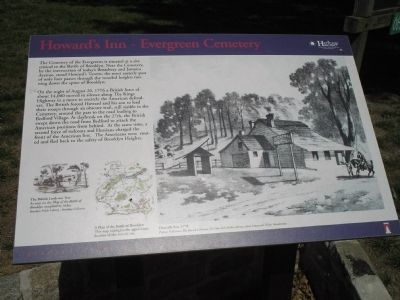
Howard’s Inn – Evergreen Cemetery
Revolutionary War Heritage Trail
On the night of August 26, 1776 a British force of about 14,000 moved in silence along The Kings Highway in a move to encircle the American defenders. The British forced Howard and his son to lead their troops through an obscure trail, still visible in the Cemetery, around the pass to the road leading to Bedford Village. At daybreak on the 27th, the British swept down the road from Bedford to attack the American positions from behind. At the same time, a second force of redcoats and Hessians charged the front of the American line. The Americans were routed and fled back to the safety of Brooklyn Heights.
Erected by New York State.
Topics. This historical marker is listed in these topic lists: Cemeteries & Burial Sites • War, US Revolutionary. A significant historical year for this entry is 1776.
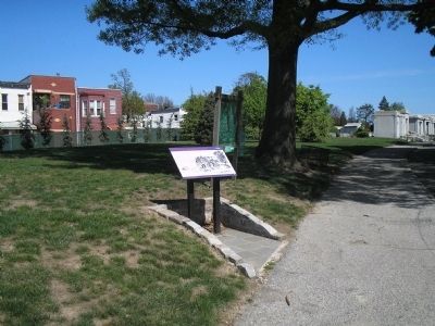
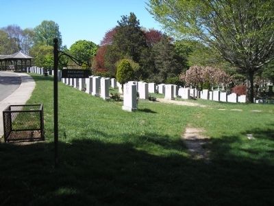
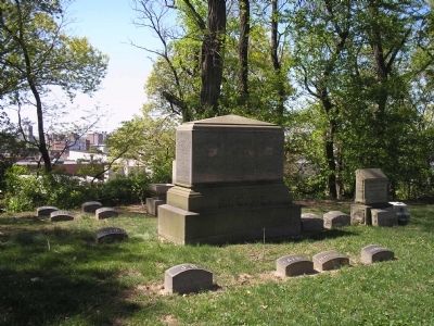
Location. 40° 40.886′ N, 73° 54.158′ W. Marker is in Brooklyn, New York, in Kings County. It is in Cypress Hills. Marker is on Bushwick Avenue, on the right when traveling west. The marker is located inside Evergreen Cemetery, near the Conway Street entrance. Touch for map. Marker is at or near this postal address: 1629 Bushwick Avenue, Brooklyn NY 11207, United States of America. Touch for directions.
Other nearby markers. At least 8 other markers are within walking distance of this marker. Rudd Playground (approx. 0.2 miles away); Callahan-Kelly Playground (approx. 0.2 miles away); Thomas Boyland Park (approx. ¼ mile away); Rockaway Footpath (approx. ¼ mile away); Hull Street Community Garden (approx. 0.3 miles away); New Hope Pentecostal Church of Greater Mt. Zion Inc. (approx. 0.4 miles away); Marion & Hopkinson Playground (approx. 0.6 miles away); Heaven Bound Church of Christ Holy Temple, Inc. (approx. 0.6 miles away). Touch for a list and map of all markers in Brooklyn.
More about this marker. The right side of the marker contains a picture of Howards Inn as it appeared in 1776. Picture Collection, The Branch Libraries, The New York Public Library, Astor Lenox and Tilden Foundations.
The lower left of the marker features a picture of The British Look-out Tree, as seen on the Map of the Battle of Brooklyn compiled by Stiles. Brooklyn Public Library – Brooklyn Collection. Next to this is a map showing A Plan of the Battle of Brooklyn. This map highlights the approximate location of this historic site.
Also see . . .
1. The Evergreens Cemetery website. (Submitted on April 24, 2010, by Bill Coughlin of Woodland Park, New Jersey.)
2. The Battle of Long Island, August 27, 1776 at Long Island, New York. The American Revolutionary War website. (Submitted on April 24, 2010, by Bill Coughlin of Woodland Park, New Jersey.)
3. Battle of Long Island, August 27, 1776. (Submitted on April 24, 2010, by Bill Coughlin of Woodland Park, New Jersey.)
4. The Battle of Long Island 1776. A British perspective of the battle from BritishBattles.com. (Submitted on April 24, 2010, by Bill Coughlin of Woodland Park, New Jersey.)
5. Evergreens Cemetery - National Archives. National Register of Historic Places documentation (Submitted on March 3, 2024, by Anton Schwarzmueller of Wilson, New York.)
Credits. This page was last revised on March 3, 2024. It was originally submitted on April 24, 2010, by Bill Coughlin of Woodland Park, New Jersey. This page has been viewed 4,063 times since then and 155 times this year. Photos: 1, 2, 3, 4. submitted on April 24, 2010, by Bill Coughlin of Woodland Park, New Jersey.


